Glacier View Parks & Trails
Discover the breathtaking parks and trails of Glacier View. Popular trails include Syncline and Gunsight mountains and Lions Head. Whether you’re seeking a leisurely stroll or an adventurous hike, Glacier View has many trails for all levels.
Show Map
Parks & Trails
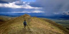
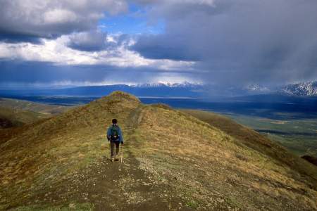
Syncline Mountain features two summits— whichever you choose, you’ll hike beneath a whole lot of sky and look out on a whole lot of country.
Beginning almost 120 miles northeast of Anchorage on the Glenn Highway, the trail to the summit of Gunsight Mountain takes a while to reach. After all, it involves a 3.5‑mile, 3,300-foot climb through some very big country. But the view from the top makes for an all-day excursion that you won’t easily forget.
Mostly walks through brush, and forest. These trails can take you to a Chickaloon-Knik-Nelchina Trail System, which provide access to multiple creeks, lakes, and other trails. Caribou, bear, fish, and other wildlife are quite abundant in this area.

Looking to break up your drive with a jog or bike ride? This little-used, 2‑mile section of the former Glenn Highway has little to no traffic. Rocks and shrubs are creeping onto the road surface in places. It’s quiet, scenic, and hilly. The roadway is officially closed in the middle but easily-passable.
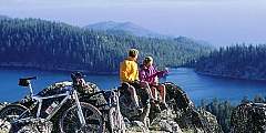
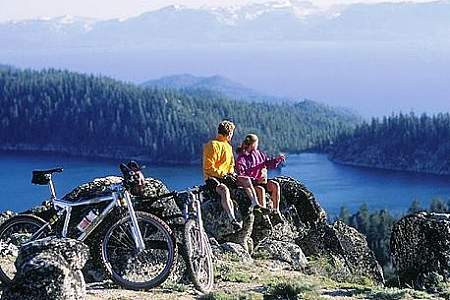
Lion’s Head is famous throughout the state. This rock outcropping is the prominent feature beside the Matanuska Glacier and is featured in magazines and advertisements all over Alaska. And you can hike it! You’ve got to be in good shape and ready for a scrambling, one-hour climb. You’ll be rewarded by great views, looking down a 2,000-foot cliff face to the glacier. You’re panorama will include views of the Matanuska River, Caribou Creek with… ...more
This is part of the Chickaloon-Knik-Nelchina Trail System. The trail then goes to the left about a mile to a high cliff that overlooks Kings River. This trail gives hunters access to game country which keeps the trail free of brush but makes mud holes muddier. The first part of the trail is good for the whole family but gets more difficult as it continues on.
Be careful, it’s easy to miss this turn-off as you drop down the hill, but look out for the sign “Caribou Creek Recreational Area.” This seldom-used campground is a quiet place to camp, away from highway noise. It has fire rings and picnic tables, and there’s a trail to the creek. It’s a one-mile walk to the water. It’s a nice stream and it’s part of the State Recreational Gold Mining Area. So bring a pan and try your luck!
This trail is part of the historic Chickaloon-Knik-Nelchina Trail System and, in the early summer, almost always has Dall sheep birthing low on the mountain sides. There are moose here all the time. Be careful when crossing Boulder Creek.
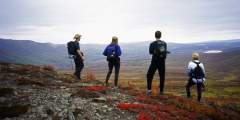
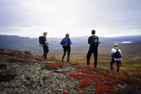
Climb to the summit of Belanger Pass, bike an all-day loop to Caribou Creek or off-road in a four-wheeler or ATV. This public access area is a gateway to adventure in the rolling tundra and alpine ridges of Belanger Pass and Syncline Mountain. The hike to the top of Belanger Pass is 90 minutes, following an old, rutted road. You can also bike this, following the Mining Road Trail for an all-day, 35 mile ride to Syncline Mountain and Caribou… ...more
A steep trail leads down to the creek from the gravel parking lot. Only pedestrian traffic is allowed on the trails (sorry, no ATV’s). The trail is difficult going at times due to its steep grade and lack of upkeep so watch your footing and perhaps take a hiking stick.
The campground is pretty open, since bark beetles killed the big, old spruce trees. The campsites attract RVers and campers, and each of the 24 sites has a fire ring and picnic table. There’s potable water at a hand pump.
This is part of the historic Chickaloon-Knik-Nelchina Trail System and travels high to show hikers beautiful sights. It starts in thick forest, but gradually climbs past lakes into wide open spaces. It used to be used to supply gold miners with equipment.
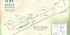
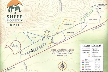
This amazing trail system was started by miners 50 years ago, and today they are maintained by Sheep Mountain Lodge Sheep Mountain Lodge owner Zack Steer. Zoom down Thriller on your mountain bike, enjoy a picnic with a view at the top of Corkscrew, search for a geocache site or come berry picking in the fall. There are 12 miles of maintained trails, which are groomed for cross-country skiing in winter. Peak blueberry season is from Aug. 15… ...more