Alaska Glaciers: Then & Now

By Bob Kaufman
Founder, Alaska.org
The following photos show the "then" and "now" of seven Alaska glaciers. Most of the "now" photos were taken in the past twenty years, while some of the older photos date back to the nineteenth century!
While a few of our glaciers are advancing, most are receding. Nonetheless, each glacier has maintained its beauty and prestige through the years. Check out what these seven glaciers used to look like, and what they look like today.
Lamplugh Glacier
Where: Photos are taken southwest of the glacier, in Glacier Bay National Park and Preserve
When: 62 years between photographs, August 1941 to September 2003
Photo credit: Then: William O. Field; Now: USGS Photograph by Bruce F. Molnia
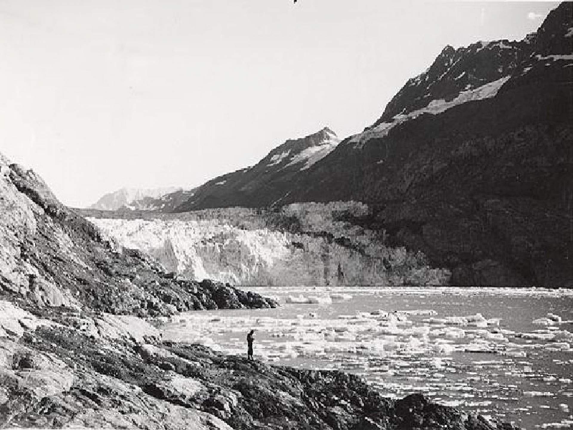
Then: Lamplugh Glacier is within 0.5 miles of the photo, with no vegetation to be seen.
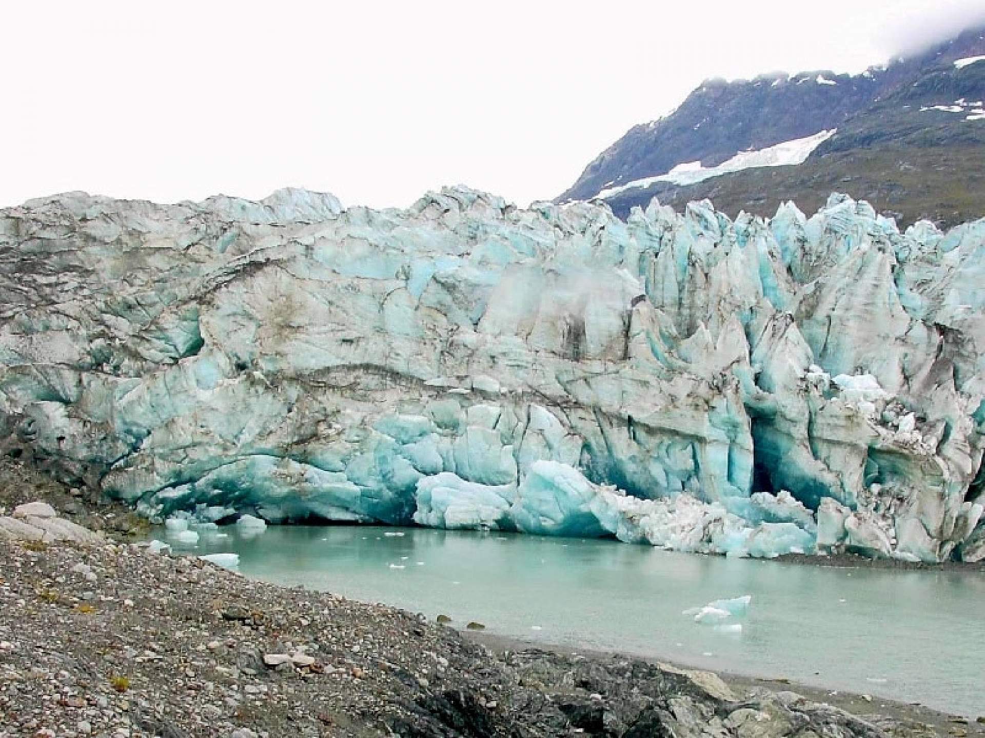
Now: The glacier has actually advanced more than 0.3 miles, and there is evidence that Lamplugh had advanced beyond the photo at some point. Some isolated vegetation.
Northwestern Glacier
Where: Northwest photos taken from Harris Bay, Kenai Fjords National Park
When: 95 years between photographs, July 1909 to August 2004
Photo credit: Then: U.S. Grant; Now: USGS Photograph by Bruce F. Molnia
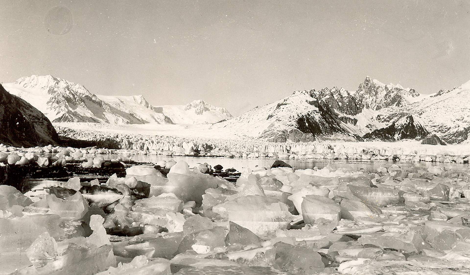
Then: At points the terminus of the glacier was taller than 164 feet. No vegetation visible.
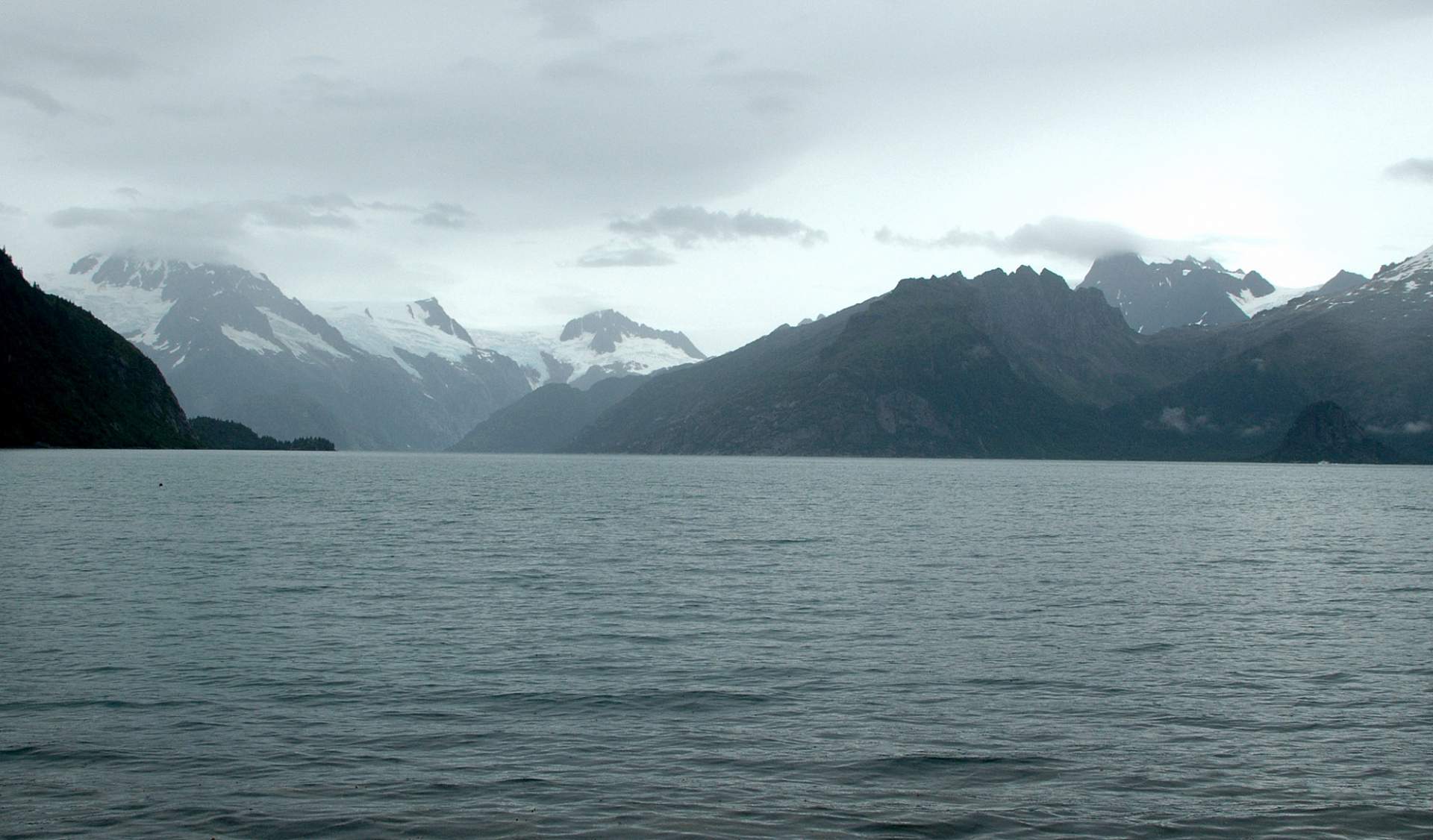
Now: The glacier has retreated out of view. The terminus in 2004 was located 6.2 miles to the northwest of its terminus 95 years before; The glacier visible to the left in the photo is Ogive Glacier, a former tributary glacier to Northwestern Glacier.
Pedersen Glacier
Where: Taken from shoreline location in Aialik Bay, Kenai Fjords National Park
When: 95 years between photographs, July 1909 to August 2004
Photo credit: Then: U.S. Grant; Now: USGS Photograph by Bruce F. Molnia
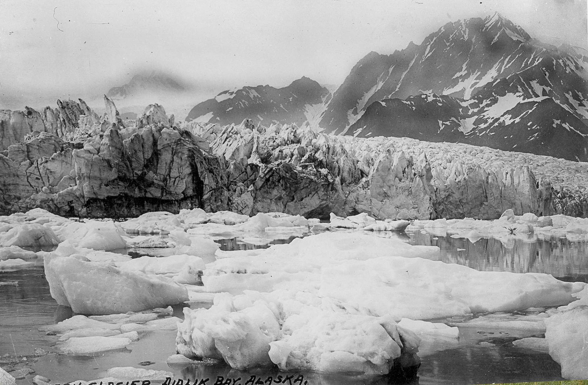
Then: The north side of the glacier can be seen grounded above tidewater. Little to no vegetation.
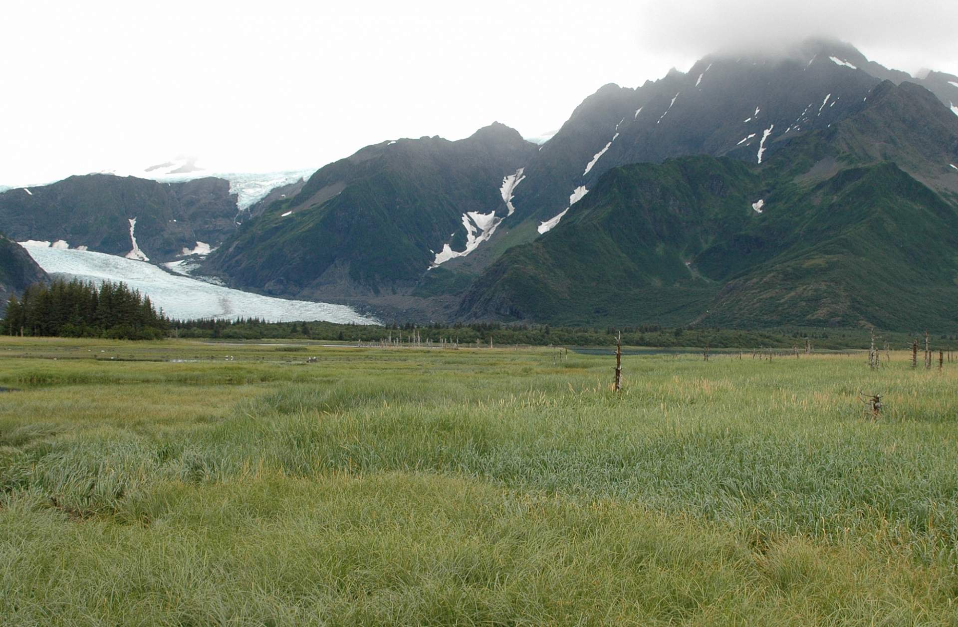
Now: The glacier retreated .93 miles, revealing a field of diverse vegetation including alder and spruce.
Holgate Glacier
Where: Taken near the head of Holgate Arm, Kenai Fjords National Park
When: 95 years between photographs, July 1909 to August 2004
Photo Credit: Then: U.S. Grant; Now: USGS Photograph by Bruce F. Molnia
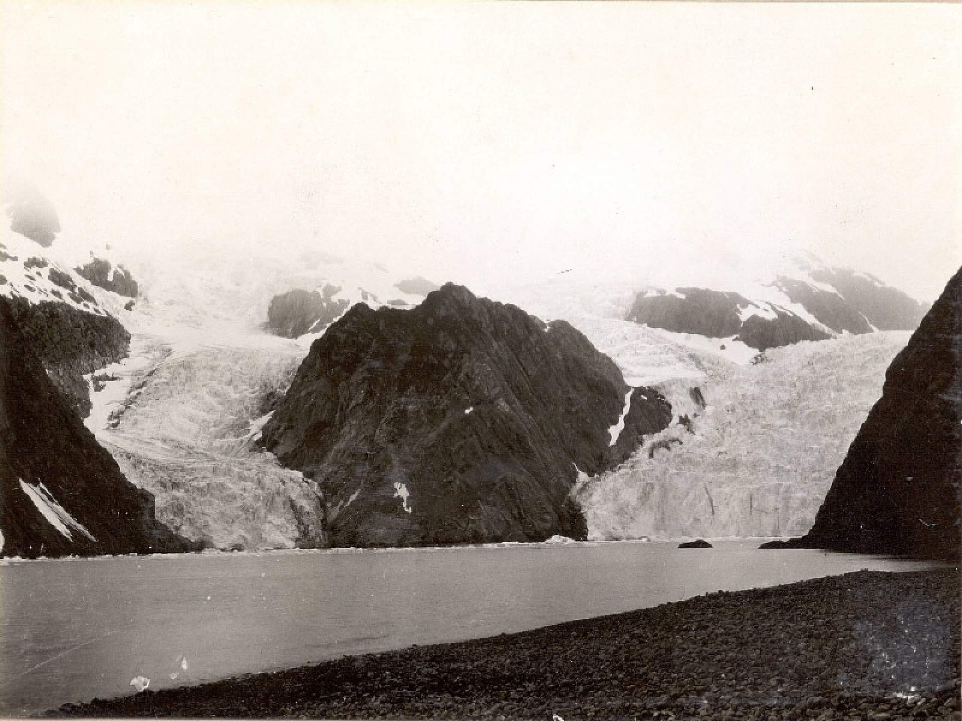
Then: Holgate Glacier and “Little Holgate Glacier” seen to the left. “Little Holgate” terminates at the shoreline, and little vegetation can be seen.
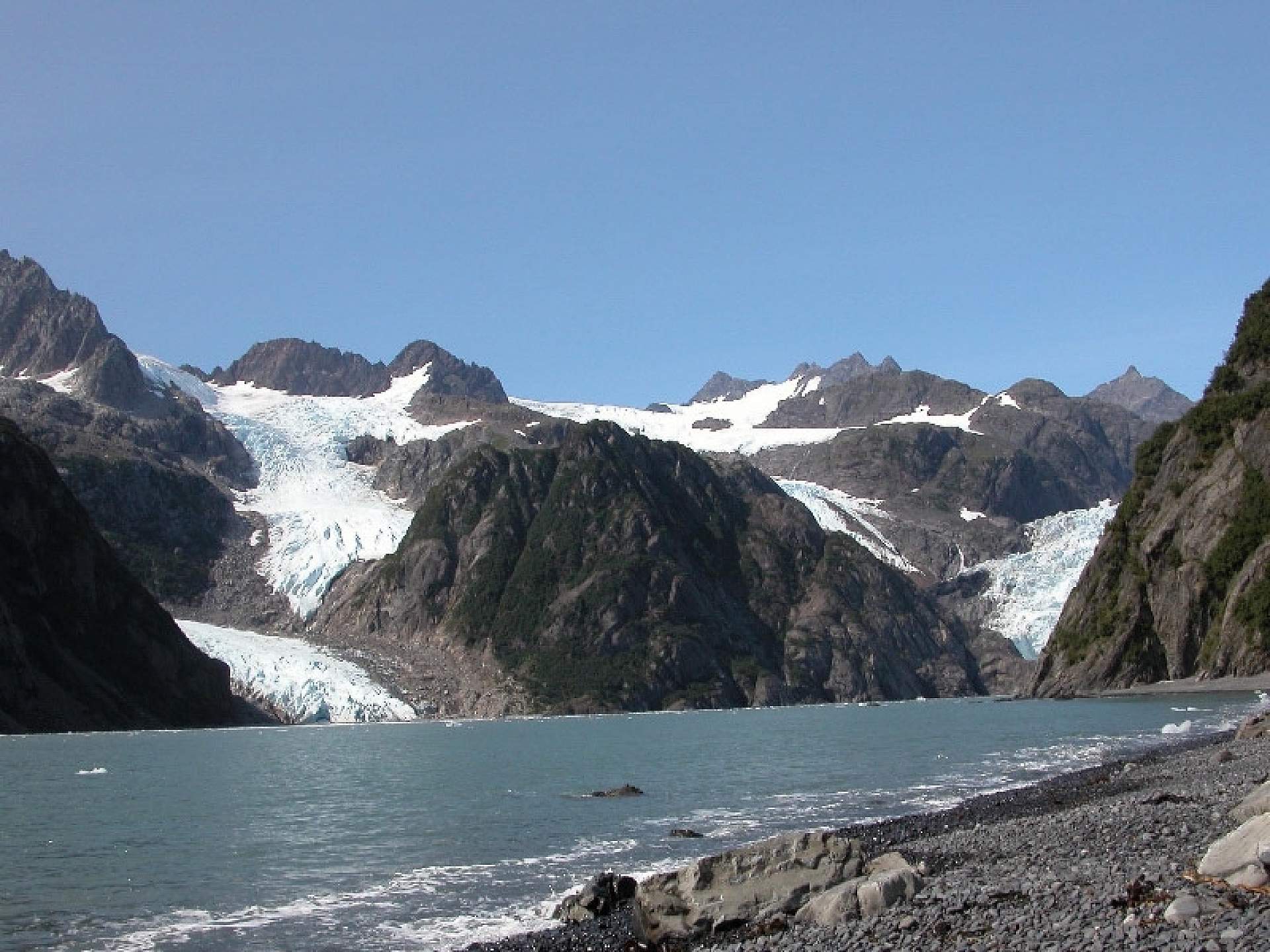
Now: Both glaciers retreated considerably. “Little Holgate” separated into several smaller ice masses. Holgate’s terminus retreated from view and alder are growing on the hill slopes.
Aialik Glacier
Where: Taken on the northwest shoreline of Squab Island, Kenai Fjords National Park
When: 96 years between photographs, July 1909 to August 2005
Photo credit: Then: U.S. Grant; Now: USGS Photograph by Bruce F. Molnia
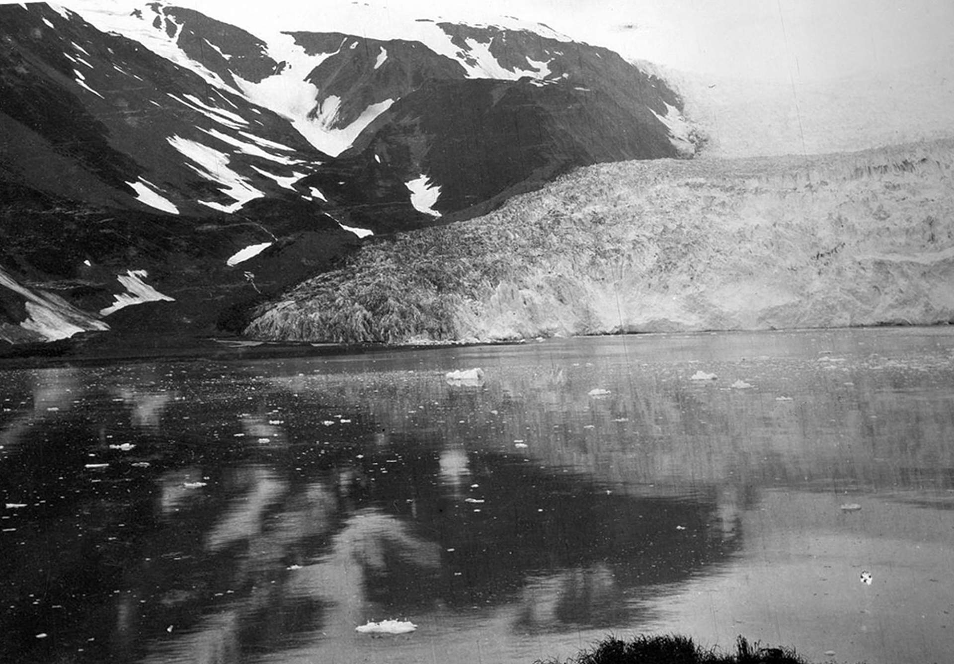
Then: Active, calving glaciers, terminus was as tall as 131 feet high. No vegetation visible.
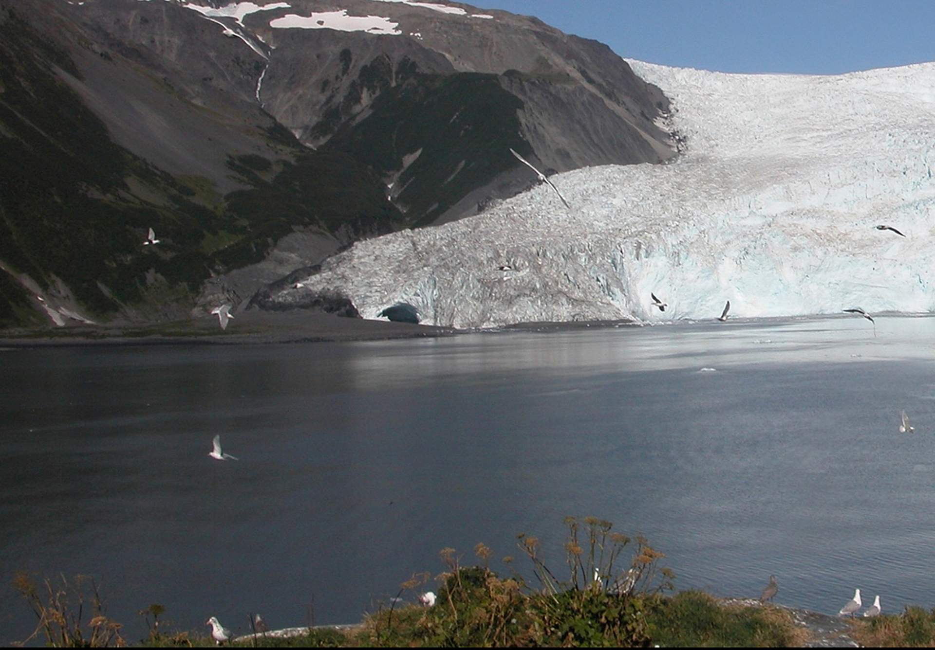
Now: The glacier thinned roughly 70-160 feet, and retreated just under 1,000 feet, but remained fairly close to its 1909 position. Aialik Glacier is still a major tidewater calving glacier. Vegetation has developed on most exposed land surfaces.
Bear Glacier
Where: Aerial photos taken of Bear Glacier, in the Kenai Mountains in Kenai Fjords National Park
When: 5 years between photographs, September 2002 to August 2007
Photo credit: All photos were taken by Bruce F. Molnia
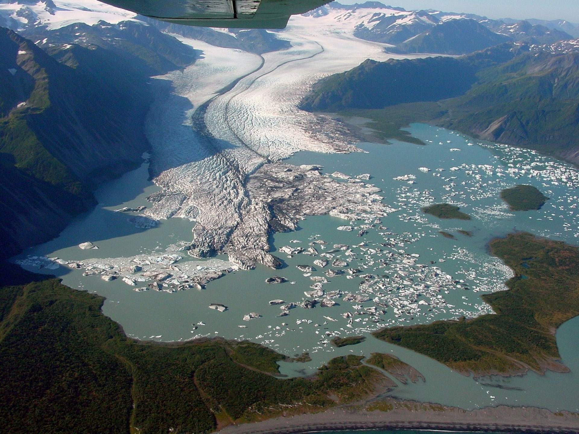
Then: The glacier can be seen retreating, and the terminus calving. Some history: Before 1950, the basin of Bear Lake was filled with Bear Glacier’s piedmont lobe - a type of glacier that develops in a relatively flat area, creating a round, bulb shaped glacier. By the latter half of the 20th century, Bear Lake had grown. Between 1984 and 2002, the lake quadrupled in size. Between 2002 and 2005, the terminus receded more than 1.9 miles.
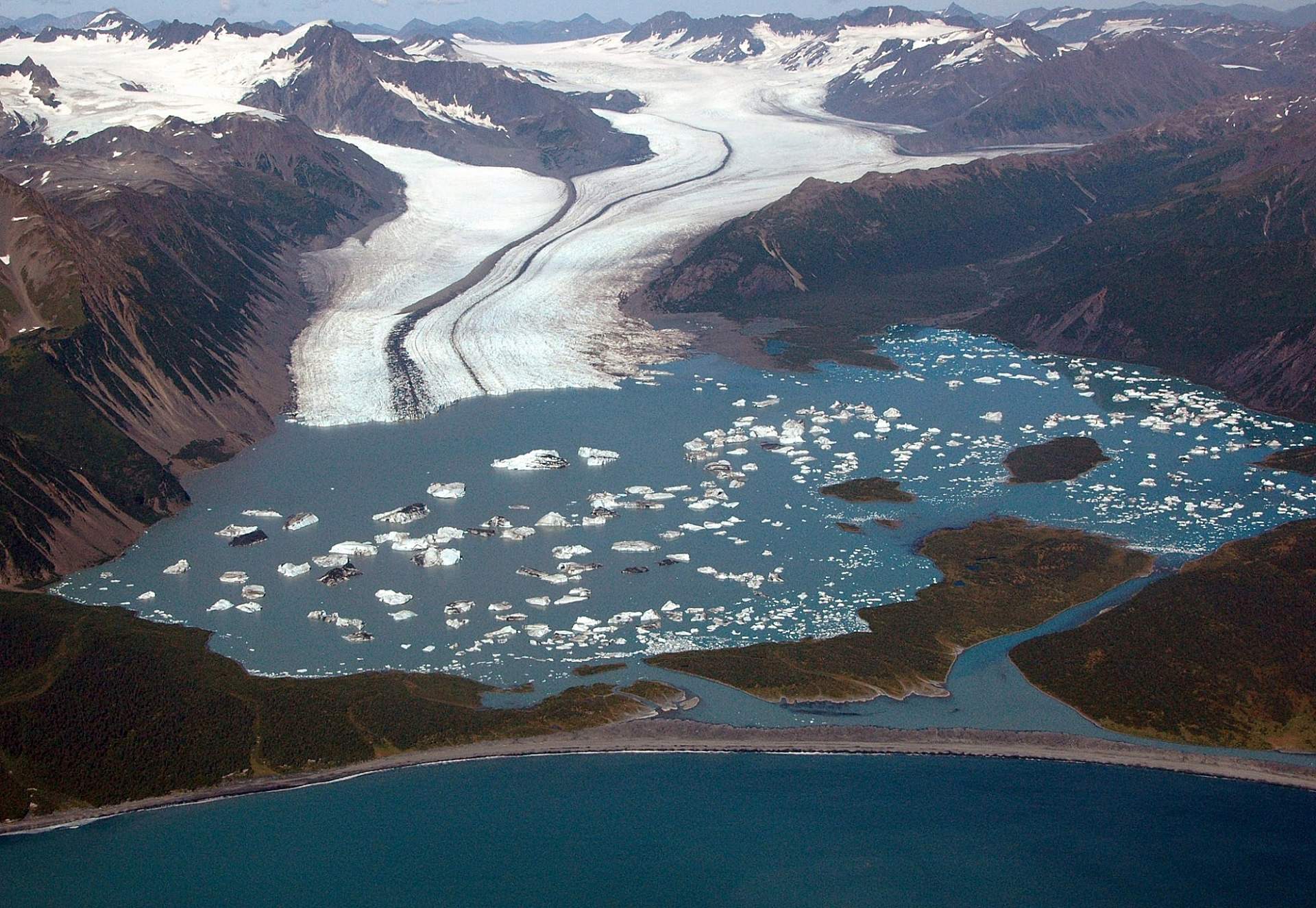
Now: While not as dramatic as the retreat between 2002 and 2005, by 2007 the glacier was still receding. Between 2005 and 2007, the western side of the glacier retreated more than 0.25 miles.

