The Best Caribou Viewing Spots in Alaska
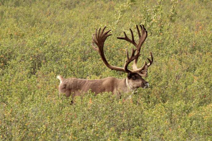
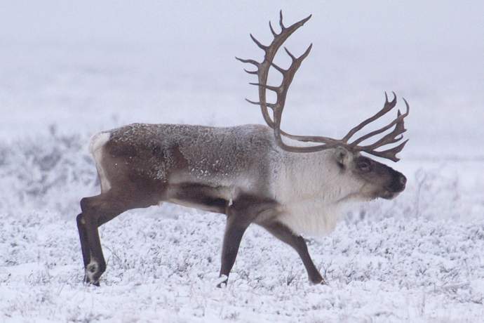
Alaska is home to an estimated 750,000 caribou spread among 32 different herds (as of 2010.) This iconic, circumpolar species with antlers and boundless energy roams from the prairie-like barrens of the Arctic Slope to the brushy Kenai River flats, from the foothills In Denali National Park to the sweeping Alaska Peninsula along the Bering Sea.
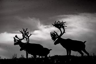
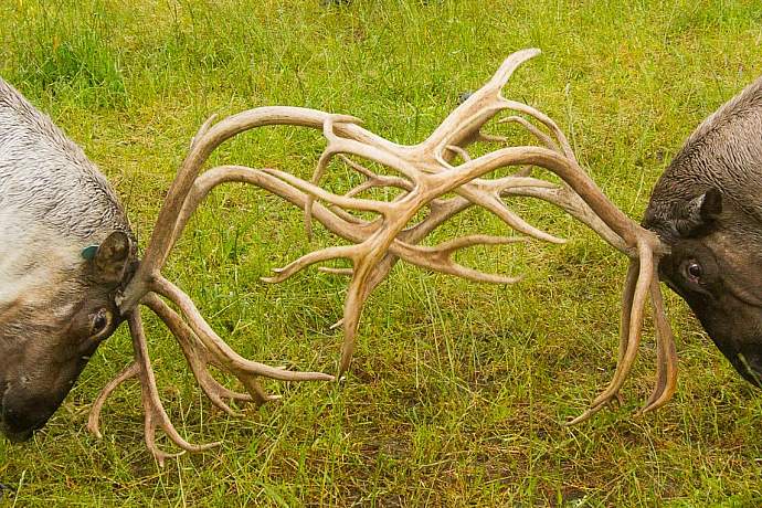
Their scientific name—Rangifer tarandus—traditionally means something like “wandering deer of the North.” And, boy, is that an apt description! Caribou are busy grazers and browsers during summer, constantly on the move. Sometimes alone or in small groups. Sometimes migrating in vast congregations that number in the tens of thousands.
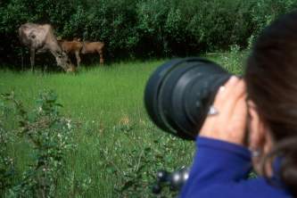
Seeing a caribou in the wild, then, can be challenging. While huge seasonal migrations do occur in some areas, most caribou show up as solitary animals or small groups. It’s a special moment, requiring a bit of timing and a bit of luck. Fortunately, several herds meander near the road system.
Show Map
Denali National Park
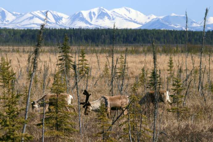
A famous and long-studied caribou herd haunts the sweeping tundra wilderness on the north side of the Alaska Range inside Denali National Park. The animals are regularly seen by travelers and hikers along the 92-mile-long Denali Park Road, sometimes close at hand. Venture out early and go deep into the park as you have time for. Use binoculars and scan periodically for movement. Also watch for the park’s other marquee mega-fauna: brown bears, grey wolves, moose and Dall sheep.
The herd—the only barren ground caribou not hunted—has ranged from 20,000 animals in the 1920s to 1,000 in the 1970s. Biologists the park’s caribou have been slowly increasing over the past decade and now number almost 3,000 animals.
Related
Getting there
Denali National Park entrance lies north of the Alaska Range on the Seward Highway, about 237 miles north of Anchorage and 124 miles south of Fairbanks. There are many options for exploring the park road. But many visitors really enjoy using the park’s shuttle bus system.
Kenai Peninsula
Several small caribou herds roam the Kenai Peninsula, all descended from animals introduced decades ago to reverse earlier extinctions. Best bet for viewing? The 150 animals in the Kenai Lowland Herd calve close to roads in the Kenai River estuary near the town of Kenai. You can see them feeding in the marshy flats on both sides of the Bridge Access Road between June and August. Another favorite caribou watching spot among locals is Marathon Road, at Mile 10 of the Kenai Spur Highway. Drive slowly north, scanning for caribou wandering the open country around you.
A larger herd centers in backcountry areas of the northern Kenai Mountains west of the Seward Highway and up the Resurrection Creek Valley south of Hope. Hikers and backpackers sometimes see them in alpine meadows. Animals from this herd also often roam the remote and difficult-to-access foothills on the west slope of the Kenai Mountains near the Chickaloon River, across Turnagain Arm from Anchorage.
Related
Getting there
Marathon Road. Take the Kenai Spur Highway north from Soldotna. Turn north on Marathon Road about Mile 10, continue past the Kenai Municipal Airport. This oil field access route gets very little traffic, but be alert for trucks. Drive slowly north while scanning the open country for animals. GPS 60.583972, -151.227732
Kenai Flats. From the Kenai Spur Highway, turn south on the Bridge Access Road about Mile 10.8. The Warren Ames Memorial Bridge crosses the river about 2.6 miles to the south, with a vista of vast flats surrounding the estuary. Park in a viewing spot on west side of the highway just south of the bridge, but concentrate the search toward the east. The scene is worth a visit almost any time for its sheer beauty, birds and views. GPS 60.525343, -151.208811
Glenn Highway near Eureka Summit
Caribou occasionally wander through the brushy taiga and tundra near the Glenn Highway on both sides of the outpost of Eureka Summit about 130 miles northeast of Anchorage. This high point along the Glenn—at 3,322 feet in elevation—is a popular winter snowmobiling area. A network of ATV trails see far less human activity during summer.
It’s not worth visiting the area solely to look for caribou, but if you are traveling between Anchorage and Glennallen (Mile 187) anyway, it’s definitely worth stopping and scanning the vistas for movement, especially during July and August. You will also have a 360-degree view of four mountain ranges—the Alaska Range to the north, the Wrangells to the east, the Chugach to the south, and the Talkeetnas to the west.
Related
Getting there
Best chances will be in the open country along the Glenn Highway on either side of Eureka Summit, from about Mile 120 to about Mile 140. This area is two hours northeast of Anchorage and about an hour west of Glennallen.
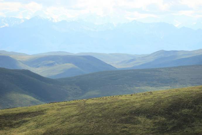
Denali Highway
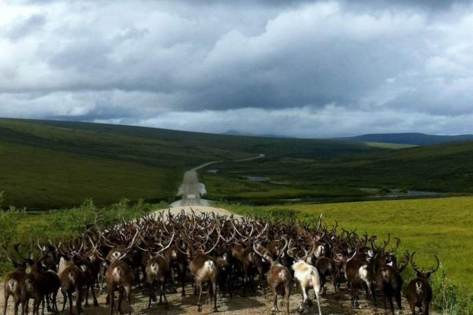
This fabled backcountry gravel road traverses the tundra foothills south of the Alaska Range, offering amazing access to the Nelchina Caribou herd. The 135-mile route once served as the only vehicle access to Denali National Park. It now connects Paxson on the Richardson Highway to Cantwell on the Parks Highway. During summer months, park in one of dozens of pullouts then take trails or walk cross country to a nearby high point. Use binoculars or scopes to scan for movement, watching for lone animals or small groups grazing in a start-and-stop manner. The animals sometimes wander within view of the highway. As summer slides into fall, the animals herd up more and may be easier to find. NOTE: Avoid mid-August through September, when large numbers of caribou hunters converge on the area. The peak of activity falls around Labor Day.
Related
Getting there
Two ways. Head east from Cantwell from Mile 210 of the Parks Highway (from Anchorage.) Head west from Paxson on the Richardson Highway 176.5 miles south of Fairbanks and 187.5 miles north of Valdez. The Denali Highway is a challenging destination that requires preparation and may be off limits for a rented car.
Steese Highway (north of Fairbanks)
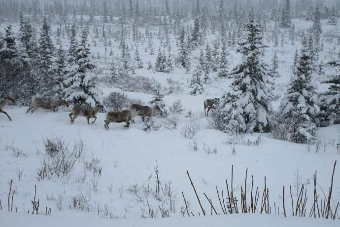
Caribou from the Fortymile Herd sometimes meander through the rugged high country traversed by the 161-mile Steese Highway between Fairbanks and the community of Circle on the Yukon River. The road is gravel beyond Mile 81.3, where it climbs into the tundra of Twelvemile and Eagle summits, both above 3,000 feet in elevation. Best chance to see a caribou will likely be in this open country above the tree line. Also watch for caribou near Mammoth Creek at Mile 116 in late winter or early spring.
Related
Getting there
The Steese Highway begins in Fairbanks and runs northwest 161 miles to Circle on the Yukon River. Inside the city, it is the main east-side expressway, running north-to-south between the Richardson Highway and Johansen Expressway.
Dalton Highway (north of Fairbanks)
For those who are prepared for a long, demanding road trip across central and northern Alaska, the 414-mile Dalton Highway to the Prudhoe Bay oil fields can deliver excellent caribou viewing. While the animals might appear in forested country or in the Brooks Range, best viewing lies north Atigun Pass in the tundra of the Arctic Slope (Mile 244.7, or about 328 miles north of Fairbanks, and beyond). Watch for the animals meandering on the vast expanse, usually in small groups. Use binoculars or scopes. During mid August through September, hunters converge in the area. The animals from the Central Arctic Herd are frequently seen near the highway and sometimes near oil infrastructure at Deadhorse at the end of the road.
Related
Nome
Caribou pass through the rolling tundra of the Seward Peninsula near Nome. But during summer, you may be more likely to catch sight of the domesticated version of the same species, the reindeer. Several managed reindeer herds graze the open range, sometimes sharing proximity with their wild cousins. Reindeer usually appear stockier (more pinto-like) than wild caribou and probably sport ear tags. Either variety might show up anywhere—from a Norton Sound beach to a remote valley enveloped in silence.
Unlike many other locales in the Alaska Bush, Nome is a vibrant first-class city with full services at the hub of a system of maintained gravel roads. The three main highways — Nome-Teller Highway, Kougarak Road and the Nome-Council Highway — collectively reach more than 300 miles into the backcountry. They offer extraordinary summer access for travelers into an amazing, little visited wilderness.
Related
- Nome wildlife viewing guide from ADFG
- ADFG guide to Kougarak Road
- ADFG guide to Nome-Teller Highway
- ADFG guide to Nome-Council Highway
Getting there
Best way to travel to Nome is a non-stop 90-minute flight from Anchorage on Alaska Airlines. Nome can be reached from other Alaska cities, including Fairbanks, but usually with multiple stops and longer travel times. Ravn Air also flies to Nome. And some people arrive by ship.
Arctic National Wildlife Refuge
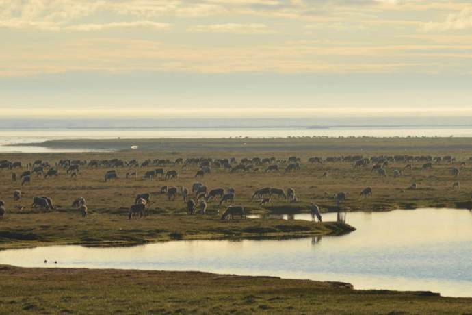
Perhaps the most talked about members of their species on the planet, the 197,000 animals in the Porcupine Caribou Herd wander a vast area of northeast Alaska and the Yukon Territory, with individual animals sometimes walking 3,000 miles over the course of year. But almost every spring, most of these caribou converge on the coastal plain of the Arctic National Wildlife Refuge to calve—a phenomenon that has made oil development in a portion of the calving grounds a subject of intense debate for decades. (Animals from the Central Arctic Herd also sometimes calve in ANWR.) The sight of tens of thousands of animals meandering across the tundra prairie may be one Alaska’s most extraordinary natural wonders. Hikers, trekkers and rafters who journey to ANWR in May or June have a decent chance to experience one of the world’s great animal migrations in real time.
Related
Getting there
Traveling to ANWR during the caribou migration is a major wilderness trip, requiring expert knowledge and skills, or hooking up with a guide or eco-tour. While it is possible to drive up the Dalton Highway to places within walking distance of the 19.2-million-acre refuge, almost all visitors launch their trek or raft trip after getting dropped off by airplane or flying into a Native community near the refuge. A good place to start researching possibilities is the USFWS’s guide to planning a visit to ANWR or scope out the agency’s list of recreational guides.
Onion Portage inside Kobuk Valley National Park
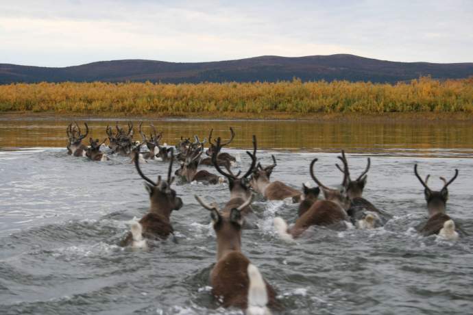
Caribou from the Western Arctic Herd flood across the Onion Portage of the Kobuk River twice a year, moving between winter and summer grounds and back again. Over thousands of seasons, the natural event has always drawn Alaska Native groups, making the portage area an important archaeological and historical site. Now within the Kobuk Valley National Park, the Onion Portage and its caribou draws subsistence hunters, scientists and visitors. Catching a glimpse of 20 or 30 caribou swimming in a line—with antlers just above the river surface—makes for an unbelievable moment. The herd, once Alaska’s largest with half a million animals, declined in recent decades but may have started a slow rebound, with numbers about 240,000.
Related
Getting there
No roads, no facilities, no maintained trails—and that means visitors must be self-sufficient and prepared for remote wilderness. A true Alaskan adventure! The Kobuk Valley National Park straddles a wild river between the remote villages of Ambler and Kiana about 500 miles northwest of Anchorage and 100 miles east of the coastal hub of Kotzebue. Though the portage is about 12 air miles downstream from Ambler, most visitors travel by aircraft from Kotzebue. To figure out logistics and timing of your trip, an essential first contact is the Northwest Arctic Heritage Center or call 907-442-3890. Or check out the list of guides licensed to operate in Kobuk Valley.
Guaranteed caribou viewing
Do you just want to meet and greet an Alaskan caribou (or the domesticated caribou known as reindeer) without scanning the country or launching an epic wilderness trip? If you don’t mind seeing animals under human care, you are in luck!
- Alaska Zoo in Anchorage. Several reindeer live in the zoo’s caribou habitat, with great information and occasional programs. 4731 O'Malley Road in South Anchorage.
- Star the Reindeer. In an only-in-Alaska tradition, a solitary (and well-cared for) reindeer has been kept for tourist viewing and civic events for the past half-century. The seventh “Star” in residence since 1960 is a young male, born at the Reindeer Farm in Palmer in 2016. See him at 840 W. Tenth Ave, facing the downtown Anchorage Park Strip at the corner of I Street. He also goes for frequent walks with his handlers, so you might meet him on the Park Strip.
- Reindeer Farm in Palmer. A family operation for three generations, the Reindeer Farm offers tours and a chance to mingle with adult reindeer and even pet calves. 5561 S Bodenburg Loop Rd off the Old Glenn Highway. Contact the farm to book a visit!
- Alaska Wildlife Conservation Center in Portage. Descended from animals rescued from starvation on remote Alaska islands, these reindeer live in an outdoor enclosure on the 140-acre facility’s 1.5 mile driving or walking loop. Mile 79 of the Seward Highway, near the head of Turnagain Arm.
- Running Reindeer Ranch near Fairbanks. This family-run farm offering a unique encounter with a small herd of friendly reindeer (and newborn calves) has long been very popular with visitors. The “ranch” also offers a taste of rural Fairbanks-area lifestyle in the Goldstream Valley. Advance reservations are required.
- Robert G. White Large Animal Research Station at University of Alaska Fairbanks in Fairbanks. Nicknamed LARS, the facility maintains a herd of muskox for nutritional, physiological and behavioral research, with Alaska reindeer and cattle also in residence. Open to visits year around, LARS offers a fascinating glimpse of scientific research in real time. 2220 Yankovich Road in the northern area of the UAF campus.
Explore Further