Alaska Arctic Grayling Fishing Spots
While all but extinct in the Lower 48, the Arctic Grayling can still be found here in healthy numbers. Take a look at all of the places to catch them.
Show Map
Arctic Grayling Fishing Spots

Clearwater creek parallels the Denali Highway and offers excellent fishing.
Small lake accessible via a gravel road off of Point Mackenzie Road. Lake is stocked with arctic grayling and rainbow trout.
Sunshine Creek flows into the Susitna River. There is an access road off of the Parks Highway. Most popular for fishing for silvers late August through September.
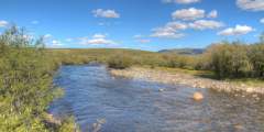
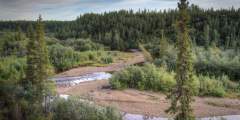
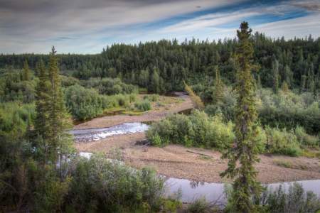
Spring fishery & BLM Campground
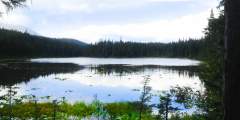
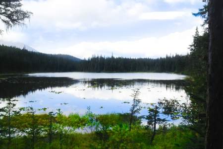
Access stunning views of Landmark Gap Lake by hiking the Landmark Gap Trail North.
Willow Creek Confluence State Rec Area, near Mile 70.8 of the Parks Hwy, offers 140 campsites where Willow Creek meets the Susitna River. Managed by Alaska State Parks, it features spruce forest, flush toilets, a dump station, and fish-cleaning areas. This busy campground is ideal for fishing, rafting, and exploring nearby Hatcher Pass, with the town of Willow just minutes away.
Fish for Arctic Grayling and Dolly Varden.
Arctic grayling, pike, and whitefish.
Fish for Arctic grayling, burbot, and whitefish. South Fork of Bonanza Creek is accessible from the Dalton Highway.
Fish for grayling at Moose Creek, accessible via a pull-out next to the Glenn Highway.
Fishing opportunities for arctic grayling, trout, and burbot. Camping available at Fielding Lake State Recreation Site.
Fishing spot for arctic grayling and whitefish accessible from the Dalton Highway.
There’s a large roadside pullout at mile 149 of the Dalton Highway. Fish for Arctic grayling.
Deshka Landing is a boat launch on the Susitna River that provides access to the Susitna, Yentna, and Deshka Rivers. The landing is open year-round (winter snowmobile use) and is managed by the Deshka Outdoor Association, LLC.
Small lake to fish for grayling at mile 7 of Lake Louise Road.
Pull-off present and sign posted at MP 168 Richardson Highway. There’s a 1⁄4 mile trail to reach the lake.
Short hike down steep hill to South; Summer Fishery. MP 10.4 Denali Hwy
Spot to fish for Grayling. There’s a small gravel pull-out just beside the Glenn Highway.
Fishing spot for arctic grayling along the Dalton Highway.
Accessible fishing lake just off the Glenn Highway. Stocked annually with rainbow trout and arctic char.
Lovely lake accessible from via Bonnie Lake Road off the Glenn Highway just north of Chickaloon. A small dock juts into the lake, as well as a gravel boat launch area. Fish for rainbow trout and grayling.
Access from the Glenn Highway via Tolsona Lake Road at mile 170 just before Glennallen. There’s a lodge, as well as a public access point. Can fish for grayling and burbot.
Gravel road from the Richardson Highway leads to a point where you can access the Little Tonsina where it meets the Tonsina River. Arctic grayling, Dolly Varden, sockeye salmon, king salmon, and coho salmon depending on the season. Check with ADF&G for current regulations.
MP 171 Richardson Hwy. Pull-off’s present; best fishing at outlet.
Small pull-off, short hike down to outlet; summer fishery. MP 10 Denali Hwy
Arctic Grayling fishing spot that can be accessed from the Dalton Highway.
Accessible via MP 170 of the Glenn Highway. Grayling fishing. There’s also a small lodge.
Seventeenmile Lake is stocked with rainbow trout and arctic char. It’s a tranquil lake with views of the surrounding mountains. The lake can be accessed from the Glenn Highway, just before Sutton, via Mile 58 Road. There’s a small gravel parking area and undeveloped boat launch off of Wishbone Place.
Small lake in Palmer, Alaska with great public access, including a parking area (with fee station) for about 4 – 5 vehicles, and public toilets. Fish for rainbow trout and arctic grayling.
Stretch your legs at this picturesque stream and perhaps drop in a line. At Daves Creek you’ll find good fishing for dolly varden and rainbow trout. Salmon can be seen spawning here in mid-July through September.
There’s a privately run campground here and access to fishing on Willow Creek. There’s also a fishing charter operator offering guided trips on the creek.
Stocked lake within the Donnelly Training Area. you must obtain a Recreation Access Permit (RAP) before fishing these stocked lakes, because they are on Army land. “J” lake is accessible from the Richardson Highway. Exit onto the Old Richardson Highway at MP 256, then turn onto Windy Ridge Road. There is a small cluster of lakes, and 2 additional lakes are accessible via short trails (Ghost Lake and Nickel Lake).
MP 46.9 Denali Hwy. North Side of Road, Lake & outlet excellent for large grayling.
Sign visible from Chena Hot Springs Road. Gravel road leads to gravel parking area with a fee station and outhouse. Lake stocked with Arctic grayling, Rainbow trout, and burbot.
Small pond stocked by ADF&G with Arctic grayling and Rainbow trout. Sign visible from Richardson highway leads to a small gravel parking area. Approximately 15 mins north of Delta Junction.
Easily accessible lake in Talkeetna, Alaska that is part of a popular chain of Lakes “X”, “Y”, and “Z” lakes. They are popular with canoeists who portage from one lake to the next. The lake is stocked annually with Rainbow Trout. There is a short trail to the lake from Comsat Road.
Popular in the summer with locals for a swim. Fishing is catch and release only.
Small fishing pond easily accessible from the Steese Highway that is stocked with Arctic grayling and Rainbow trout. There’s a sign visible from the highway and a gravel parking area. This area is about a 45-minute drive from downtown Fairbanks.
Stocked with Arctic grayling and Rainbow trout by ADF&G. Easily accessible from Chena Hot Springs Road.
Accessible via the Richardson Highway. There’s a large parking area near the bridge. Popular salmon fishing spot when in season. Refer to ADF&G for current guidelines.
These popular trails lead to two beautiful, pristine lakes. Even better, they’re both easy hikes, which makes them perfect for people of all ages. Bring a fishing pole and angle for stocked trout in Meridian Lake or grayling in Grayling Lake.
This tributary of the Kenai River flows alongside the Sterling Highway, just north of Cooper Landing (from milepost 40 – 45). There are plenty of designated pull-offs along the highway — like Quartz Creek Road, which leads to Kenai Lake, as well as the popular access point at the Quartz Creek Bridge.
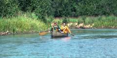
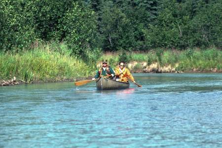
A good dirt road, with plenty of pull-outs, leaves the main highway on the south side of the road. The “Alascom Road” runs four miles across the valley floor. There are several lakes, stocked with trout and grayling, for fishermen, and plenty of camping spots. It’s quiet, and there’s great canoeing and bird watching on the lakes. It’s a popular weekend destination for Anchorage folks, so you might not be alone. And in the fall, you’ll see plenty ...more
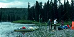
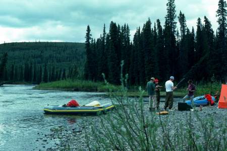
The Susitna River is a major drainage system in the Denali region. The river flows south from the Susitna Glacier and the Alaska Range and eventually turns west to flow through the Talkeetna Mountains and then south to Cook Inlet. The Susitna is not floatable because of Devil’s Canyon downstream. Access to the historic Valdez Creek Mine is on the east side of the Susitna River. The mine is now closed and the land is being reclaimed.
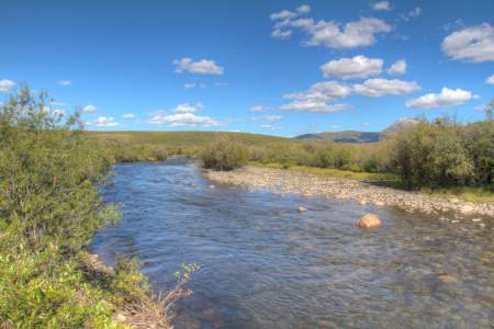
This quiet little pullout is next to a small babbling brook filled with Dolly Varden and Arctic Grayling. During winter, the thick cover of willow along the river is an important concentration and feeding area for willow ptarmigan.
Fairly accessible lake off the Dalton Highway to fish for Arctic grayling. There’s a small roadside turnout.
A great place for a picnic, and an excellent place to fish for arctic grayling and arctic char. Don’t forget your bug dope!