Mint Glacier
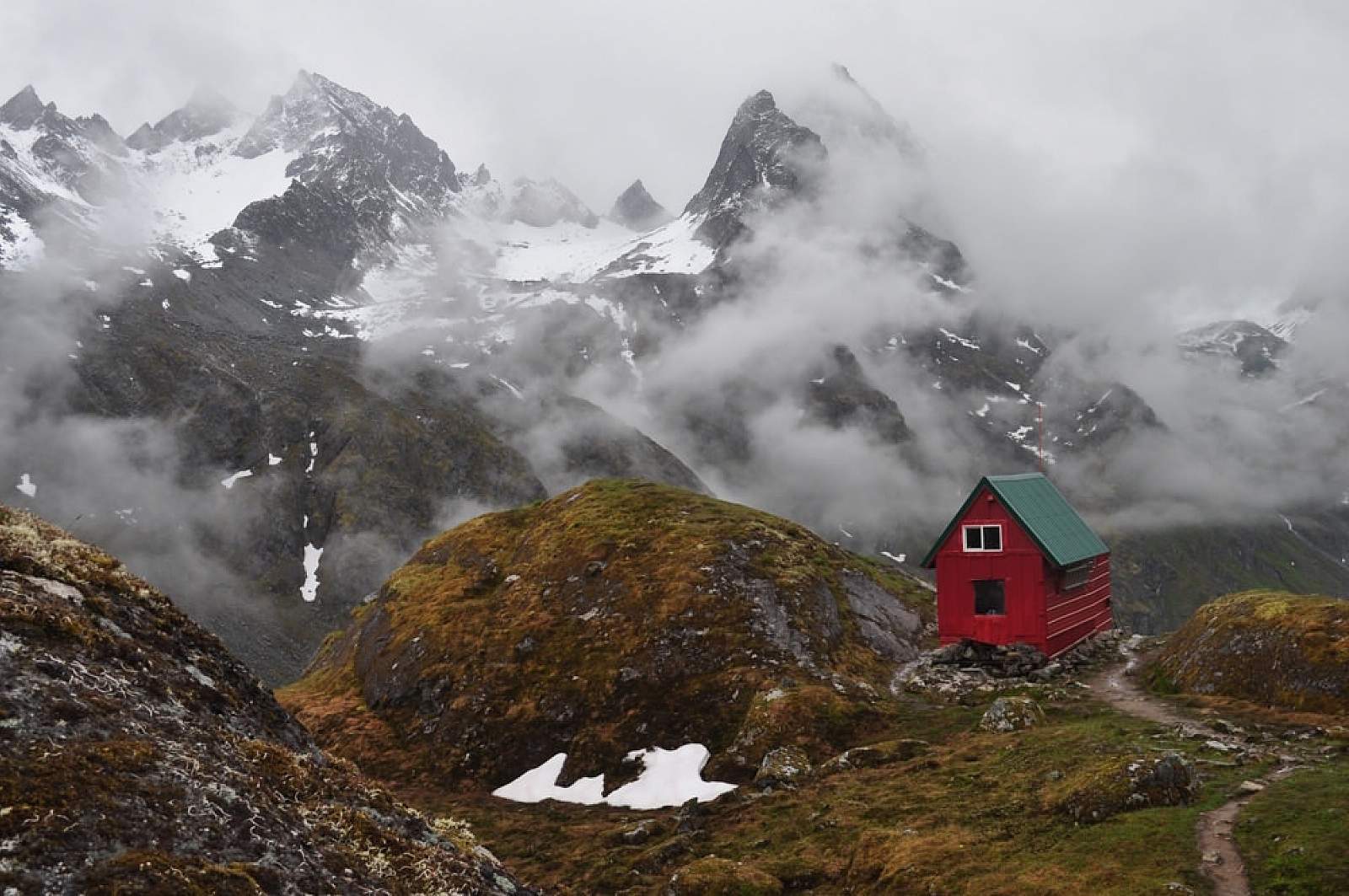
This glacier fills the bowl at the head of its valley in a great amphitheater of ice, with meltwater gushing from its toe to form the Little Susitna River. Located in the Hatcher Pass area of the Talkeetna Mountains northwest of Palmer, the Mint Glacier area is a popular day-hike, summer backpacking and ski mountaineering destination. The approach parallels the river—filled with striking granite boulders and plunge pools—up a brushy valley that rises into tundra with one great view after another. You don’t have to hike all the way to find photographic gems that include the glacier, perched about 3,000 feet above the valley floor. But for those who make it all the way to the glacier’s elevation, a first-come, first-use mountaineering hut nestles below and to the west of the glacier.
This route is a leg on a popular glacier mountaineering loop known as the Bomber Traverse. There are other glaciers in the Hatcher Pass vicinity that can be approached via day hikes—basically the head of every side valley ends in a nook holding multi-year ice. For a particularly gorgeous hike that traverses one section requiring boulder scrambling, try the Reed Lakes Trail. You’ll find a hanging valley with a lake and a glacier all its own.
Best Viewing Spot
The Gold Mint Trail begins from a parking area about Mile 14 of the Palmer-Fishhook Road, right where the road turns west in a sharp switchback away from the Little Susitna River on its climb toward Independence Mine State Historical Park. Intermittent views of the glacier will only get better the further you hike up the valley. The last eighth-mile is steep, leading to the Mint Hut, with the glacier looming above and to the east.
Getting There

Coordinates
Latitude: 61.8678273Longitude: -149.0794092
The Hatcher Pass recreation area is centered 60 miles north of Anchorage in the Talkeetna Mountains northwest of Palmer, with the Gold Mint Trailhead about 56 miles. From Anchorage, most people take the Glenn Highway to the Parks Highway, then exit north almost right away onto Trunk Road. After traveling north for about 6 miles, turn left (northwest) on Palmer-Fishhook Road and continue another 11 miles (through the canyon of the Little Susitna River) to the trailhead at about Mile 14.
Photos