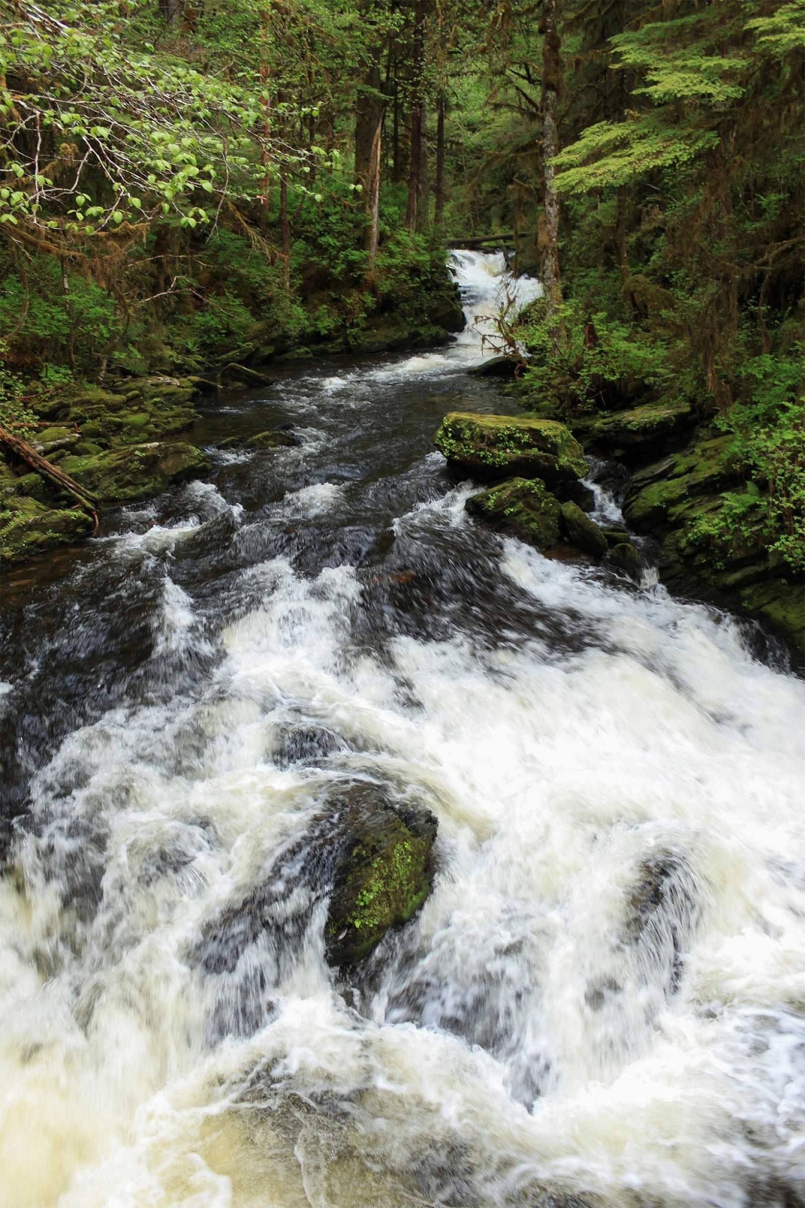
What’s nice about the Lunch Creek Trail is that it is all the way out north where the road dead-ends and is absent of homes and motorized traffic, except for the quite turn-off of Settler’s Cove Campground, where Lunch Creek pours into the Tongass Narrows. The Lunch Creek trailhead swings to the right. If one goes left, the trail will lead them to a waterfall platform and down to the ocean and will join the Lunch Falls Trail, if taken to the right, which is approximately a 0.5-mile loop. But Lunch Creek Trail follows east along Lunch Creek up a ladder of many beautiful waterfalls and past some of Ketchikan’s largest western red cedar, hemlock, and Sitka spruce.
Once the stairs are climbed not far into the hike, the gravel trail levels out for a while as it traverses land owned by the Alaska State Parks. About a mile in, the trail turns to dirt, roots, and stones when entering the Tongass National Forest at a nice sandy river bend where a sign reminds us that we are in bear country. Continuing up the valley, the trail becomes boardwalk over a couple muskeg sections, where one can see the towering ridge on the other side of the river. The trail then begins to climb into the forested hillside away from the river, crosses some small streams, and eventually comes back down to walk along the river side once again. Next the trail begins to turn north and crosses a bridge to the other side of the river for the first time. Boardwalk steps begin the more serious elevation gain now, which soon leads you to an intimate perch beside a waterfall, where sometimes American dippers can be found repeatedly diving into the rapids to feed and pop back out onto a rock. This is a nice place for lunch and rehydration and where one can refill a water bottle if equipped with a proper backcountry water filter or water-treatment system.
The trail continues to climb and alternate between boardwalk steps, roots and dirt, and sometimes muddy holes, which all lead to a level boardwalk across a muskeg field. Eventually the boardwalk leaves off to just muddy footprints trammeled through forested muskeg lanes that climb onward until you end up at the headwaters of Lunch Creek—the shores of Lake Emery Tobin, which is surrounded by a rim of steep mountainsides often capped with snow ridges and peaks. From late fall to early spring, these last muskeg sections can often be covered in snow and the lake frozen. Sitting at the edge of the lake is a perfect place for a warm cup of tea and quiet reflection. If you want to get away and don’t have a boat or a plane, this is as far away north one can easily get from Ketchikan.
*Trail description written by Teague Whalen, owner and operator of Mindfulness Rainforest Treks. Join him for a guided hike on Coast Guard Beach when you’re in Ketchikan.