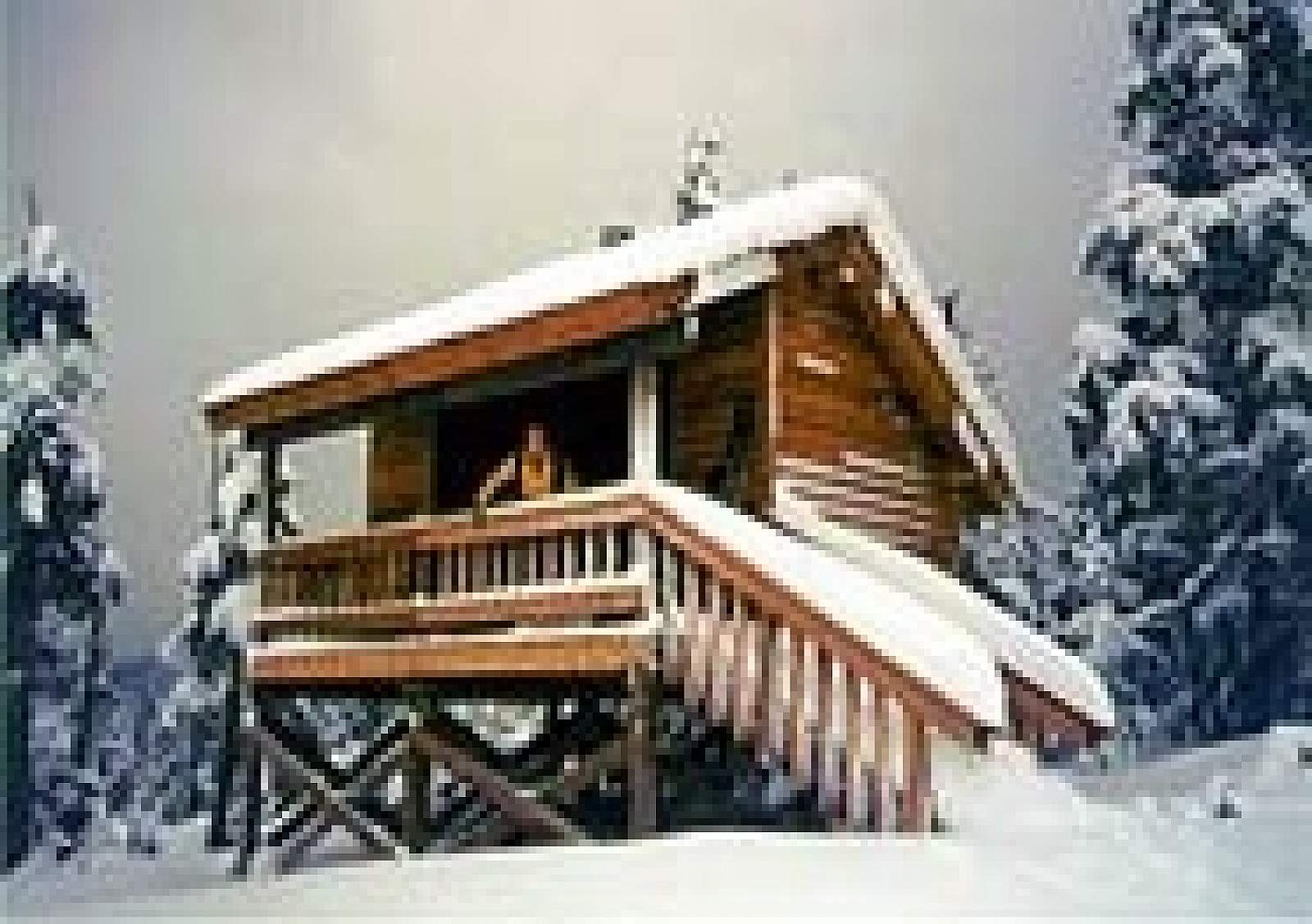
Description
Small 3-sided Adirondak style shelter designed for winter use.
Facilities
Wood stove, Benches. Water is available from river or nearby streams. Treat all water before using.
Area
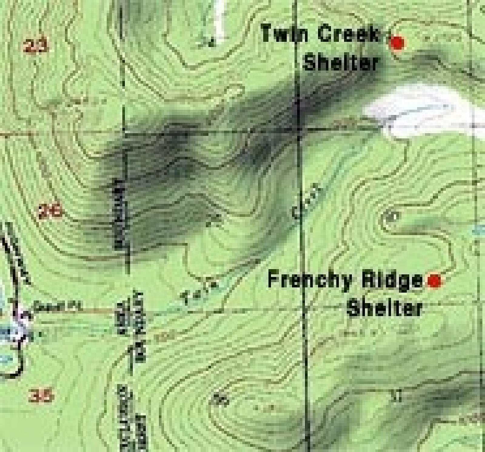
Mitkof Island
Location
On Frenchy Ridge along the Upper Twin Ski/Snowmobile Trail, 4 miles (6 km) from the Twin Creek Shelter.
Access
7.5 miles (12 km) from Petersburg on Mitkof Highway, snowmobile or cross country skiing 3.3 miles (5.3 km) up Twin Creek Road to trailhead, then 4 miles (6.4 km) on Upper Twin Ski Trail to shelter.
Terrain
Open, rolling muskeg hills and spruce/hemlock forest.
Special Features
Sweeping views of the coastal range to the east (Devil's thumb, Kate's Needle, Castle Mountain). Excellent snowmobile, skiing and snowboarding terrain
Season Of Use
Year-round; mostly winter
Managing Agency
Tongass National Forest
What To Bring
Firewood and fire starter, drinking water.
Rowboat
No
Stove
Wood
USGS Topo Map
Petersburg D-4, C-3
Rental Fee
None. First come, first served.