Eklutna Glacier
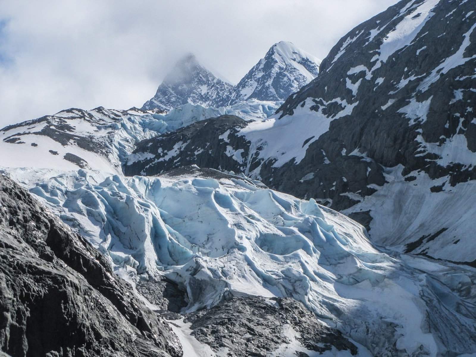
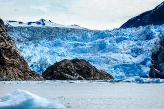
This rugged glacier emerges from a gorge beyond the head of Eklutna Lake, at the end of a multi-use trail deep inside Chugach State Park. The glacier once descended from its vast ice field somewhat like a ramp, offering relatively no-fuss access for mountaineers attempting a glacial traverse to the other side of the mountains near Girdwood. But a dramatic retreat during recent decades has made the terminal area much more treacherous, with exposure to rock fall and a swift, icy creek that might need to be crossed to find the best route. Depending upon snow depth and current conditions, the terminus can present a gauntlet of headwalls and ice fins, requiring technical mountaineering skills and equipment. It’s a raw, primal-looking scene. Casual summer visitors will marvel at the rugged, shattered rock and fresh slides and dirty ice—the very picture of raw climate carnage in real time.
Best Viewing Spot
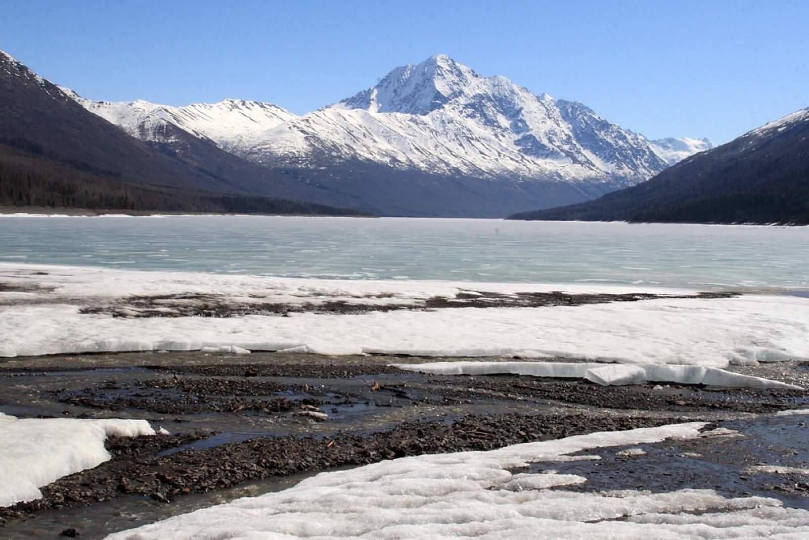
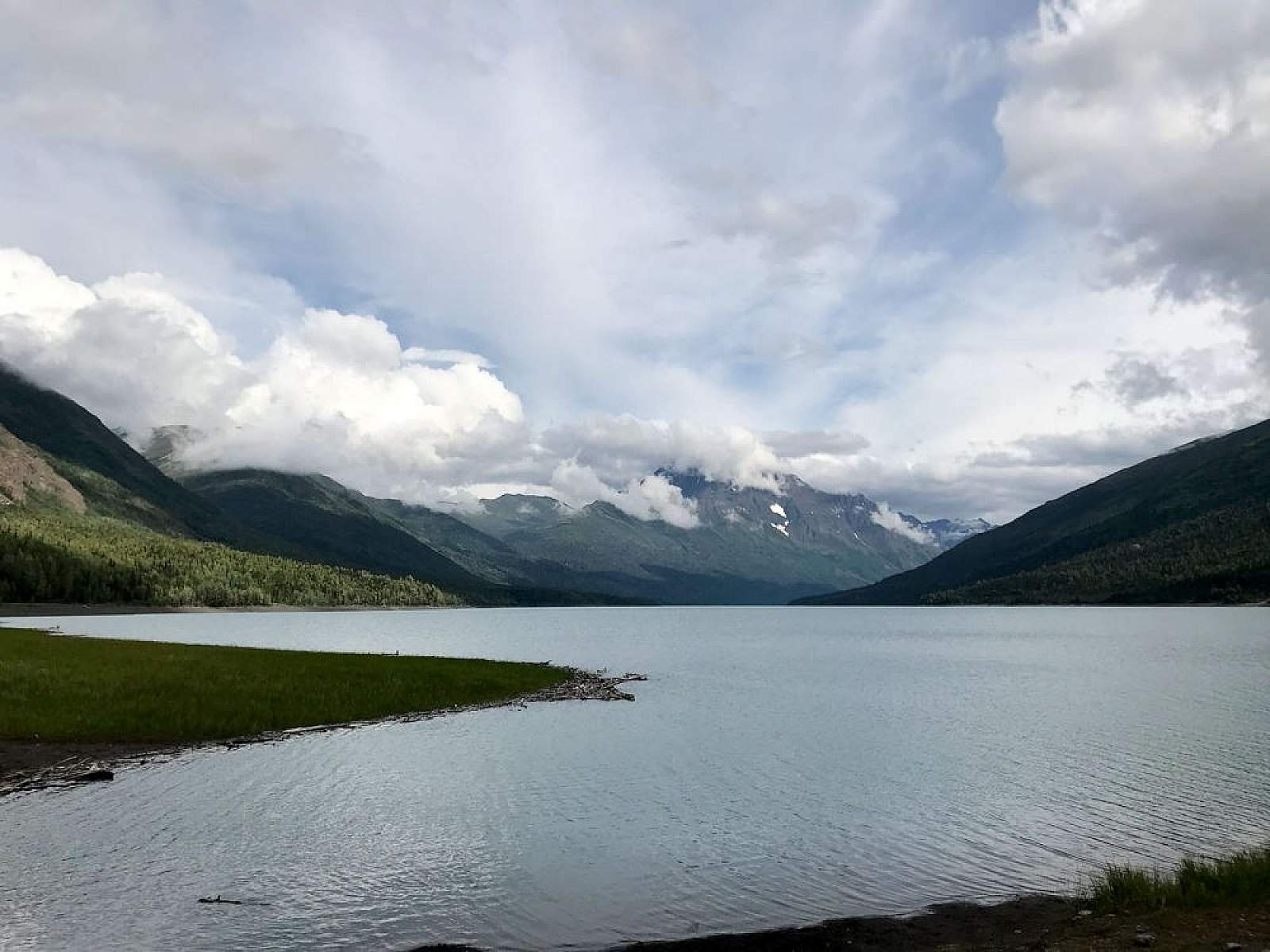
To see the glacier, you have to travel into the gorge, a 26-mile round-trip from the trailhead over a mostly flat multi-use trail. (It opens to ATV use on certain days.) Once you enter the canyon, you will see the rugged, boulder-choked terminus with fluted ice above. This somewhat strenuous day-trip over a gravel ATV route takes you deep into the backcountry in just a few hours, with great photography and a chance to see the ravages of climate change in action. (Many visitors book a night at Serenity Falls Hut and take at least two days.) The glacier toe is continuing to disintegrate, with its face changing every season.
Getting There

Coordinates
Latitude: 61.2619428Longitude: -149.0008427
From Anchorage, take the Glenn Highway north to the Eklutna exit about Mile 26. Drive into the mountains about 10 miles to the Eklutna Campground and park in the day-use lot by the northern shore of the lake. From there, take the lakeside trail about eight miles to the head of the lake. This route often branches into a “high road” and a “low road.” ATVs are restricted to the very hilly “high road.” Hikers and bikers should take the flatter “low road” that frequently runs right along the lakeshore. From the head of the lake, continue another four miles to a bridge over the west fork of the Eklutna River (just past a fork that leads to Serenity Falls Hut.) Continue south along the west side of the river, passing Serenity Falls itself, as the canyon narrows into a gorge. The glacier toe is about a mile past the falls
Photos