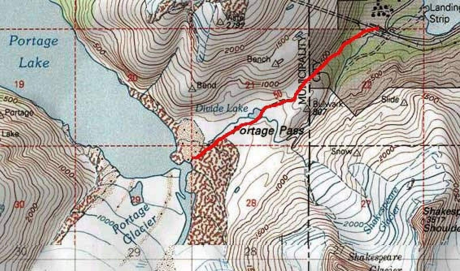
Portage Pass Trail
Distance
2 miles
Difficulty
Moderate
Why Take This Hike
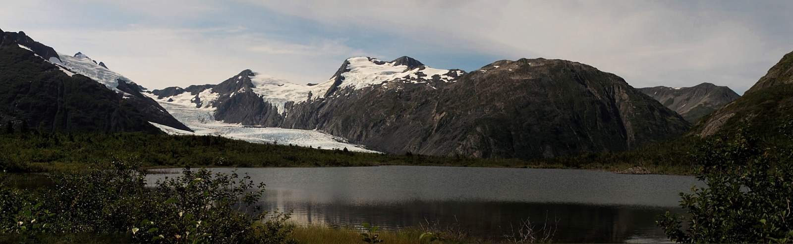
This 2-mile-long (4 roundtrip), family-friendly trail, which begins 90 minutes south of Anchorage at the far end of the Whittier Tunnel, remains the only easy way to see Portage Glacier on foot. And it’s has a spectacular conclusion: After cresting Portage Pass, the trail drops through glacial scrub before popping out on the wide gravel shores of Portage Lake, directly across from the snout of gorgeous Portage Glacier.
The Details
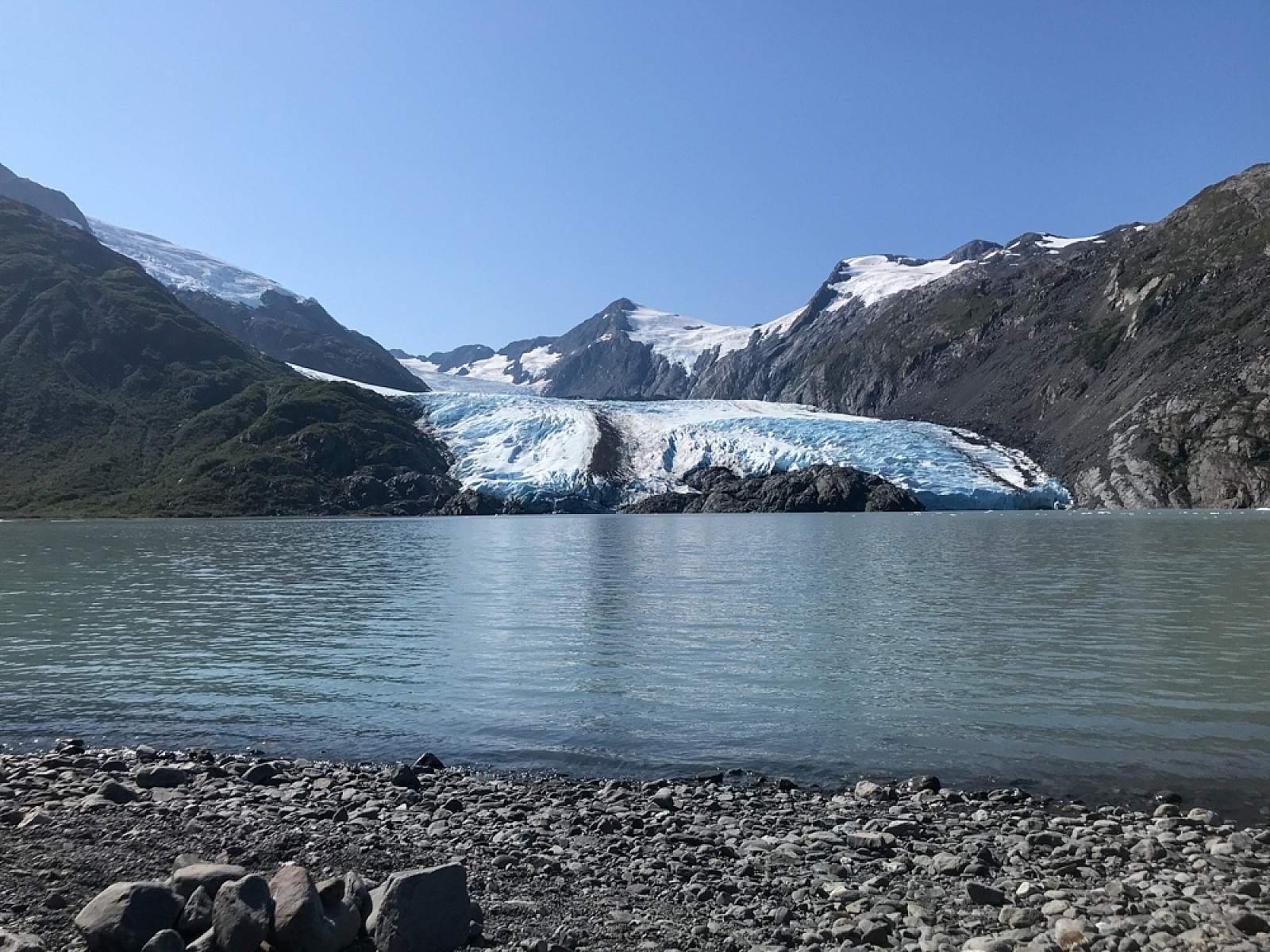
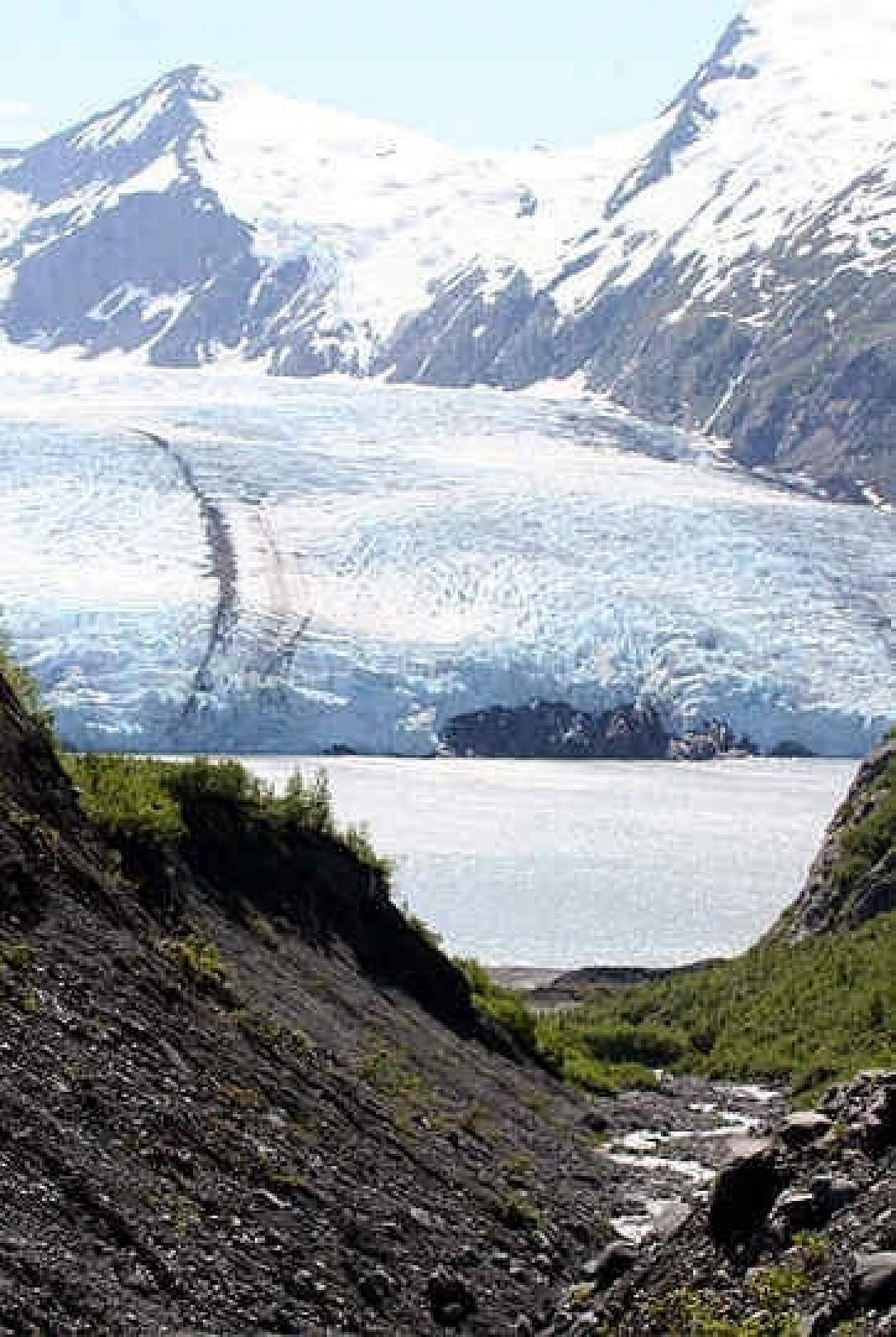
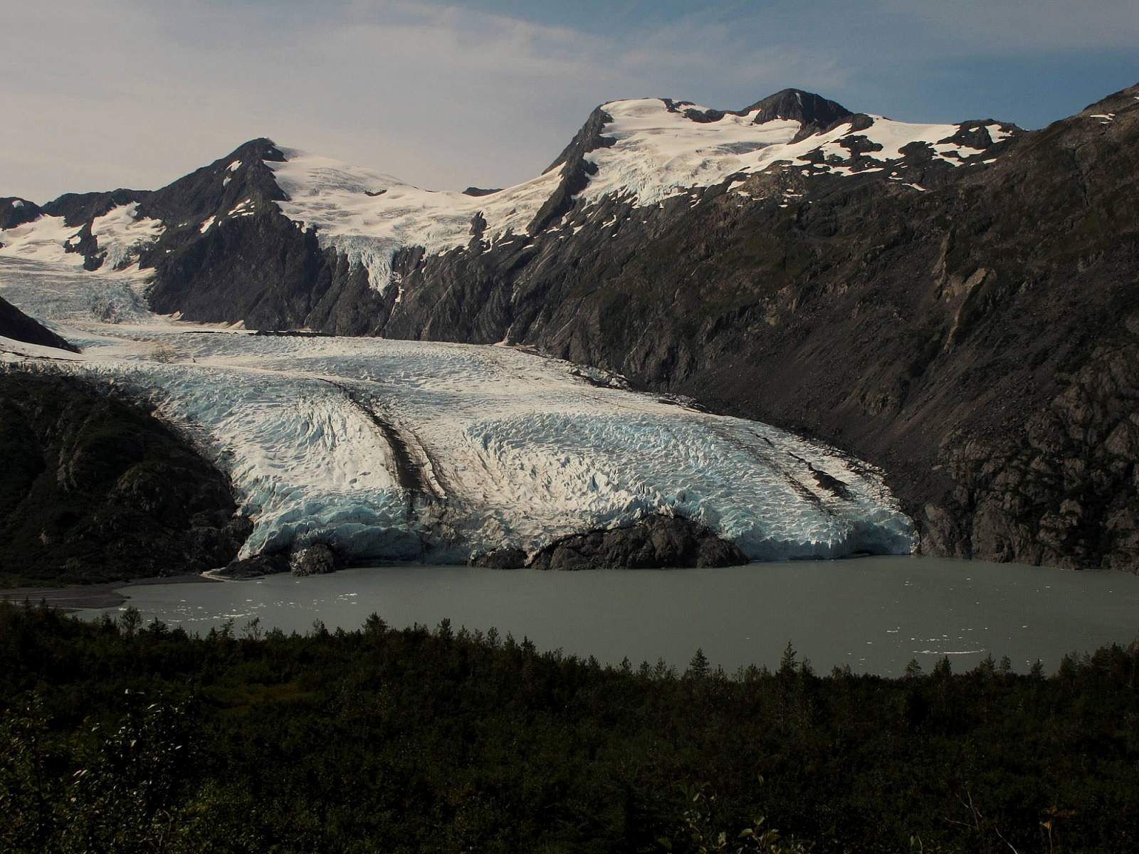
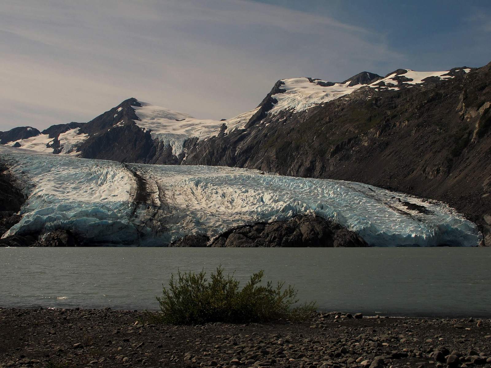
Not too long ago, you could walk from Begich, Boggs Visitor Center on the western end of Portage Lake down to a beach and reach out and touch the big, blue chunks of Portage Glacier.
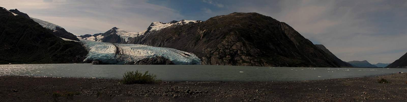
Those days have passed. Now the lake extends from the beach in one large gray expanse. The glacier, once so near, has now retreated far behind the north buttress of Byron Peak. You can still see the glacier by boat, but to see it by foot, you have to hike the length of Portage Pass Trail. Fortunately, this excursion makes for a fine family outing.
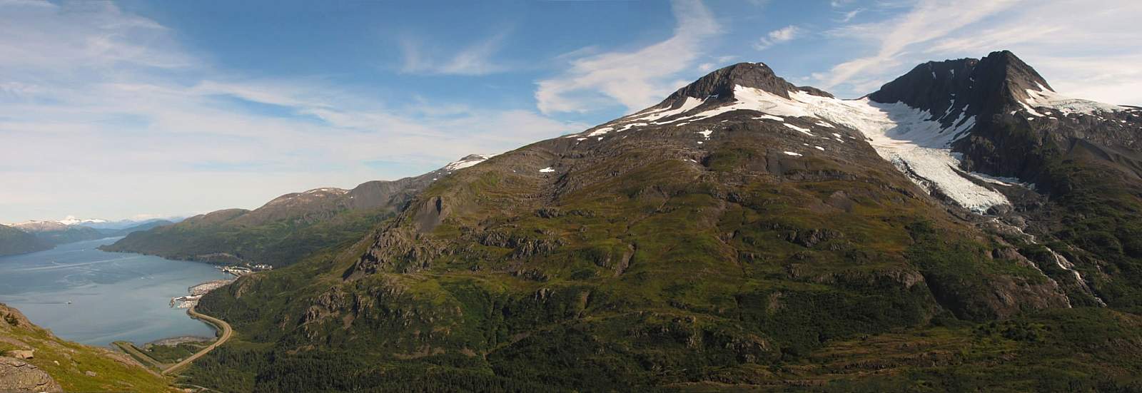
The adventure begins with the drive from Anchorage to Whittier down Turnagain Arm, which is considered one of the world’s most scenic. Then you’ll experience the two-plus-mile-long drive through the Whittier Tunnel, a World War II relic designed for one-way train use. Emerge from the tunnel to see Passage Canal and glacier-draped mountains rising along its flanks. Turn sharply left and you can look directly up the length of Lenard Glacier to where it disappears high above around the backside of Maynard Mountain.
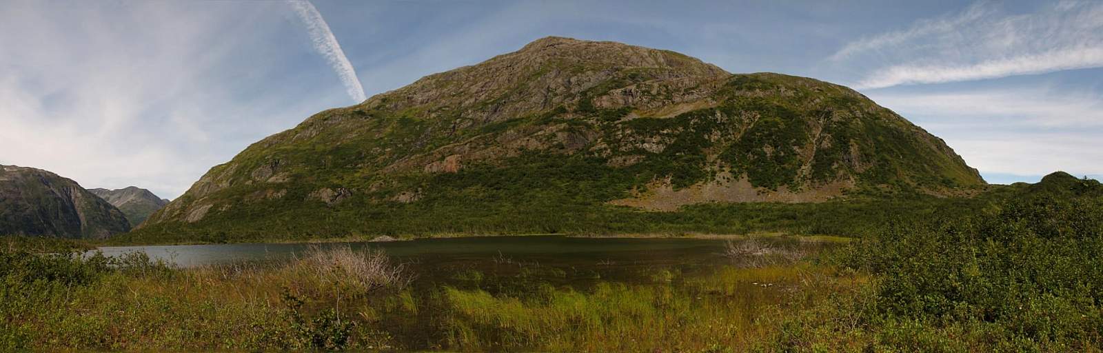
The hike offers even more marvels, and few difficulties. As you climb steadily up the old road that now forms the trail, you pass glacier-scraped stones and slabs both on and alongside the trail. When you look up, the low brush allows views of the steep, cliff-streaked slope of 4,000-foot-plus Maynard Mountain, as well as the massive rock of 3,718-foot Shakespeare Shoulder across the narrow valley.
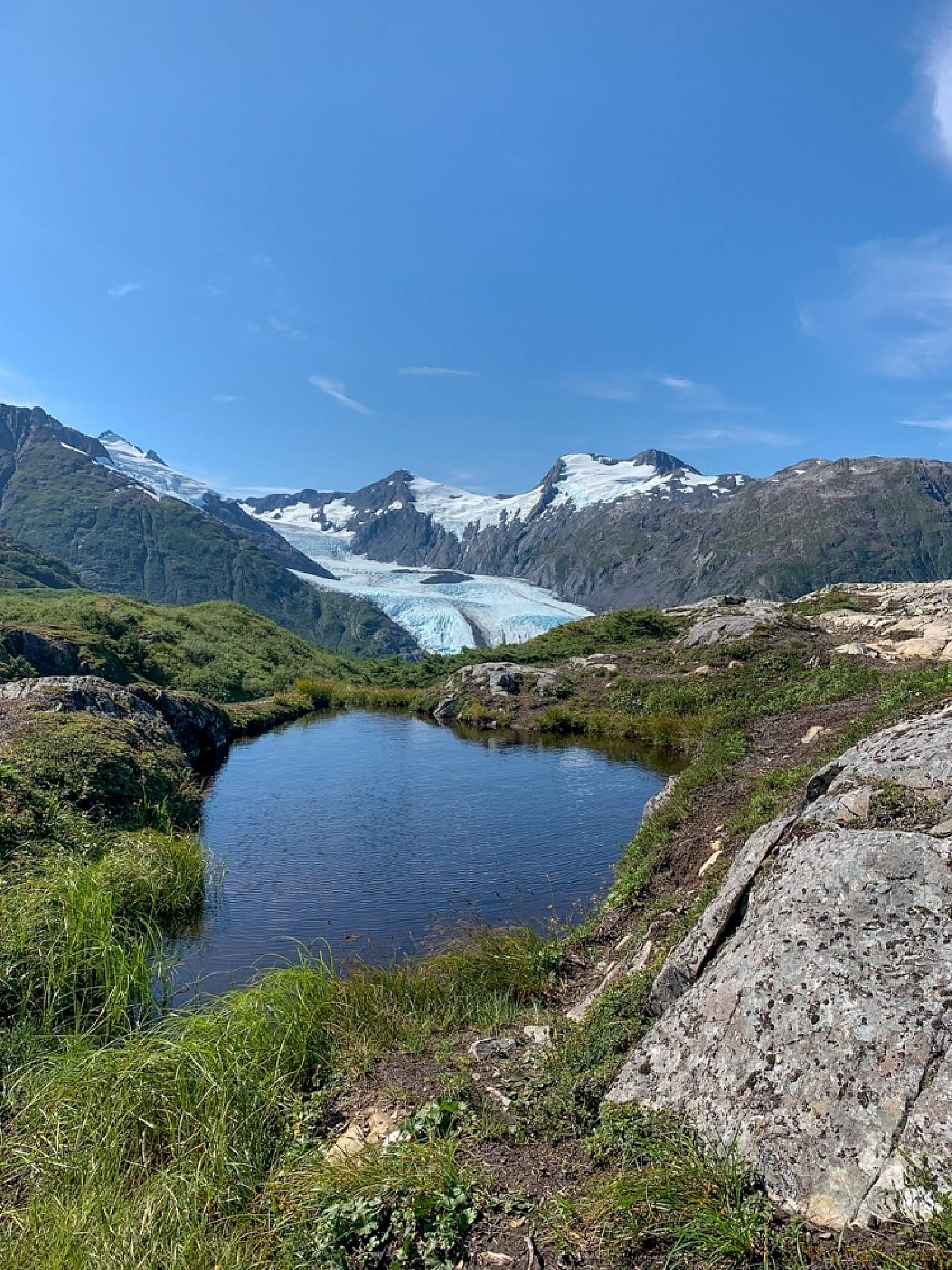
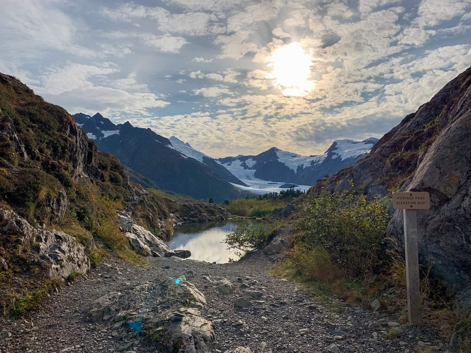
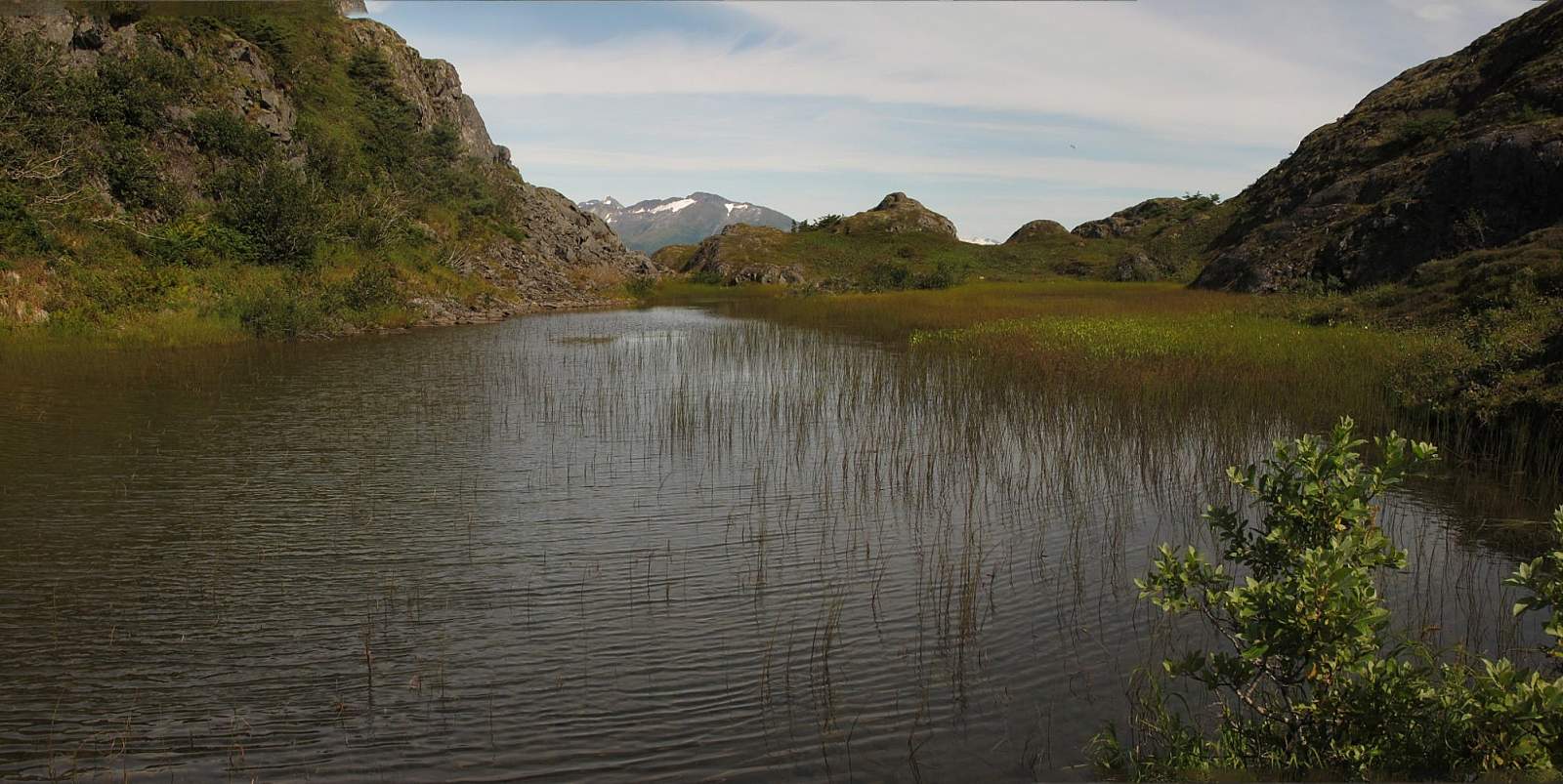
All the while you continue hiking steadily toward two stone towers rising against the sky in the pass above. When you climb the last few steps into the narrow gap between those two towers, you’ve reached the pass—a mere 800-or-so feet above sea level. Here, tundra-carpeted mounds beside the trail offer plenty of places to take a break. Between the mounds, you’ll see deep trenches, evidence of the power of ice to shape the landscape
If you feel particularly adventurous, zigzag your way through the tortured landscape to the left of the pass. Look 30 feet down into a gorge as the run-off from nearby snowfields and glaciers rumbles through.
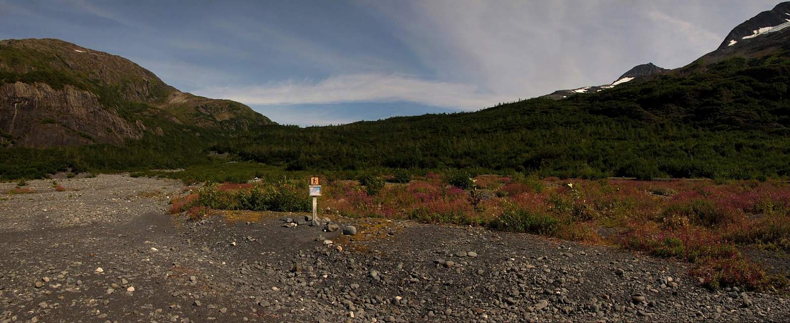
You’ll skirt one of the sources of that water—a small lake that fills the length of the narrow pass—then begin the descent to Portage Lake. Along the way, you’ll pass the appropriately named Divide Lake, which flows eastward to Passage Canal.
At the far end of the lake you then pass over a low rise and begin the 0.75-mile descent to Portage Lake. After winding down through the brush, the trail pops out onto a gravel embankment. From here, a series of small cairns lead you down the slope’s alluvial plain to the wide gravel beach across the lake from Portage Glacier.
Settle yourself onto the gravel and listen to the water lapping on the shore. Listen even more carefully and you can also hear water spilling from the snow-girted mountains that rise all around the lake. You may even hear the sounds of ice scraping against rock and water dripping through caverns, as Portage Glacier continues its long and slow retreat back into the mountains from which it once came.
One important thing to keep in mind: be sure to bring rain gear and warm clothing. No matter how clear and sunny the day appears in Anchorage (or even in Girdwood), the weather may be cloudy and rainy on the other side of the Whittier tunnel. Whittier, one of the wettest places in Alaska, often lies under lots of clouds, which makes for potentially hypothermic conditions.
Author: Shawn Lyons

Photos