Kachemak Bay State Park

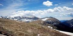
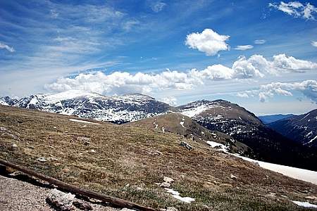
Alaska’s first state park, and only wilderness park, contains roughly 400,000 acres of mountains, glaciers, forests and ocean. The bay’s twisted rock formations are evidence of the movement of the earth’s crust. Highlighted by constantly changing weather patterns, the park’s outstanding scenery is a backdrop for high quality recreation. Park visitors will find opportunities for fishing, boating, kayaking, hiking, camping and mountain sports.

Kachemak Bay is a critical habitat area, supporting many species of marine life. Visitors frequently observe sea otters, seals, porpoise and whales. Intertidal zones offer natural settings for marine studies. Land mammals include moose, black bear, mountain goats, coyotes and wolves. The many species of birds that inhabit the bay, including eagles, gyrfalcons and puffins, make it a popular area for bird watching.

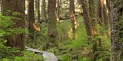
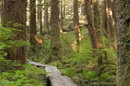
Hiking and camping along the shoreline and in the surrounding forests and mountains are excellent. Above timberline, skiers and hikers will find glaciers and snowfields stretching for miles. Special park attractions include Grewingk Glacier, Poot Peak, China Poot Bay, Halibut Cove Lagoon, Humpy Creek, and China Poot (Leisure) Lake.

Access to the Park

Access to the park is by boat or airplane.

Camping

Camping is permitted in most areas of the park. There are a number of sites that have been developed to include fireplaces, picnic tables, tent platforms, information, outhouses or food caches.

Getting There

Coordinates
Latitude: 59.281317
Longitude: -151.00708
Driving Directions

Show Map

Kachemak Bay State Park Points

Difficulty: Moderate

For a longer day hike, add this pop­u­lar route to the Glac­i­er Lake Trail loop. You’ll pick up the trail head­ing south down the Sad­dle Trail, then climb a steep ridge above tree-line to alpine tun­dra, with great views of Kachemak Bay, Grew­ingk Glac­i­er, and the glacial val­ley. In August, you’ll find ripe blue­ber­ries. Retrace your steps and con­tin­ue down the Sad­dle Trail to the Hal­ibut Cove pick­up. It is 5 miles out and back, plus Glac­i­er Lake…  ...more

Difficulty: Difficult Distance: 1 mile Elevation Gain: 1632 feet

Note: To get to the sum­mit you most get to the Sum­mit Junc­tion, and con­tin­ue the final .3 miles from there. The trail begins .5 miles beyond Chi­na Poot Lake. The ele­va­tion gain tells it all — 1632 feet in just over a mile! This trail does­n’t mess around. It is dif­fi­cult but can be fun. Right from the trail junc­tion, the trail will climb straight up, with no tra­vers­ing or switch­backs. The trail climbs over exposed tree roots, sev­er­al slick…  ...more

Difficulty: Difficult Distance: 1 mile

This trail is short and steep through thick for­est that leads to incred­i­ble sce­nary. The trail­head can be reached via the high­est point of the Lagoon Trail, two miles from the ranger sta­tion. Rock cairns mark the trail to an open alpine ridge, where the trail gen­tly climbs to a sum­mit that has some of the finest views any­where of Kachemak country.

Difficulty: Difficult

This trail winds along Hal­ibut Cove and pass­es though to Hal­ibut Creek delta, a wet bog­gy sec­tion. The riv­er can be ford­ed at low tide but may be dif­fi­cult to cross at oth­er times. The trail con­tin­ues on to lead you to Chi­na Poot Lake Trail, should you choose to go on.