Best Alaska Glaciers
Seeing icy glaciers is a quintessential Alaskan experience. Here are the most popular glaciers and the best ways to see them.
Show Map
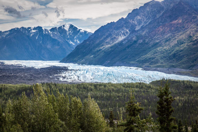
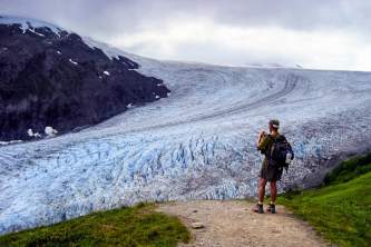
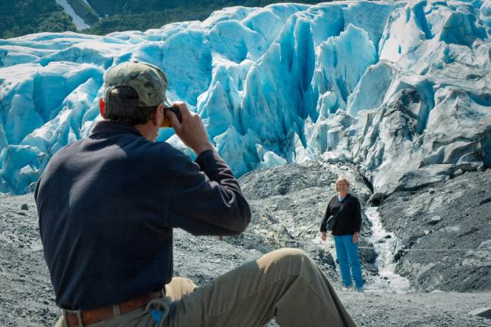
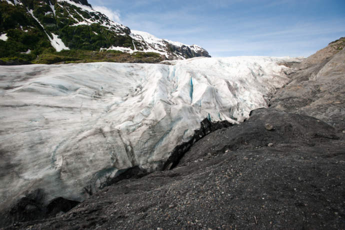
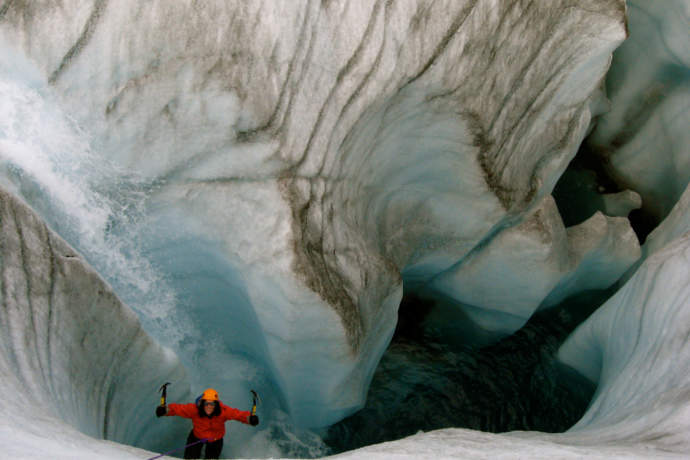
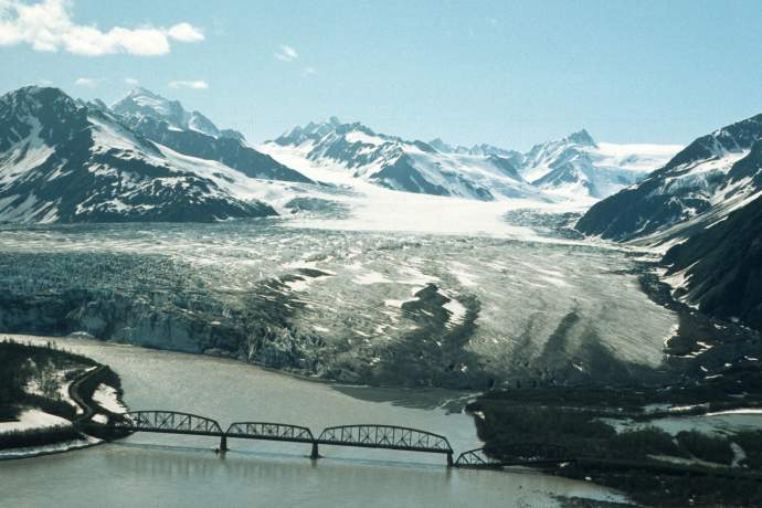
Matanuska Glacier: Hike or Drive
Being able to walk up to any glacier is a stunning experience, and this big boy is the biggest, and perhaps most impressive roadside glacier, in part because you can easily touch it.
Just a 2.5-hour drive from Anchorage, the Matanuska Glacier sits off the scenic but less-traveled Glenn Highway. More than four miles wide at its terminus, Matanuska is so massive that the water flowing out of its snout forms the roaring Matanuska River.
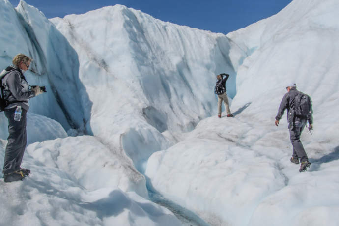
To see the glacier, you can just take one of the pullouts all along the highway —each with great photo ops—or you can drive near the glacier’s edge for up-close photos. One qualifier: Access to the glacier is on private land, so to get on the glacier you must join a guided tour. Options include a glacier walk / hike or ice climbing class. The sheer ice walls, deep blue holes (called moulins) and creaking ice make it an unforgettable experience.
At the very least, it’s a great excuse to drive the Glenn Highway. This road trip gives you a feel for the colorful adventurers, guides and backcountry Alaskans who live in these remote corners of the state. It’s easy to spend a couple days out here, thanks to the great lodges—not the big, cruise-circuit lodges, but intimate, family-run places that attract independent-minded travelers. See other great roadside glaciers.
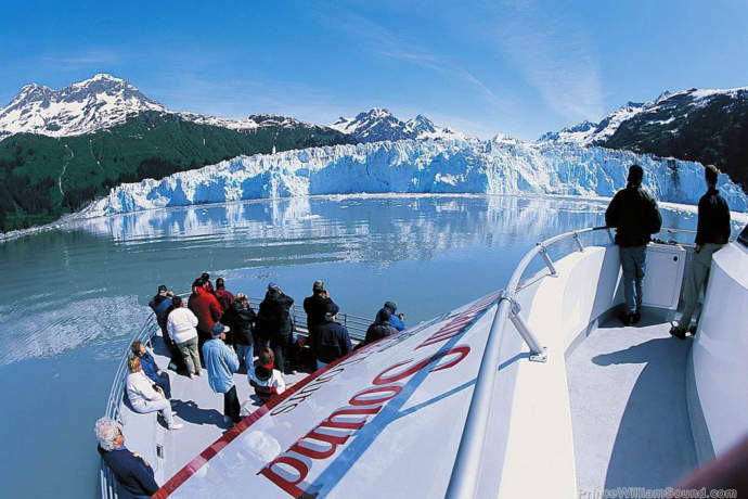
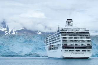
Prince William Sound: Day Cruise
You’ve likely seen those iconic glacier images, with hunks of ice crashing into the ocean. But to experience that humbling sight in person, your best bet is to go to Prince William Sound.
Tidewater glaciers originate high in the mountains and cover dozens of miles before plunging into the sea. Only 90 minutes from Anchorage by car or train, Prince William Sound has more tidewater glaciers than anywhere on earth, and it’s one of the easiest places to take a glacier cruise.
Most day cruises take between four and five hours, but there are two distinct types of cruises, and they offer different experiences: You’ll see more glaciers on the high-speed catamarans—such as the Surprise Glacier in Harriman Fjord, which some people think is the best calving glacier in the sound. The slower cruising boats, on the other hand, spend more time at the glaciers they visit, and those trips often include Blackstone Bay, where you can listen to the creaking and cracking ice while eating prime rib and king crab.
Or, totally immerse yourself in the sound on a multi-day small ship cruise or private yacht charter.
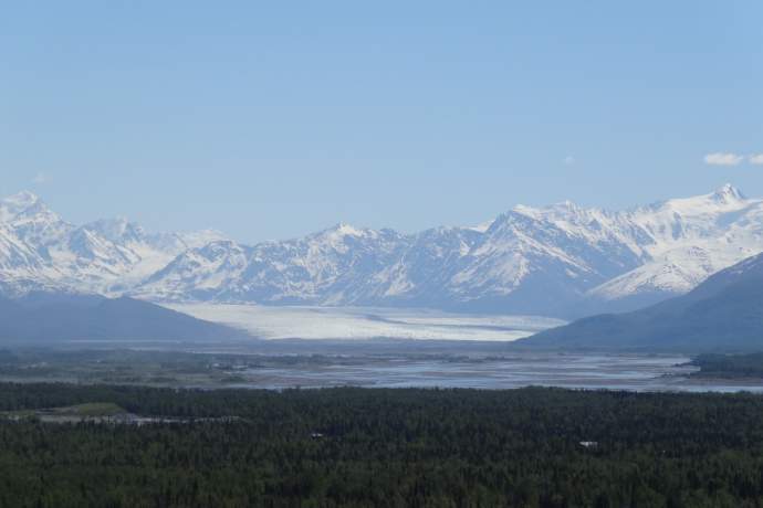
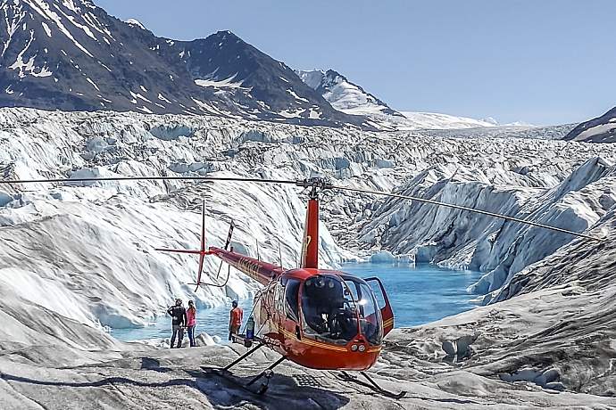
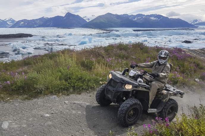
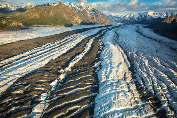
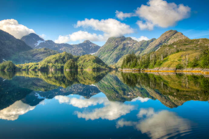
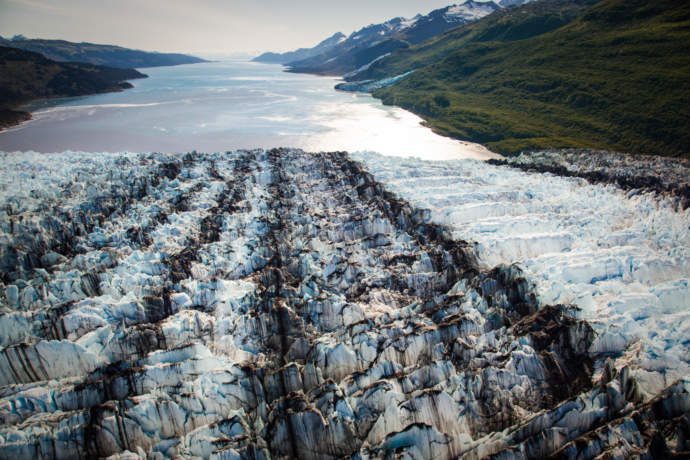
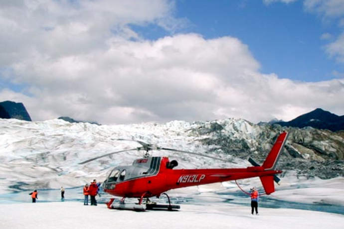
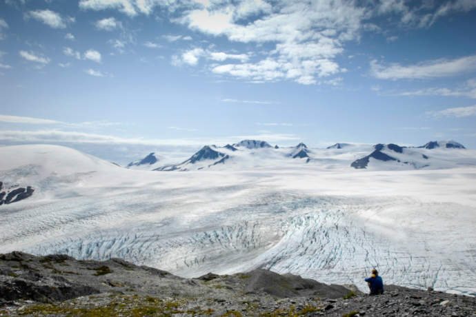
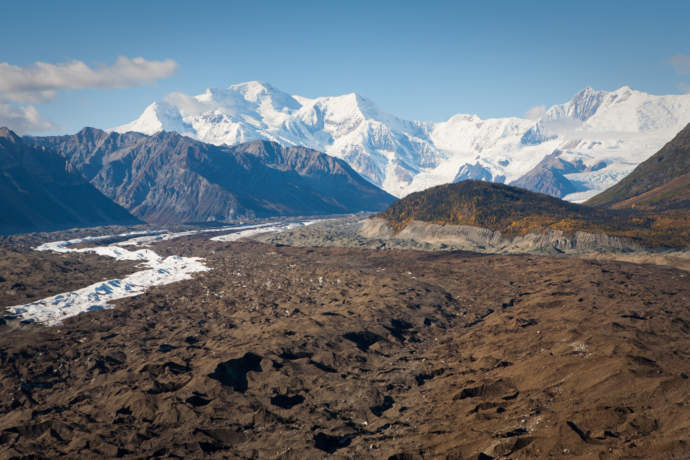
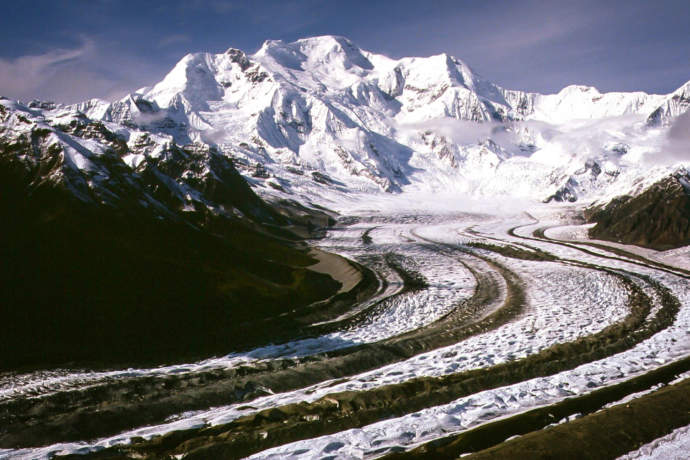
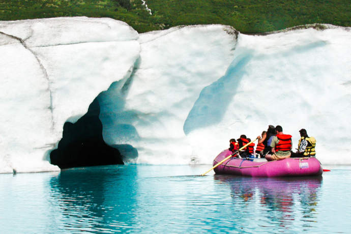
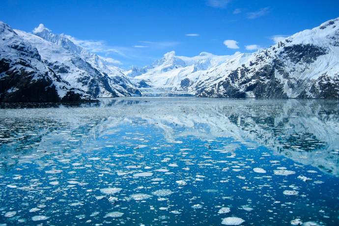
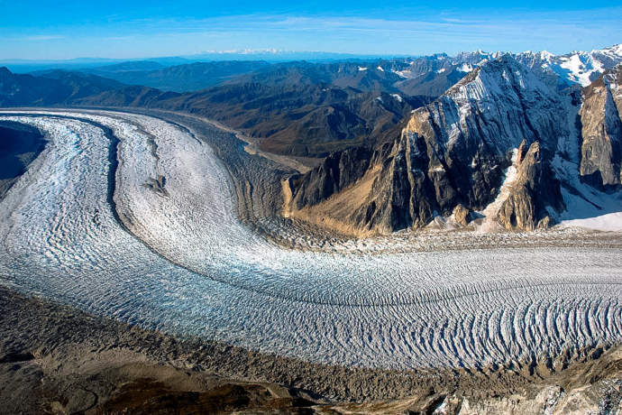
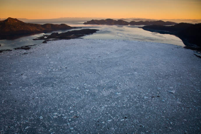
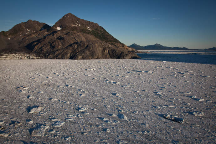
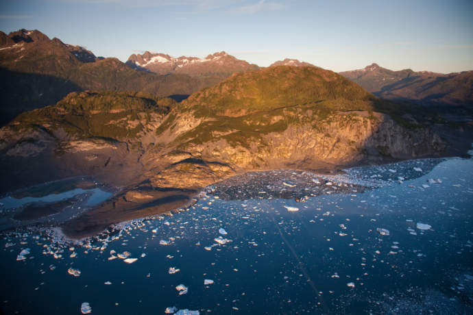
Knik Glacier: Flightseeing, ATV Tour, or Hike for View
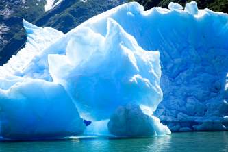
The 25-mile-long Knik Glacier snakes out of the Chugach Mountains before tumbling dramatically into an iceberg-studded lake that feeds the Knik River. With a five-mile-wide face and daily calving, the glacier’s an impressive sight: Its 400-foot-tall ice walls rise up from the lake where those icebergs are floating, turning, and breaking apart.
Even better, the Knik Glacier is close to both Anchorage and the Mat-Su Valley, and some great tours can get you up close. Flights are as short as 90 minutes round-trip (and up to 2.5 hours if you’d like to land on the glacier); heli-tours from the Palmer area get you to the glacier a little faster.
Soar over the ice, touch town for a landing, and explore the ice with grippers on your shoes. You can also go ice climbing, paddleboarding in the blue melt pools, or dogsledding up on the glacier’s snowfield. Or take an exciting all-day ATV adventure to experience the shimmering lake at the glacier’s face.
If you're ok with a view from afar, the West Butte Trail offers a great view (first picture) of the Knik Glacier tucked into the valley.
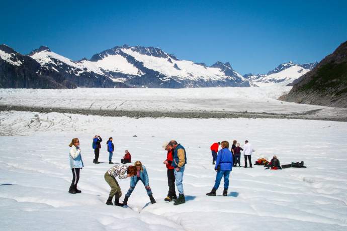
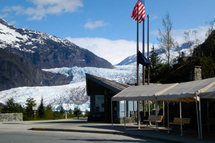
Mendenhall Glacier: Hike or Float
Southeast Alaska has just one glacier accessible by road, but it makes up for its novelty in being extremely accessible: you can even take a cab here pretty easily.
Located 12 miles outside of Juneau, Mendenhall Glacier gets more than 400,000 visitors each year. You can get there by taking a narrated bus tour, but you can also go on your own: A taxi to the glacier costs $35 one way, while a shuttle bus is just $8 each way.
A half-mile wide, the glacier feeds Mendenhall Lake, which stays pretty placid: While there are some icebergs in the lake, the face ranges from 5 to 200 feet tall, so you can’t expect booming calving action.
You can, however, do some good exploring. There’s a Forest Service Visitor Center overlooking the lake and glacier, which has a large aerial map of the icefield, an informational video and spotting scopes ($3).
The Forest Service also maintains several trails. One of them is The Trail of Time, a ½-mile paved interpretive walk, with signs marking the glacier’s recession. The East Glacier Trail, meanwhile, is a 3.5 mile loop with 500 feet of elevation gain, which gives you a good bird’s eye view of the ice.
You’ll get good photos from any trail, but none of them will lead you up to the glacier ice, due to the lake and cliffs. You can also take a guided hike of this area.
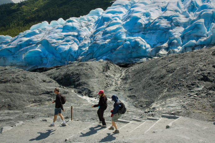
Exit Glacier
There are some glaciers you can drive to, but very few that you can stroll to. Just 15 miles from Seward—where many cruises embark and disembark—Exit Glacier is one of the most popular road-accessible glaciers in the state. In fact, you can walk almost right up to the face of it in 30 minutes, by way of the Edge of the Glacier Trail.
Exit Glacier is not huge, but it looks big up close, so it makes a great place for photos. It’s also a good spot to learn about glacial movement, since it’s receding quickly; there's even a guide marking its recession over the past 120 years.
The well-developed trails here have good footing and interpretive signs, explaining the return of plant life after the ice. There’s also a self-guided audio tour on The Alaska App, narrated by the Park Service’s chief interpretive ranger.
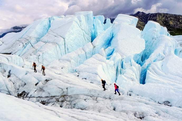
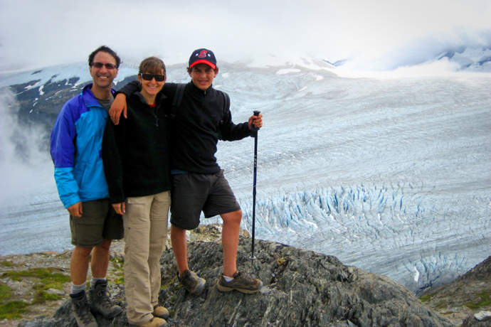
If you’re looking for more of an adventure, take the Harding Icefield Trail, which climbs 3,500 feet in 4 miles, and gives great views of the glacier. There are also guided hikes on the glacier, if you want to strap on crampons and walk on the ice.
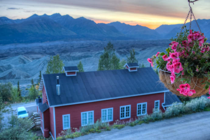
Stay at the Kennicott Glacier Lodge
Talk about a room with a glacier view: This is the only glacier in the state with a hotel across the street. There’s no other place where a glacier is such a constant presence—that tongue of ice creating a backdrop for your whole stay.
The Kennicott Glacier Lodge looks out over undulating piles of rock and silt, as well as the moraine on top of the ice. On clear days, you can see the alpine ice falls on Mount Blackburn (16,390 feet) at the head of the glacier.
The only challenge: McCarthy-Kennicott is pretty remote—an 8-hour drive from Anchorage or a 2-hour flight. But there’s plenty to do in this old mining town, including glacier day hikes, whitewater rafting and flightseeing over the ice-studded Wrangell St. Elias Mountains.
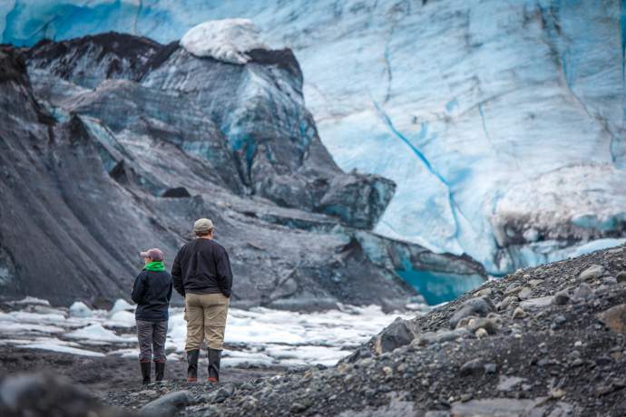
If enjoying the views isn’t enough, directly across from the lodge is the office of Kennicott Wilderness Guides. They will equip you with crampons for a guided walk on the nearby Root Glacier. That’s two glaciers in one day!

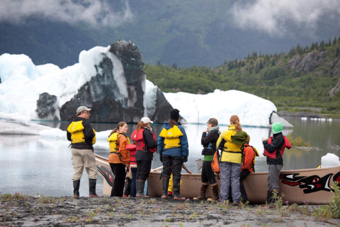
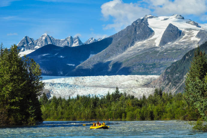
Take the Railroad to Spencer Glacier
Robustly colorful and relaxing to reach. Set between Anchorage and Denali, Spencer bends the road-accessible glacier definition just a little: the only way to see it is by rail.
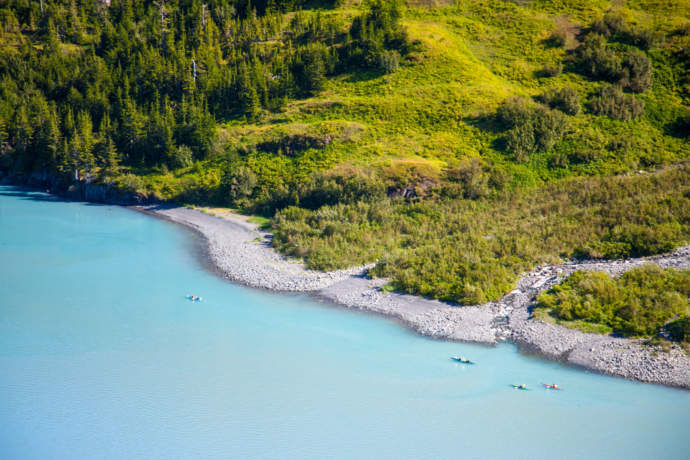
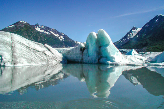
Spencer Glacier ends in a glacial lake, and such lakes are gorgeous sights themselves. When the ice rolls, it reveals deep, dark blue ice that’s saturated by fresh water. Spencer Lake is filled with blue icebergs—which, in fresh water, are called growlers.
When you get off the Alaska Railroad, you can float next to the ice on a raft trip across the lake with Spencer Glacier Rail and Raft. Or, you can hike to the glacier. You can hike on your own or join a Forest Service employee for an interpretive hike; there are two trails, both gravel-surfaced, which are 2.6 and 6.8 miles round trip. You’ll have two hours to explore the area before you have to catch the train heading southbound.
If you opt for the longer trail, you’ll just have to hustle to get back in time. But the bonus with the latter trail is that you’ll get to within 100 feet of the glacier’s terminus.
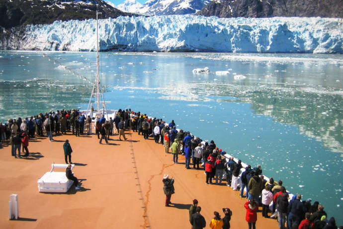
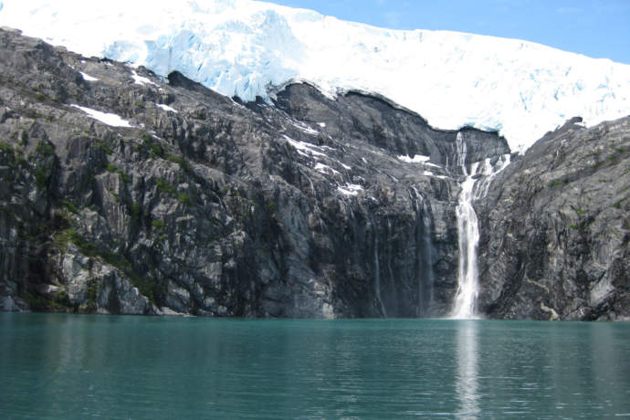
Glacier Bay National Park
Dozens of glaciers, calving action and wildlife galore: this National Park and Preserve is popular because it offers a greatest hits collection of Alaskan sights and is boat-accessible.
Glacier Bay has more than 50 named glaciers, as well as two major arms: East Arm and West Arm. Most people who come to the Park—and there can be 400,000 of them a year—come by way of a cruise ship, and most of those ships head up the West Arm, towards the Margerie Glacier. The reason? It's the most impressive glacier, which is advancing 12 to 14 feet a day and calves frequently.
You’ll often see seals hauled out on the ice chunks, here; if you’re in front of the Margerie Glacier, you’ll also be within sight of the Grand Pacific Glacier. This glacier once filled the entire bay, reaching Icy Strait in the late 1700s. Receding rapidly, its face is now covered with rocky moraine. Other well-known glaciers in the Park include Johns Hopkins, Reid, Carroll and Lamplugh glaciers.
Just as impressive as the glaciers, however, is the land exposed by the ice’s recession. You’ll see sculpted rock, eroded hillsides and scraped granite. The Park is also filled with wildlife, with bears foraging the tide line, mountain goats grazing near sea level and seals, sea lions and whales bustling about in the water.
If you're not cruising, stay a few days at Glacier Bay Lodge, the only lodging within the National Park boundaries. Take a catamaran tour for a close-up look at the bay’s massive, tidewater glaciers, a much more intimate experience than the typical visitor gets from the deck of a multi-story cruise ship. You may also see whales, bears, and mountain goats. You can also book excursions for kayaking, fishing, flightseeing, and more.
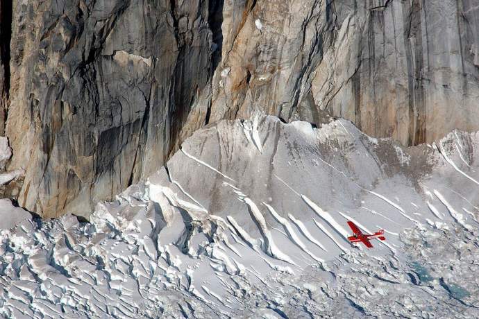
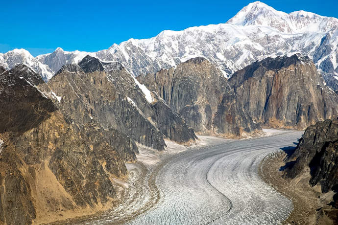
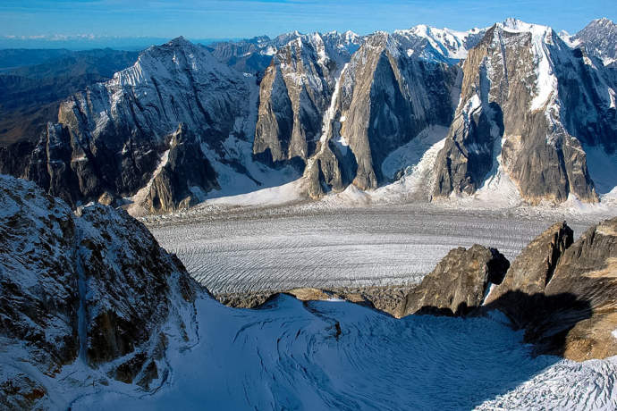
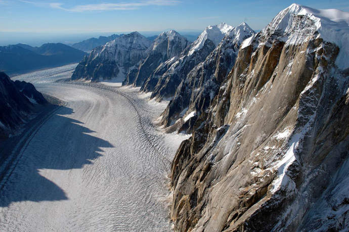
Flightsee Ruth Glacier
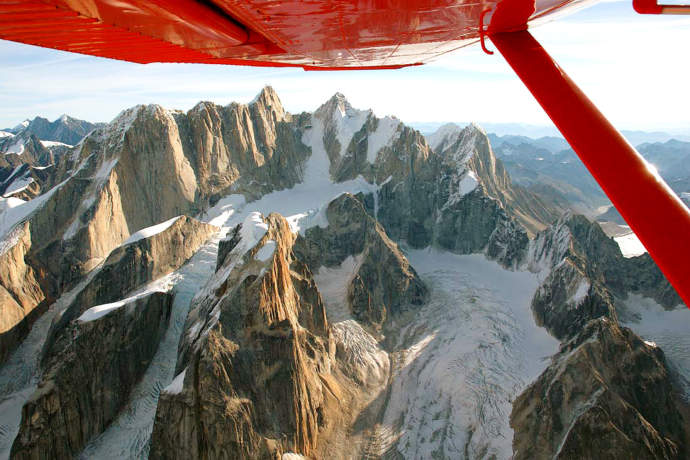
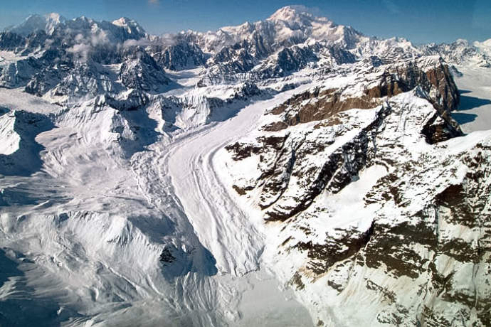
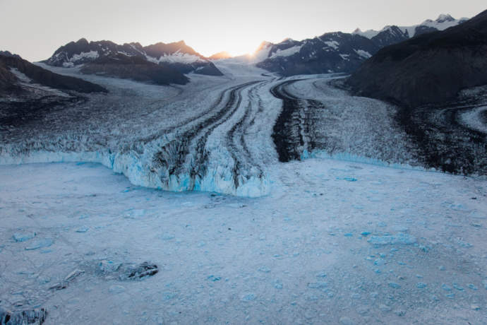
With a gorge deeper than the Grand Canyon, and glacial ice 3,800 feet deep, it’s hard to find a more impressive alpine glacier environment than this in Alaska. And while this mind-blogging spot near Mt. McKinley is famous among mountaineers, you don’t have to be one of them to make your way there.
Alpine glaciers form on the peaks or slopes of mountains, and are higher in elevation than valley or tidewater glaciers. The Great Gorge of the Ruth Glacier has 5,000-foot sheer granite walls rising up on either side of the ice, making them some of the highest granite walls on earth. The glacier ice drops 2,000 feet in ten miles— and if the ice melted away, the remaining gorge would be deeper than the Grand Canyon.
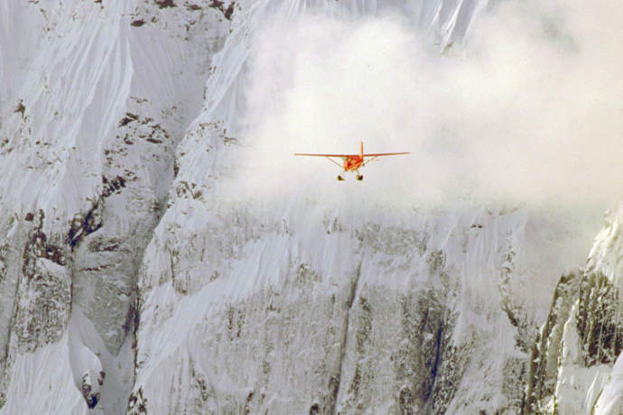
Your best bet for seeing it is to take one of the flightseeing tours from Talkeetna that fly over the Ruth. Some of these tours make glacier landings, of a half hour or so, in the Ruth Amphitheatre, a wide-open section of the Ruth Glacier surrounded by mile-high peaks and views of Mt. McKinley (which is just 6 miles away).
If you want to spend a whole morning or afternoon near the Ruth Glacier, K2 Aviation offers a guided hiking experience to Moraine Lake: You’ll land on a floatplane on a glacial lake on the edge of the Ruth Glacier, and then take a guided hike with the massive Ruth Glacier as your backdrop.
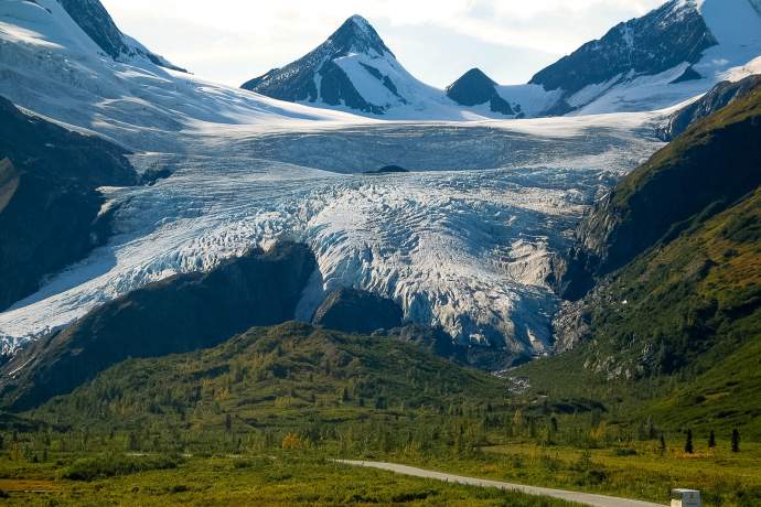
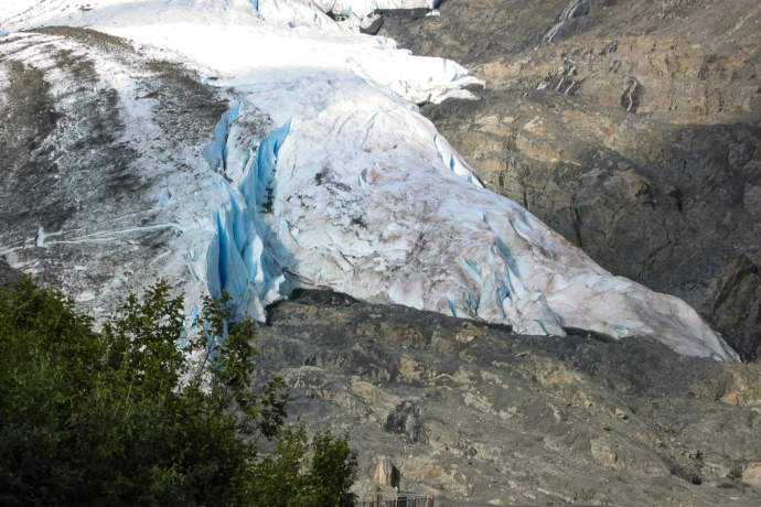
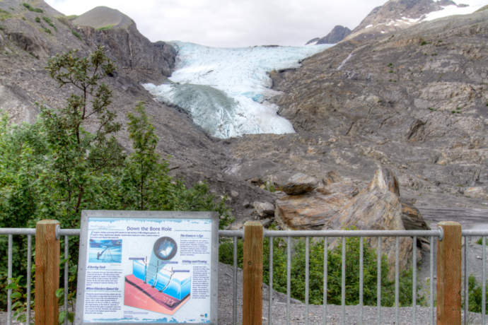
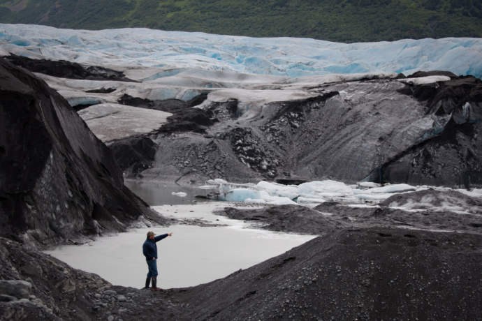
Drive to Worthington Glacier
If you can’t get enough snow, this spot is for you: Just 28 miles from Valdez, the Worthington Glacier is fed by the snows of the Chugach Mountains around Thompson Pass—and in fact, it's the snowiest place in the state.
How snowy can it get here? During its peak winter, 1951-52, the area got more than 80 feet of snow. Because of the steady snows, Worthington Glacier is not retreating as quickly as most. It’s also one of the most studied glaciers in the state: a National Science Foundation project is three-dimensionally mapping its flow.
Plus, it’s one of the easiest “walk-up” glaciers in the state, with a short paved hike to a viewing platform. Motorcoach tours visit the glacier, which has a large parking area, covered viewing shelter and interpretive signs. But if you’re traveling on your own, you can rent a car for the quick drive from Valdez, or join a guiding company for a glacier trek or ice climbing trips.
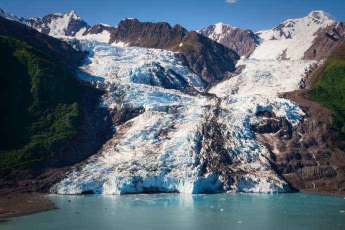
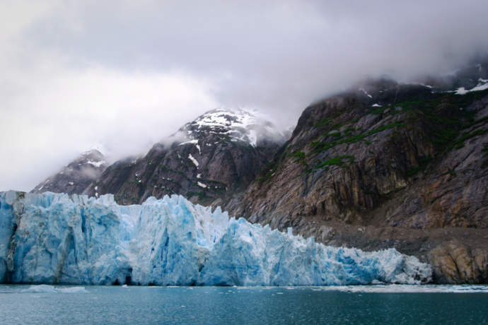
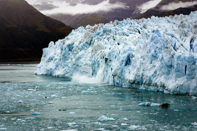
Childs Glacier: Float
Talk about natural drama: This is probably Alaska’s best roadside glacier, because it's the only one where you are almost guaranteed to see calving.
The Copper River flows into and past the Childs, undercutting the face and causing continuous calving—and we mean continuous: during the summer, it happens about every 15 minutes.
The only issue here is access. You have to fly or ferry to Cordova, a small fishing town, and from there you drive an hour along a road that was once the route of the Copper River Railway. The glacier is across the river, ¼ mile away, so you can’t walk up to it, but the view is great and the calving is intense. There’s even a viewing platform, since big calvings send waves across the river that scour the beach.
Indeed, there is some comfort in the fact that you can’t get any closer. There are stories of people finding salmon stranded in the forest, washed 20 to 30 feet from the river by these glacier tsunamis. Nearby, too, is the famous Million Dollar Bridge.
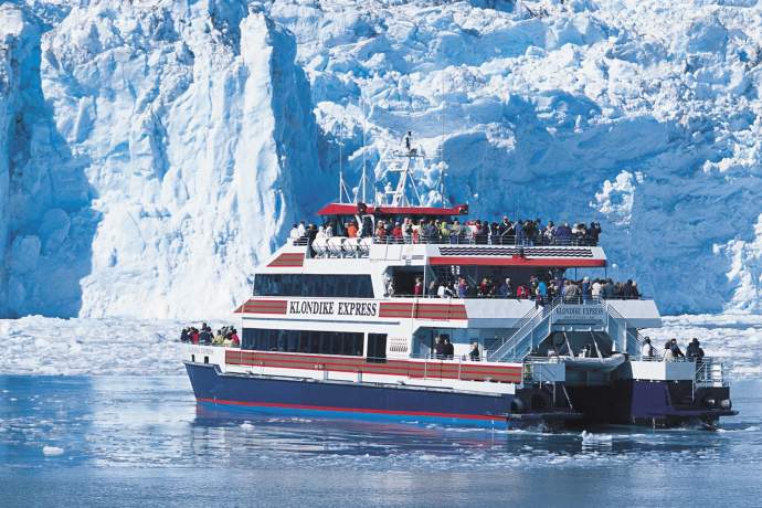
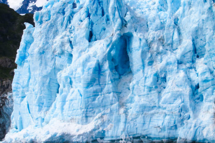
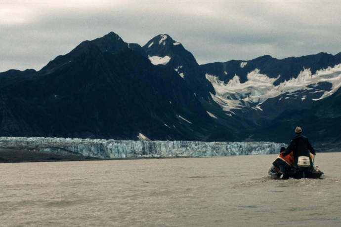
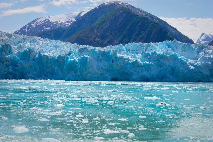
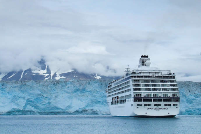
Columbia Glacier: Day Cruise or Kayak
Want some dramatic scenery? This glacier in the eastern part of Prince William Sound has been in a “catastrophic” retreat since 1982, a phenomenon predicted to stop by 2020.
Indeed, every day, 13 million tons of ice break off the face of it, leaving chunks in the water that are often twice as big as the boat you’re riding. That means that just getting close to this glacier can be tricky.
Tour boats leave from Valdez to see the Columbia, and tours tend to be about seven hours long, with wildlife viewing along the way. If the boat can get close to the glacier, you’ll be within one mile of its face, and you’ll get a 270-degree view of glacier ice that’s 200 to 400 feet tall. (Otherwise, you might be no closer than 12 miles.)
To get a preview of this dramatic glacier, check out this aerial video, filmed by Alaska.org’s Bob Kaufman from his airplane.
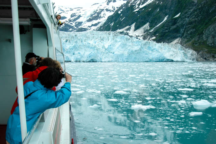
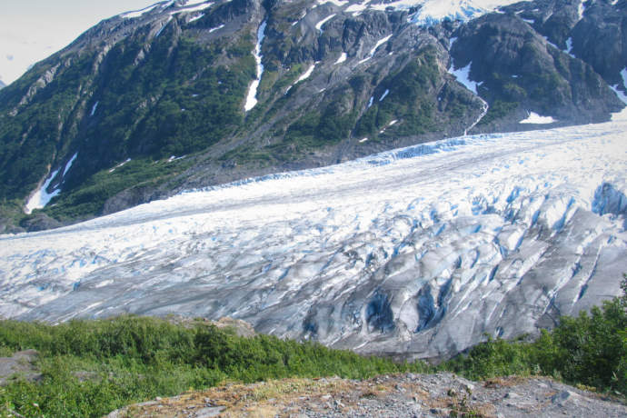
Twin Sawyer Glaciers in Tracy Arm
If you travel for the photo ops, the twin Sawyer Glaciers will keep you very busy: touring them gives you an up-close, vivid look at the ice.
The North and South Sawyer Glaciers are tidewater glaciers at the head of Tracy Arm, a 27-mile long inlet 50 miles south of Juneau. The inlet is incredibly narrow—often times no more than ½ mile wide—and cliffs rise over 3,000 feet on either side, with waterfalls covering the sheer rock walls.
The tour then, is nicely dramatic. Large cruise ships and day tours navigate tight S-turns to the glaciers. The South Sawyer is the larger of the two, and if the ice conditions are good, you can come within ½ mile of the face. Because this glacier extends deep underwater, the ice is compressed, making for very big and very blue icebergs.
There’s more than just ice to see, too: You can often spot bears and mountain goats on shore, and a seal colony near the glacier. See other best glaciers from a cruise.
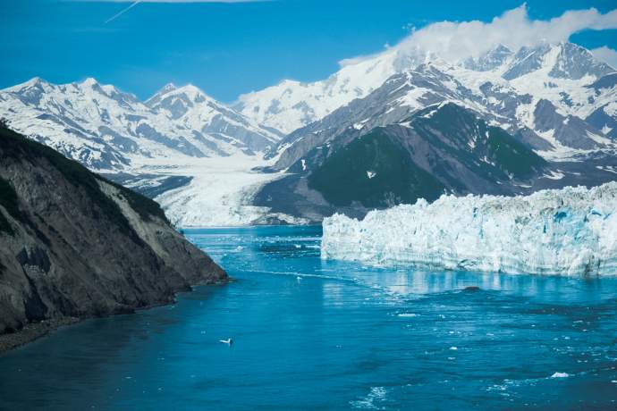
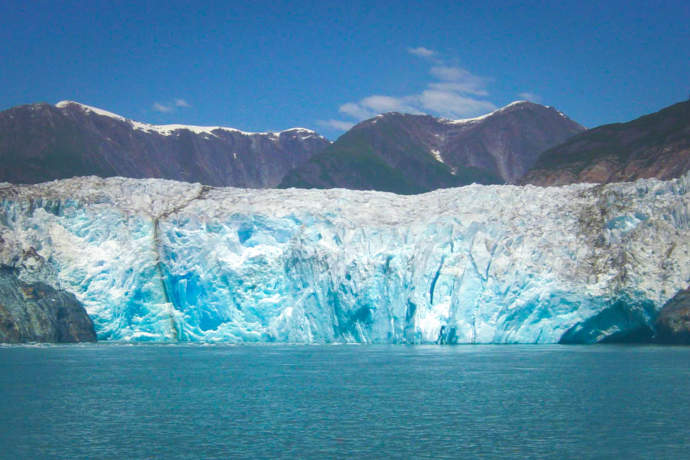
Hubbard Glacier: Cruise
This tidewater glacier may be a bit of sleeping giant. Off the coast of Yakutat—200 miles NW of Juneau—Hubbard is certainly gigantic: it's more than six miles wide where it meets the ocean.
It’s also been very active in the past, having had two major surges in the past 30 years. Those surges were big enough to cross the bay, turning the fjord into a lake and threatening to flood the coastal town of Yakutat.
For now, the glacier isn’t surging, but you could say that it’s a pretty light sleeper— it does calve a lot. The face is up to 400 feet tall, and icebergs 3 to 4 stories in height aren’t uncommon.
Granted, most of that ice is below water, but the ice can be so thick that cruise ships can’t get too close. In the right conditions, however, your ship might be able to get within 1/2 mile of the face.
Explore Further