Why Take This Hike
If you only have a little experience doing off-trail hiking, then this scenic 5-miler will help you get a bit more under your belt. Beginning on Rabbit Creek Trail, in the Front Range just above Anchorage, this hike visits a surprisingly expansive and scenic plateau that remains hidden from sight until you actually climb to it.
The Details
This adventure begins on the drive from the uppermost end of Canyon Road, as you navigate the last steep dirt mile to the parking area. On any given weekend day or summer evening you may find this parking area nearly full of people climbing Flattop Mountain’s backside (up to the left) or hiking the 5.5 miles to Rabbit Lake. It may not seem like the right place to find solitude, but be patient; that will come when you step off the trail.
Unlike many trails, which start in the forest, this one begins very close to tree line. As you work your way up the wide trail, look across the mile-wide valley to the wide and long McHugh Peak, its bulky ridges extending out over many square miles. This view will accompany you throughout the hike. Up to your left rise Peak Two, Peak Three, and Flaketop—a series of peaks that forms one long ridge against the sky. Soon, the indomitable summits of the intimidatingly named South Suicide Peak and North Suicide Peak come into view.
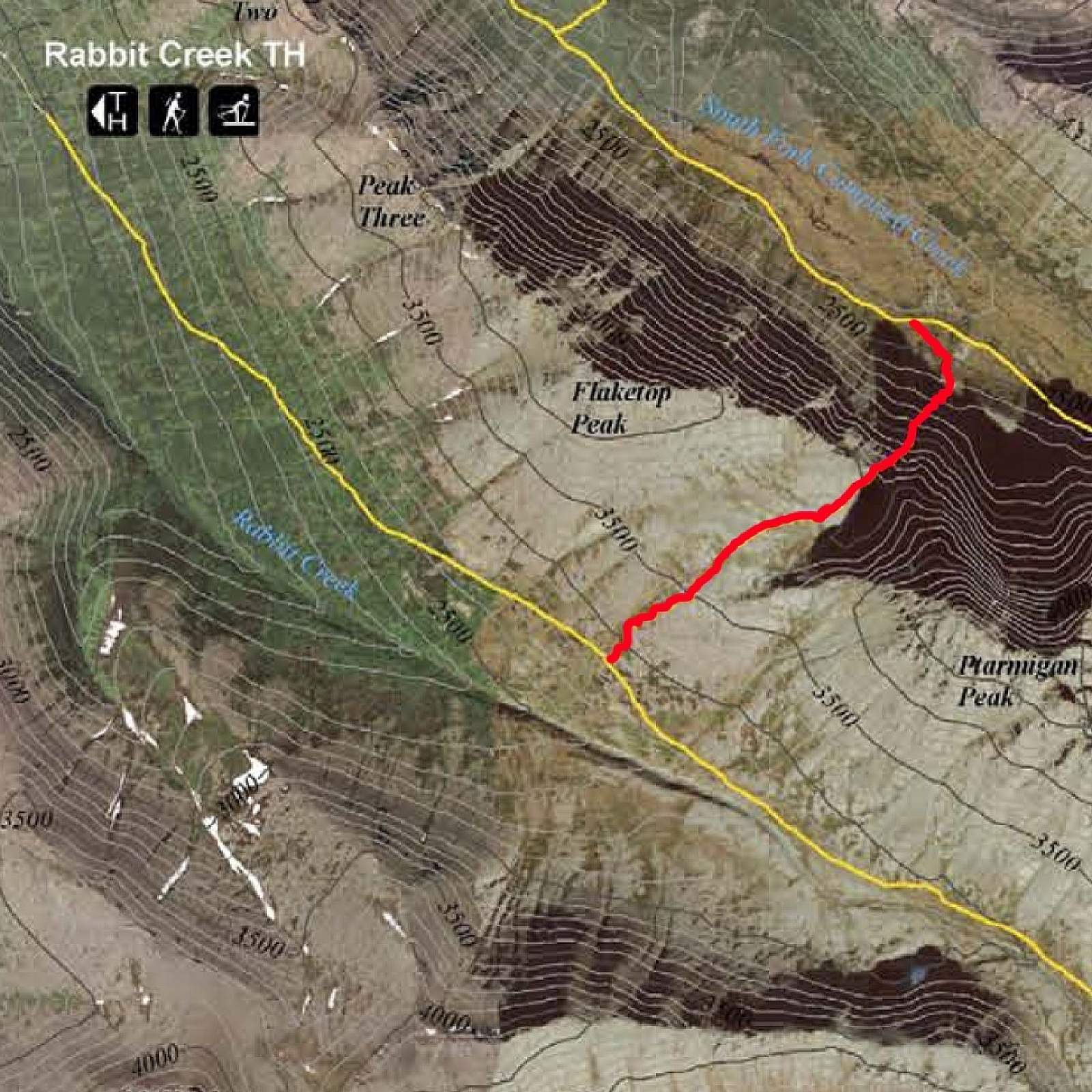
About 2 miles from the trailhead, begin to look for the broad gap in the ridge above you to the left, which forms the rim of Ptarmigan Pass. Then, just above the last trees, the trail descends to the broad flats leading to Rabbit Lake.
Now you can step off trail and set off on your own, up the wide tundra slope toward that gap above. After 800 feet of climbing, you reach the top of the shelf. Ptarmigan Pass suddenly spreads out before you, with the sheer west face of Ptarmigan Peak rising above its far end.
But don’t stop here. Continue diagonally across the pass for about 0.5 miles to the far corner just below Ptarmigan Peak, where you’ll look down a deep hollow to an emerald tarn.
This spot, between the waters below and the towering rocks above, makes a fine place to stop and rest. But if you have the energy, consider climbing onto the low ridge just to the left of the tarn. From that vantage point you can look directly down into Powerline Pass Valley and its network of trails, which lead to other off-trail adventures that you may now have more confidence to explore.
Author: Shawn Lyons