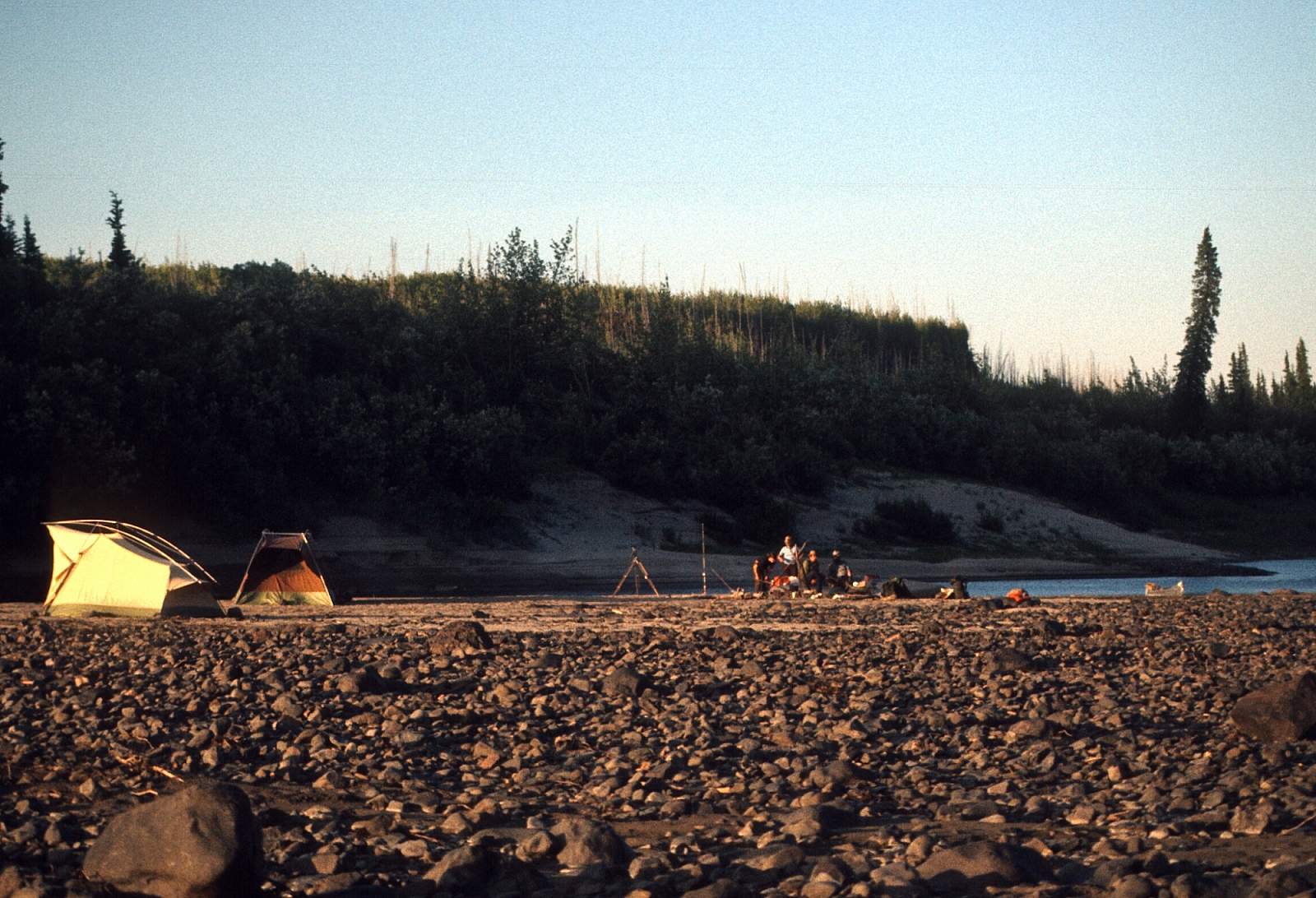
Why Float This River
The Porcupine River begins in the vast reaches of interior Canada in the Ogilvie Mountains and travels 300 miles of Canadian waterway and 200 miles of Alaskan waterway, to where it joins the Yukon River near Fort Yukon. It is a Class I wilderness trip that is suitable for anyone comfortable with camping in mosquito and bear country and flows through the boreal forest of spruce, birch, poplar and willow. It has headwaters that join with the Bell River and Eagle River to make the Porcupine River a large volume river early in its length. It is the namesake for the Porcupine Caribou herd that spends the winter months in the forested regions here before their annual migration to the Arctic coastal plains calving grounds. There is much riverboat traffic from the local Gwich'in Athapaskan native groups that live in and around Old Crow and the river has been a trade route to the Yukon for centuries. It has several vertical walled, smooth water canyons and eventually meanders its way through the Yukon Flats to join the mighty Yukon River just downstream of the town of Fort Yukon. The most common way to see this country is to start at the village of Old Crow and by floating the nearly 300 mile section to Fort Yukon and will take 10 to 14 days. To float a longer section you could drive the Canadian Dempster Highway to mile 373, 6 miles north of the Eagle Plains Lodge to the Eagle River Bridge where you can float the Eagle River to the Bell River and on to the Porcupine River. This is a 220-mile stretch of river to Old Crow and is another 10-day trip. Or you can fly in to Summit Lake at the headwaters of the Bell River for a 210-mile stretch to Old Crow.
Put In
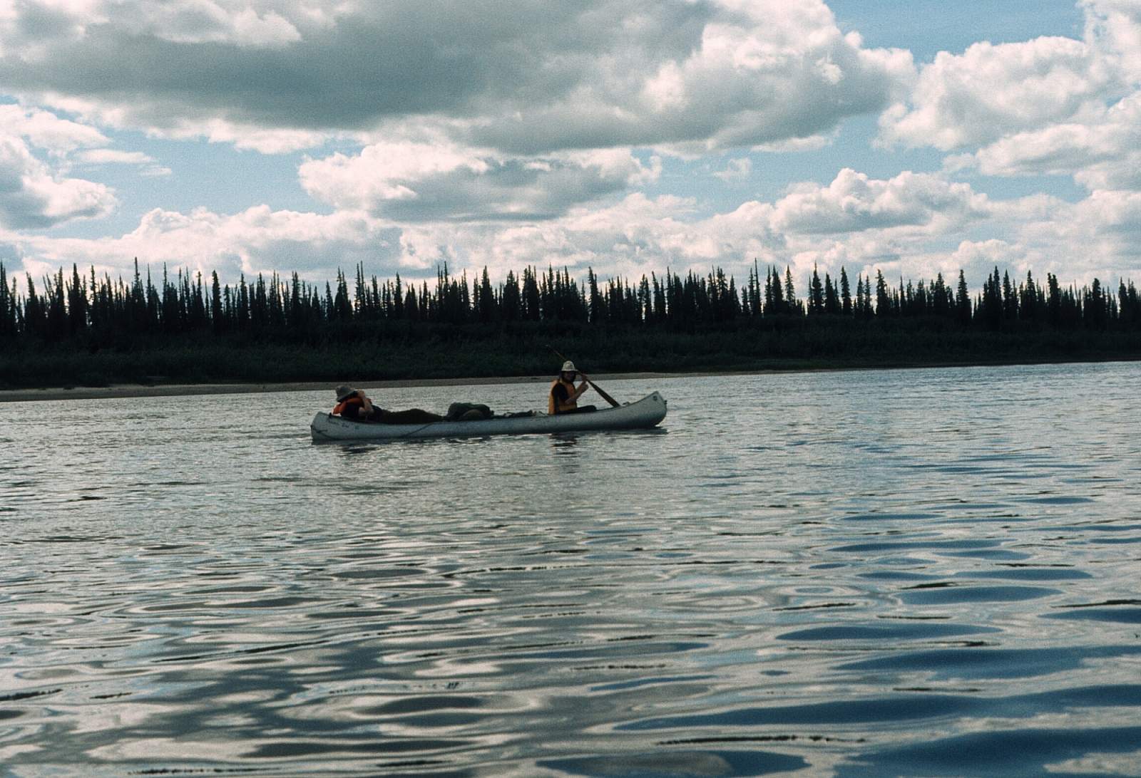
Rafting parties will want to start in Old Crow, while inflatable kayaks are well suited for the Eagle and Bell River sections. To begin the journey you will need to get to Whitehorse or Dawson, Yukon Territory, Canada by driving or by flying commercial airlines. From either of these cities you can charter a flight in to Old Crow, or Summit Lake on the Bell River, or arrange a car shuttle to the Eagle River Bridge along the Dempster Highway.
Take Out
Take out options are either Old Crow for the upper river or Fort Yukon, Alaska where regular commercial airlines operate flights to Fairbanks.
The Trip
Summit Lake to Old Crow: 210 miles
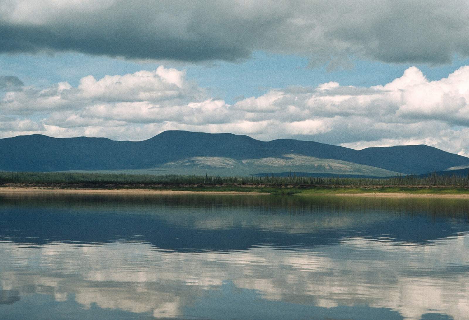
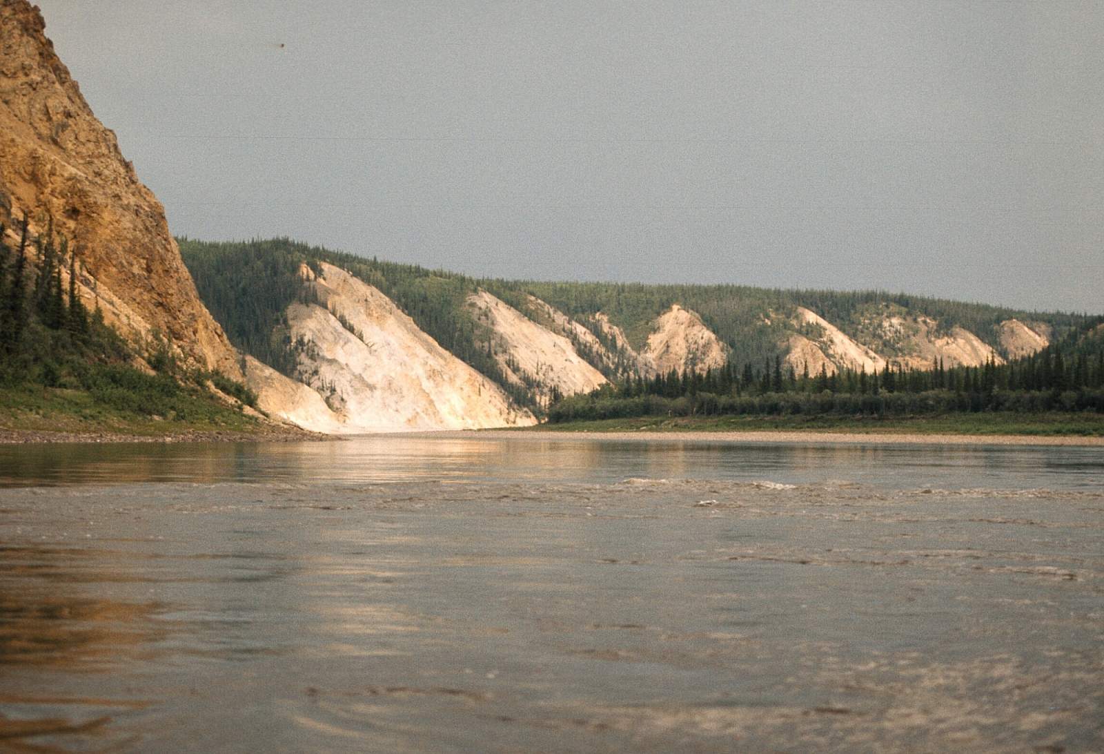
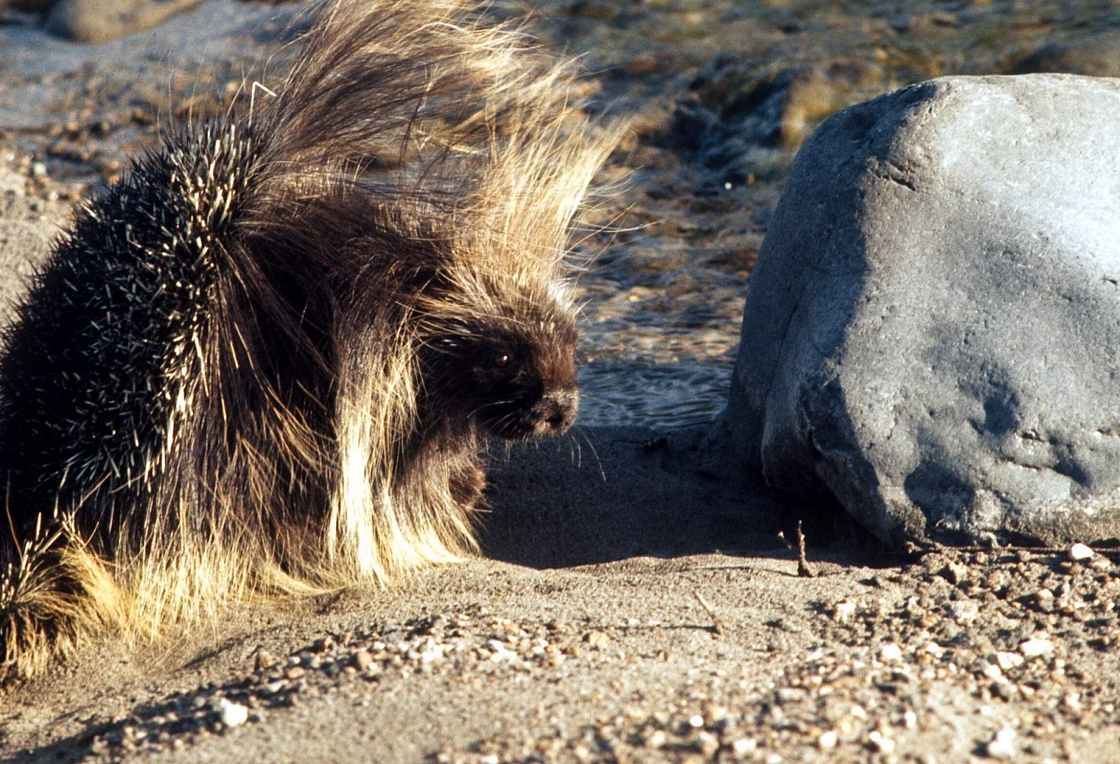
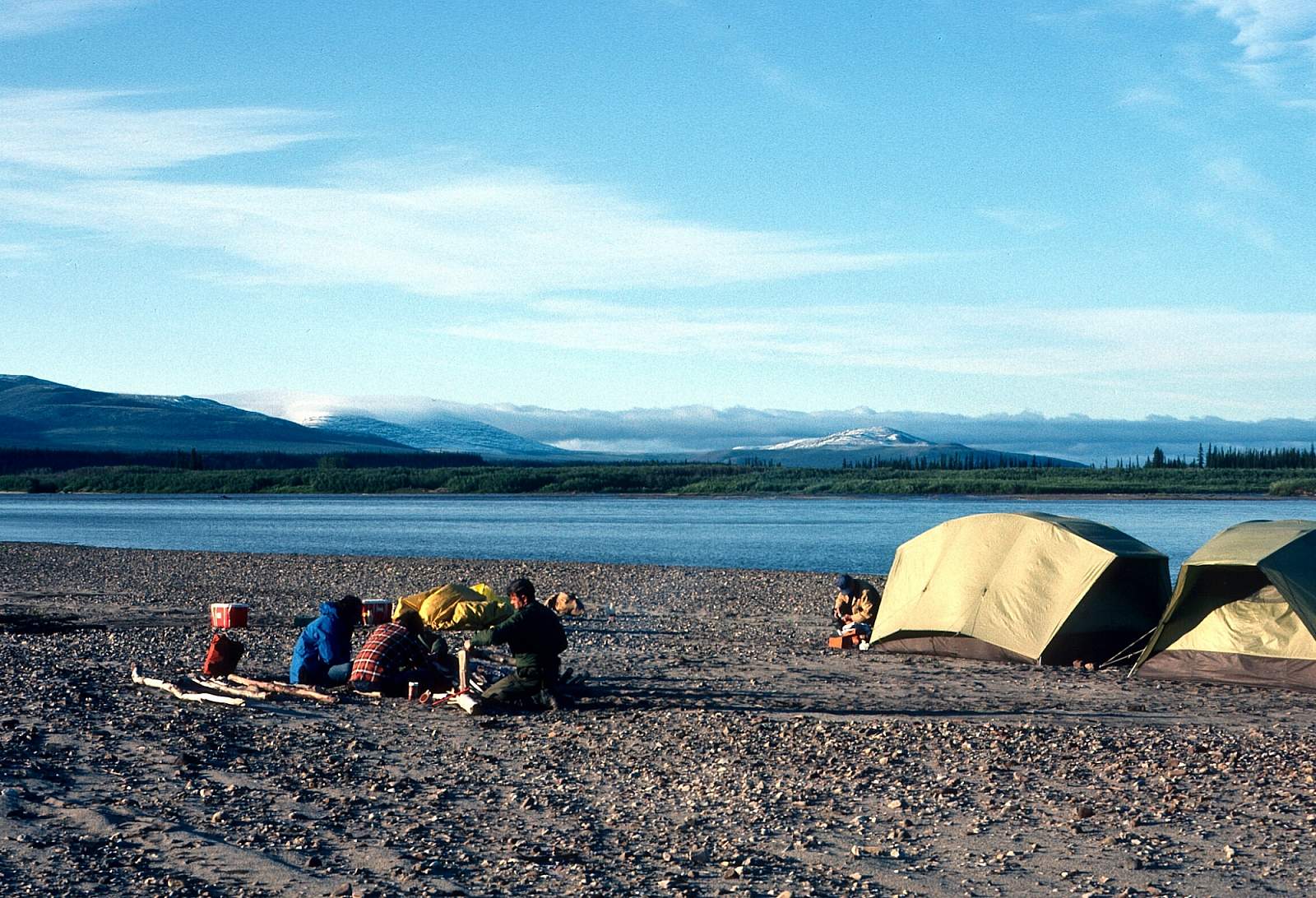
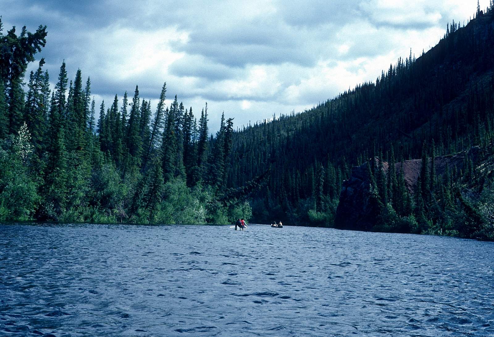
From Dawson, a flight into Summit Lake takes you across the miles of boreal forest that encompass this region and form the wintering grounds of the 160,000 strong Porcupine Caribou Herd. If you drive the Dempster Highway to start your trip you will see the beautiful Tombstone mountain range and both the Eagle River and Bell River are swift Class I sections that have lots of busy sections to keep you alert as you float through this beaver and muskrat country. Sweepers are the main obstacles to be aware of. It is about 80 miles to the confluence with the Porcupine River and there are no major obstacles to be ready for. Allow 4 to 9 days to the Porcupine. This is an area rich in fur bearing animals such as beaver, muskrat, otter, martin, lynx and wolf and there is good fishing for Arctic Grayling, Northern pike, Whitefish, Sheefish and Burbot. There is a large Chum Salmon fishery here as well.
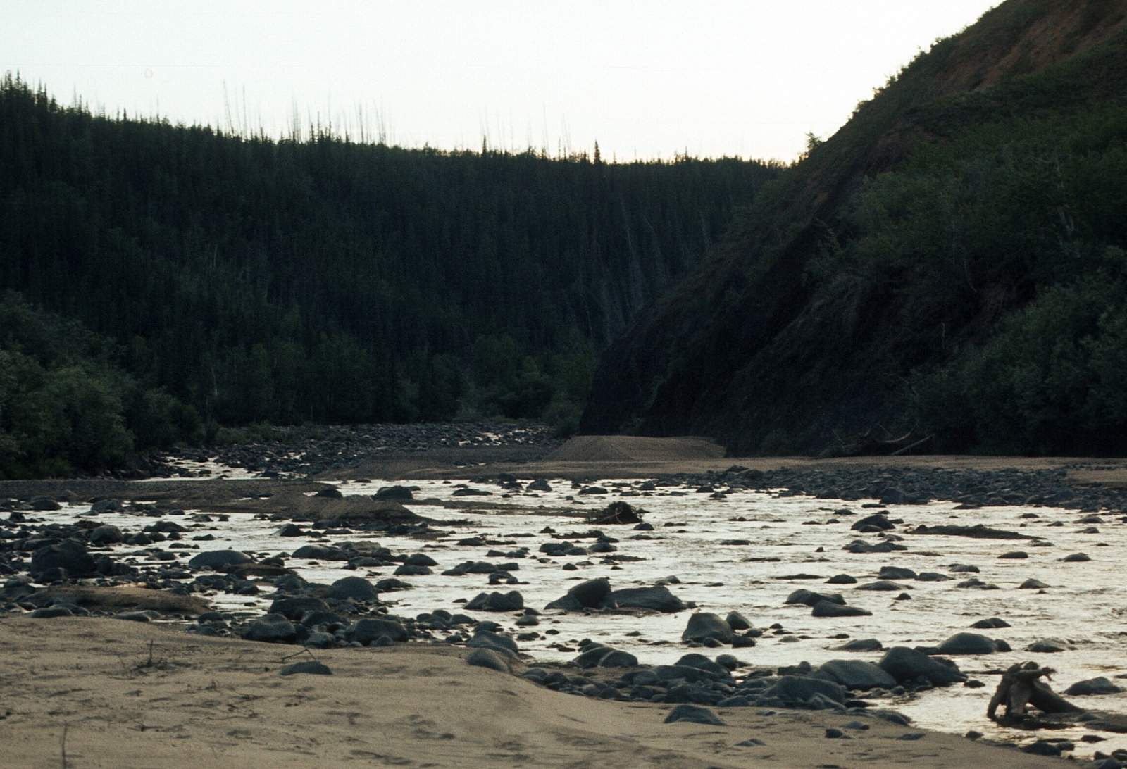
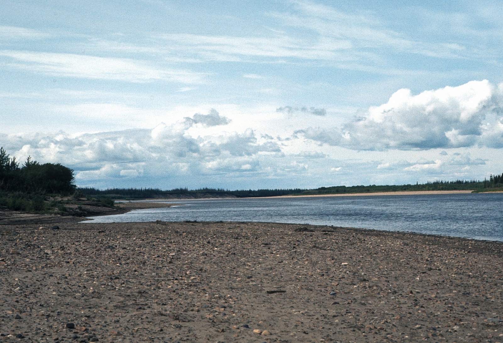
Old Crow to Lower Rampart Canyon: 180 miles
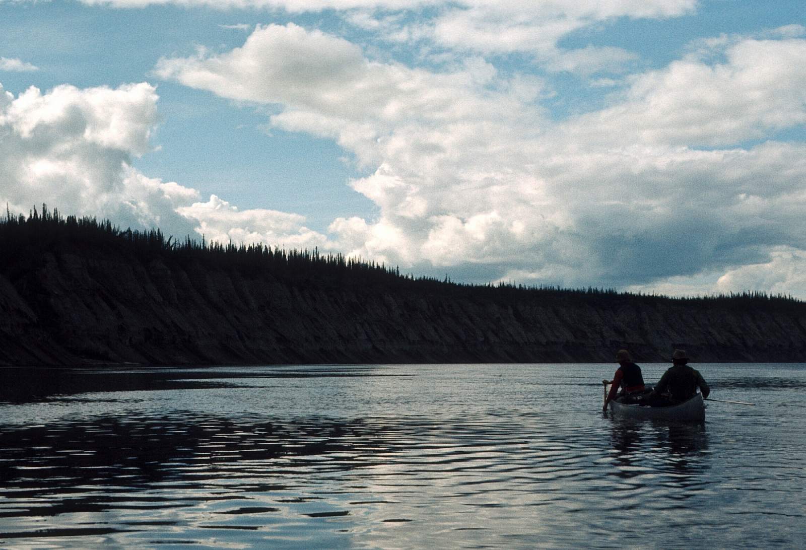
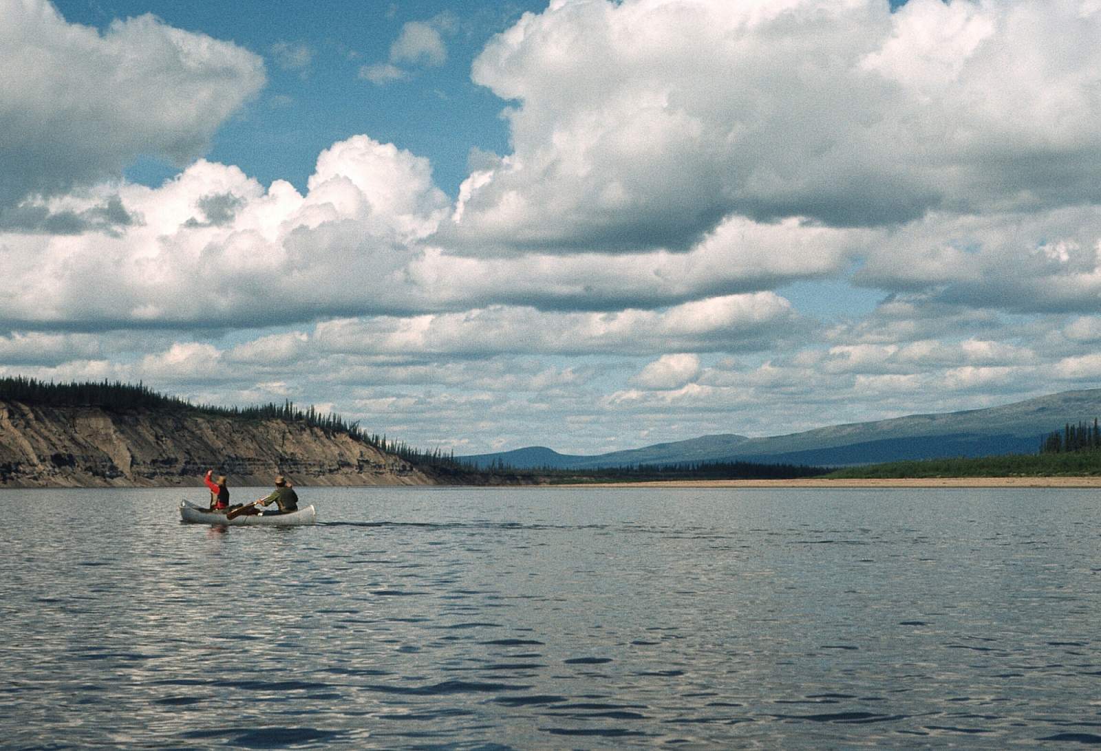
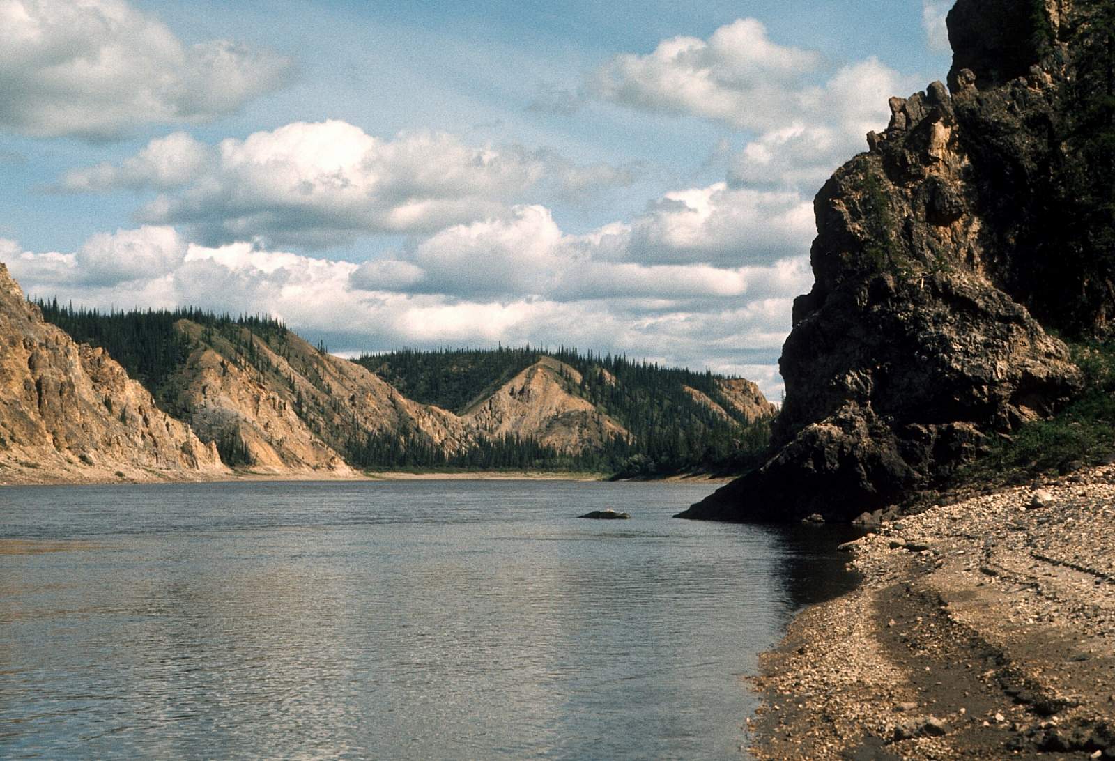
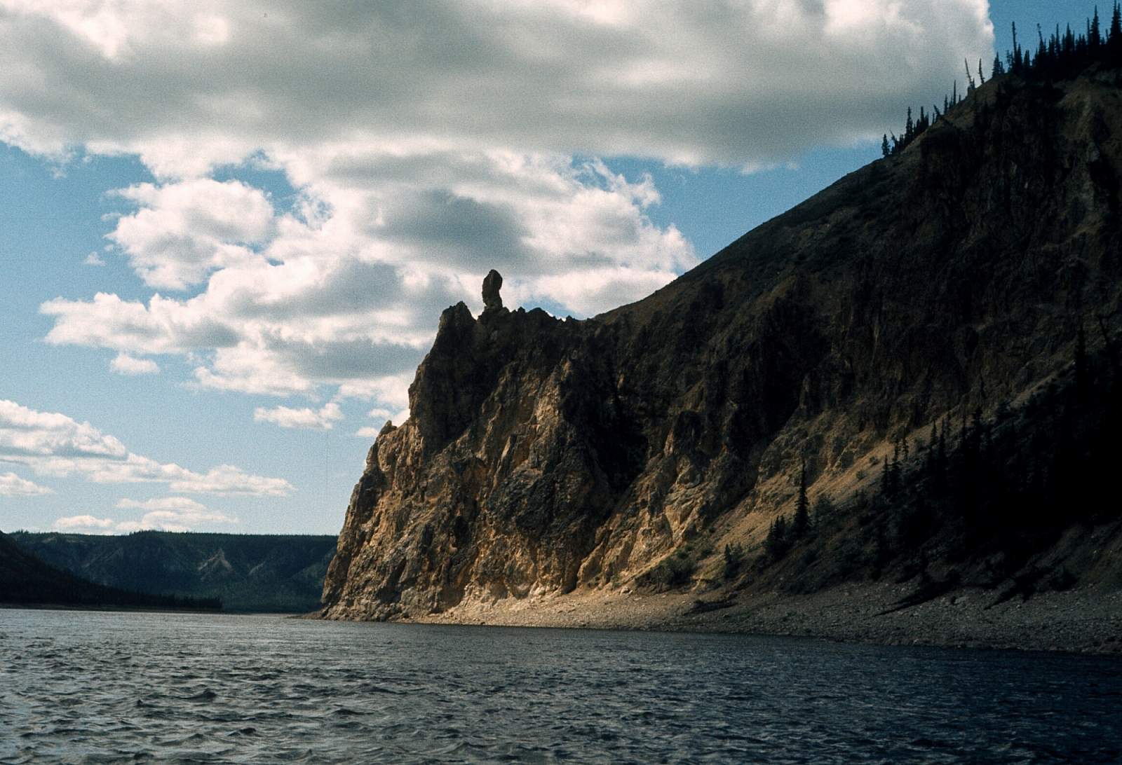
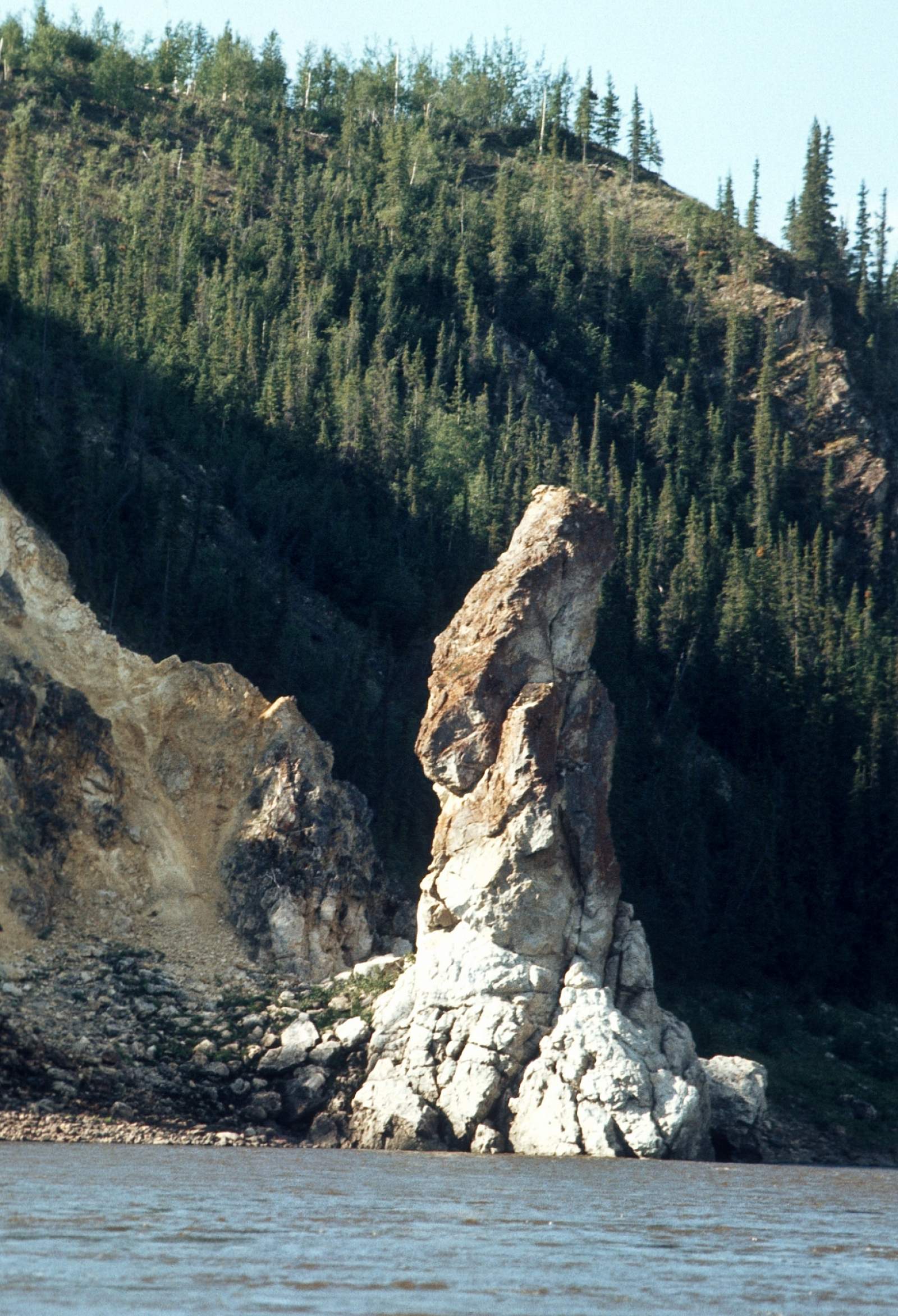
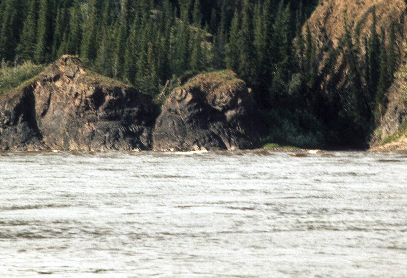
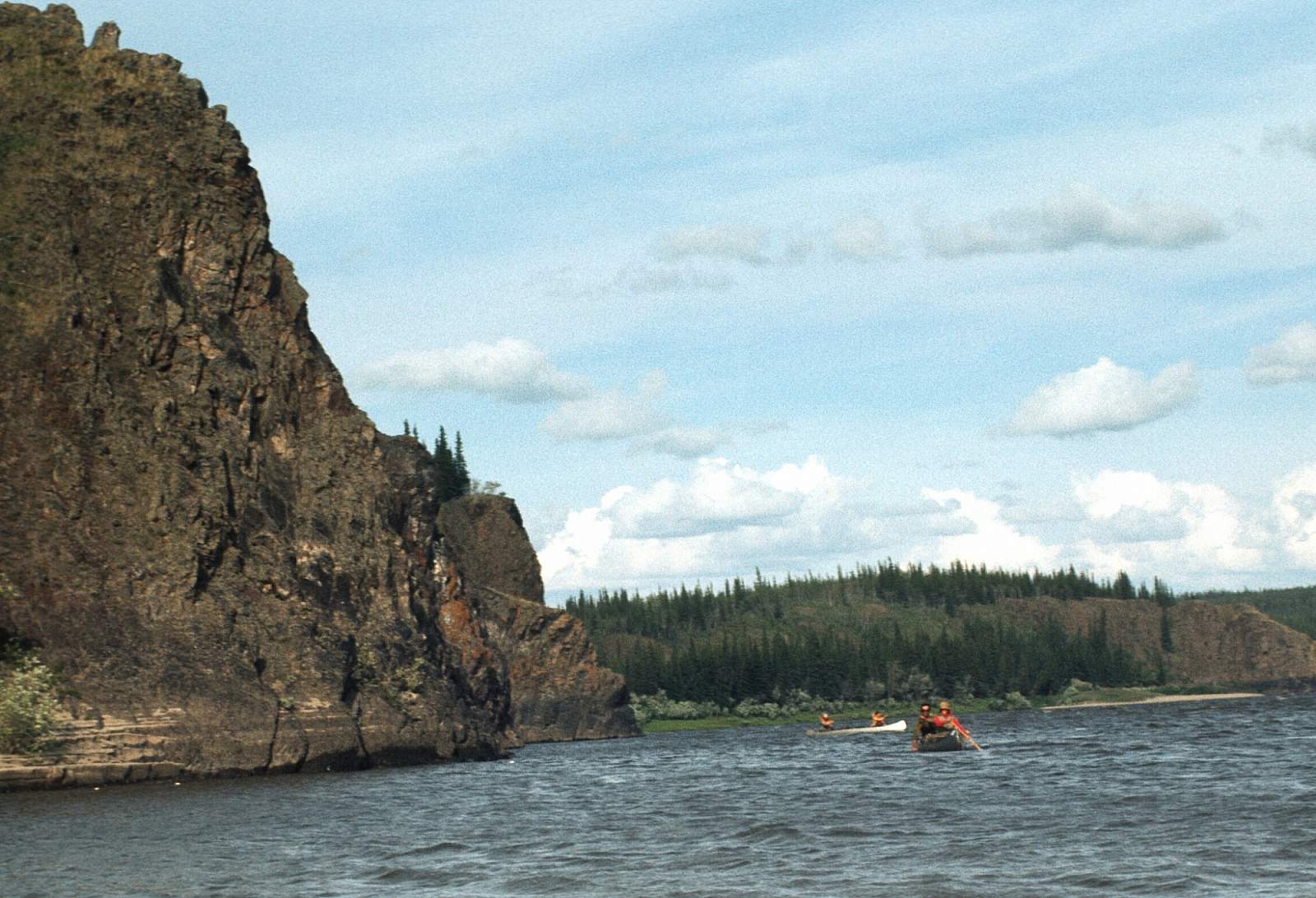
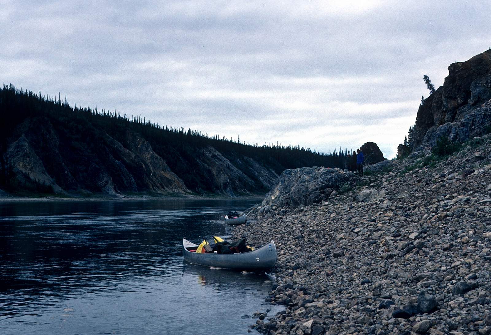
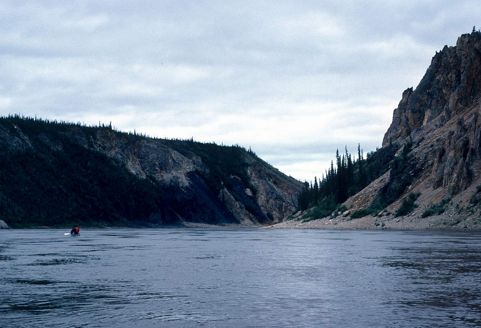
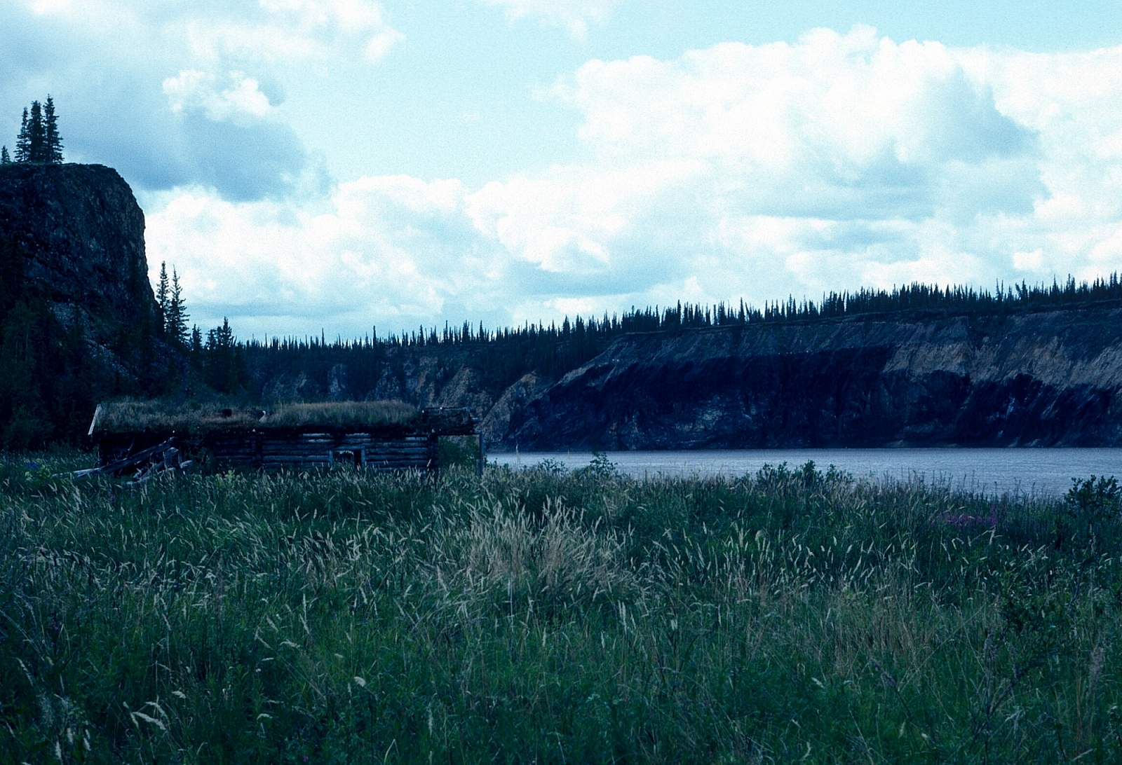
For the 60 miles or so below Old Crow the river winds and meanders heavily through the spruce forested hillsides, before it begins a more general WSW course. Starting near the US-Canadian border, there is a nearly continuous section of cliffs rising up to 500 feet above the water. This begins the Upper Rampart Canyon and at the old site of Rampart you will find buildings and relics of the days of riverboat trade between fur buyers and local trappers. At the lower end of the canyon is a feature known as Red Gate and is a colorful, vertically walled section of canyon. For the next 35 miles below Red Gate the river is flowing among low-forested hills with the Coleen River entering from the north on river right. About 15 miles below this is the Lower Rampart Canyon, where there is another 15 miles of limestone formation creating cliffs down to the waterline.
Lower Rampart Canyon to Fort Yukon: 120 miles
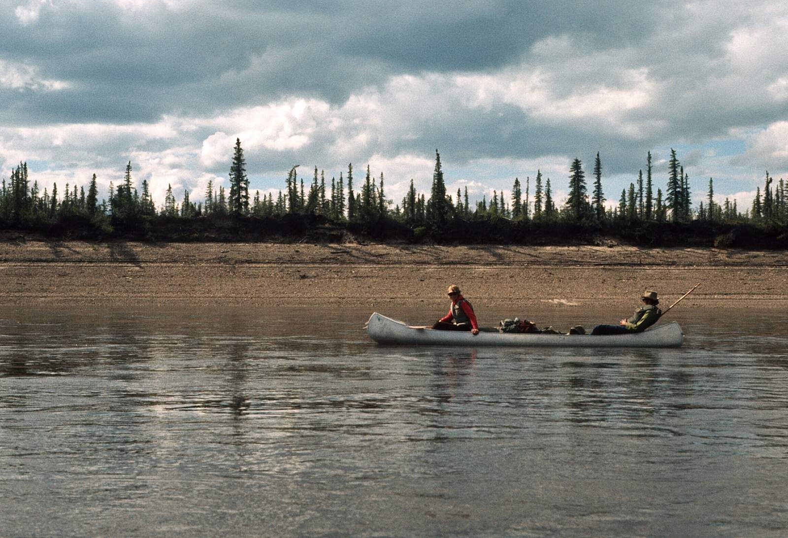
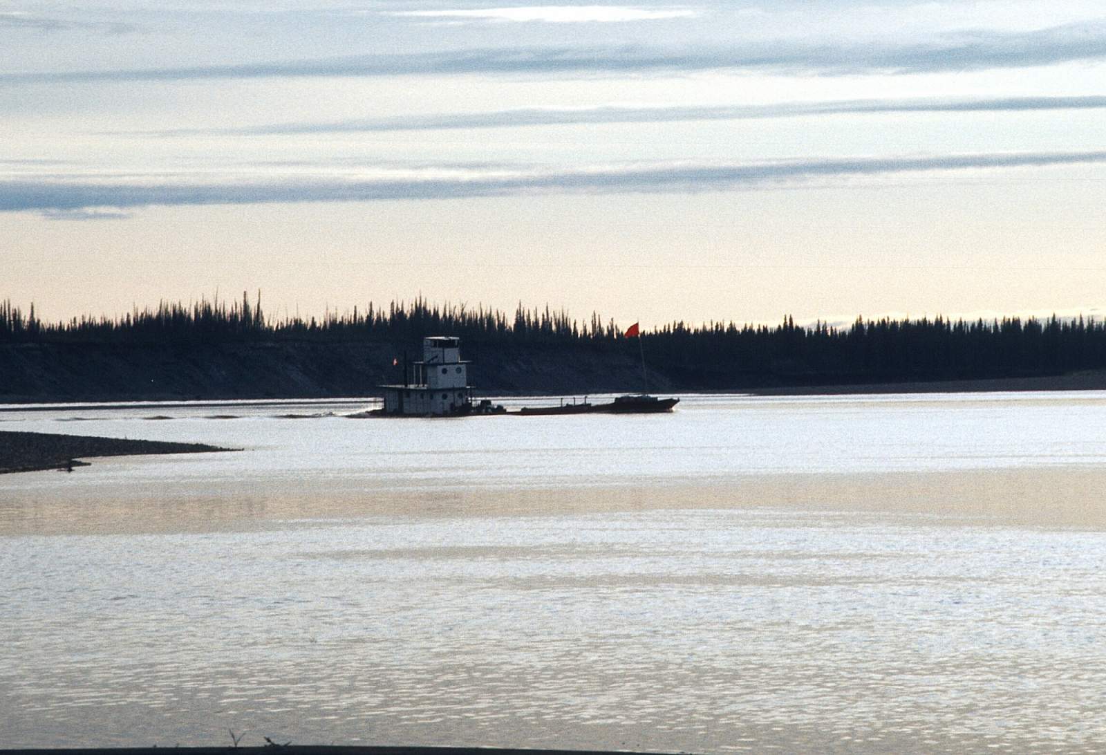
Beyond the limestone cliffs of Lower Rampart Canyon, the river enters the Yukon Flats National Wildlife Refuge, and as a result the gradient all but disappears and the river's course is a looping meandering one that seems to go on forever. There are thousands of lakes here, and subsequently, many moose and waterfowl to watch for. There is often heavy riverboat traffic along here. The take out scene is one to be ready for, as once you are passing Homebrew Island be ready to paddle up the Sucker River, that comes in on river left just a few miles before the river meets the Yukon. By paddling up the three miles of weak current of the Sucker River you reach a road that accesses the Fort Yukon airstrip. If you go all the way to the Yukon River you have two miles of strong current to go against as you go upriver to the town site.
Other Advice
- This is thick country with lots of black bears so keep a clean camp and use proper food storage techniques.
- Mosquitos as well as Black Flies can be pesky so have your repellant of choice with you.
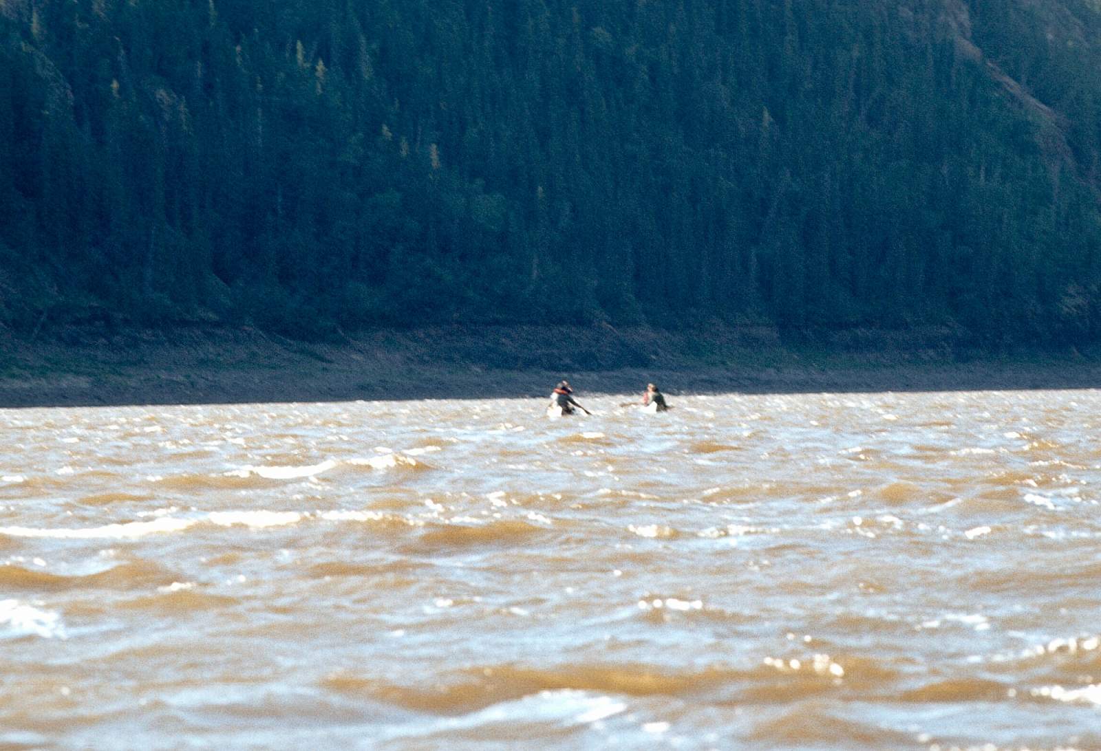
- If there have been heavy rains and the water level is high be prepared for swift water in the Rampart Canyons.
Porcupine River GPS Coordinates
Fort Yukon
Take out here and catch a regular commercial airline flight to Fairbanks. Take out option for Porcupine River.
66.56301600, -145.27908300
Fort Yukon
The frugal will likely forego a floatplane pickup and will go all the way to the Yukon River and up it a ways to the town of Fort Yukon where commercial flights are scheduled in and out. This takes a committed group as the last hundred miles are a meander through the Porcupine and Yukon Flats. The Sheenjek will take you to the Porcupine River and then down to near the Yukon River, where you can go up the Sucker River to a point near town. Take out option for Sheenjek River.
66.56267400, -145.27224500
Old Crow
Rafting parties will want to start in Old Crow, while inflatable kayaks are well suited for the Eagle and Bell River sections. To begin the journey you will need to get to Whitehorse or Dawson, Yukon Territory, Canada by driving or by flying commercial airlines. From either of these cities you can charter a flight in to Old Crow. Put in/Take out option for Porcupine River.
67.56838000, -139.82849100
Summit Lake
To run this river you have to fly in to Summit Lake in a floatplane and then portage your gear to the channel that leads to where you can then line your boats till there is enough water to float. From Anchorage you could charter to fly directly to the river, an hour flight, or you could take a regular scheduled flight to Port Alsworth or Iliamna and charter to the river from there. The river starts from a glacier on the SE side of the pass, flows down the mountainside and splits into two channels—one going NE into Summit Lake and the other SW as the Tlikakila River. Put in option for Tlikakila River.
60.63283800, -149.50728200
USGS Maps
Table Mountain A-4, B-4, B-5, C-5, D-5
Coleen C-6, D-5, D-6
Christian A-1, B-1, C-1
Fort Yukon C-2, C-3, D-1, D-2
Distance
300 miles
Days
10-14
Difficulty
Easy
Class
I
Craft
Kayak
Raft
Cost
$$$