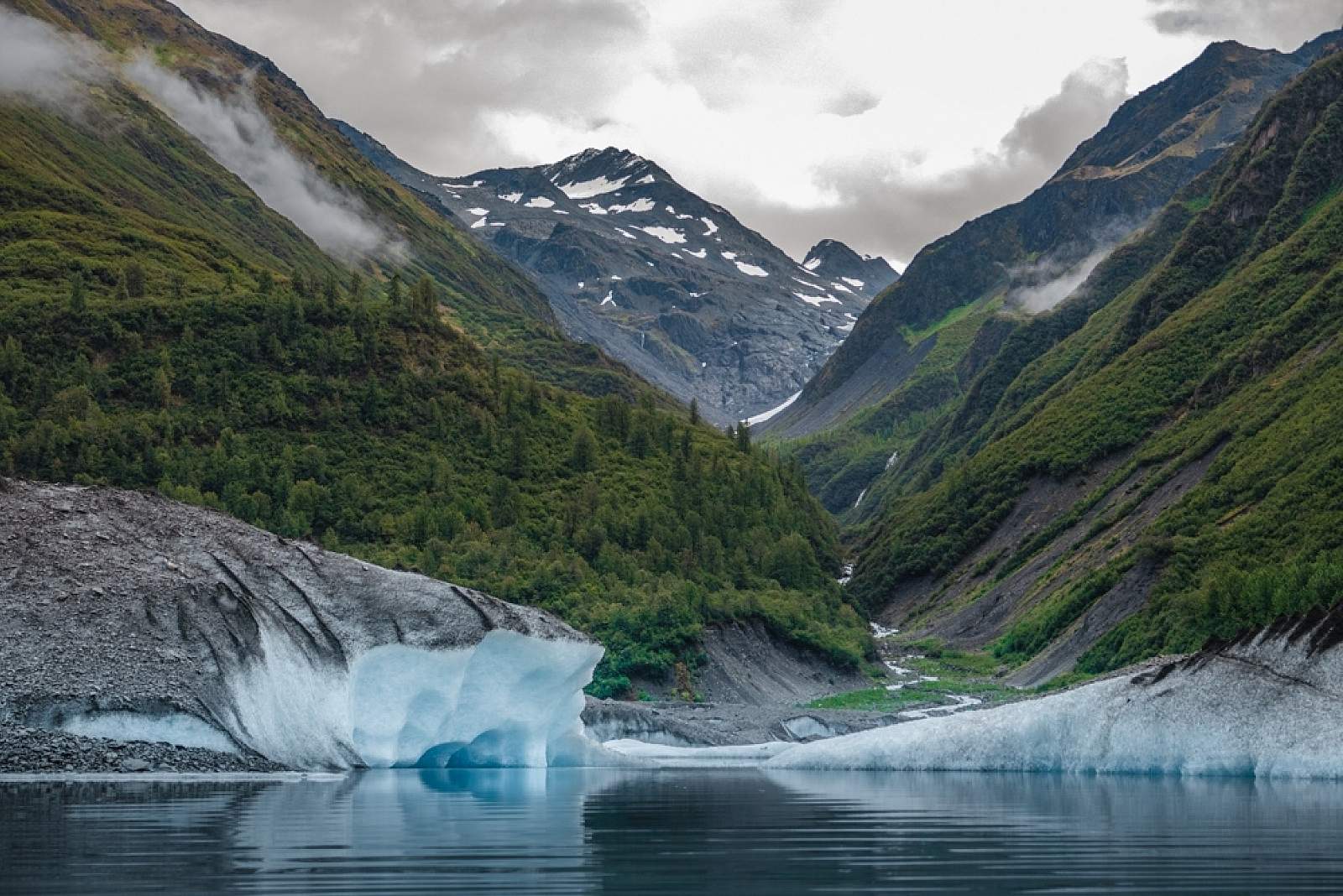
Valdez Glacier Lake
If you’ve yet to set eyes on an iceberg, this is your chance: Gorgeous Valdez Glacier Lake is often home to large chunks of floating ice that have calved off from the Valdez Glacier. Along with the dramatic icebergs, you’ll get unimpeded views of the snow-capped Chugach Mountains. And while you can’t see the glacier itself from the lakeshore, you can if you get out on the water. The area is definitely a place worth experiencing while in Valdez.
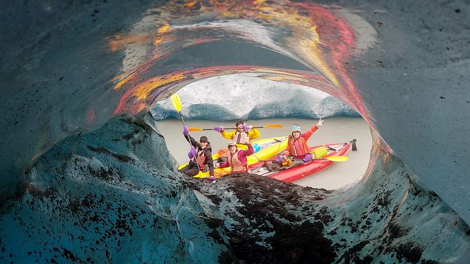
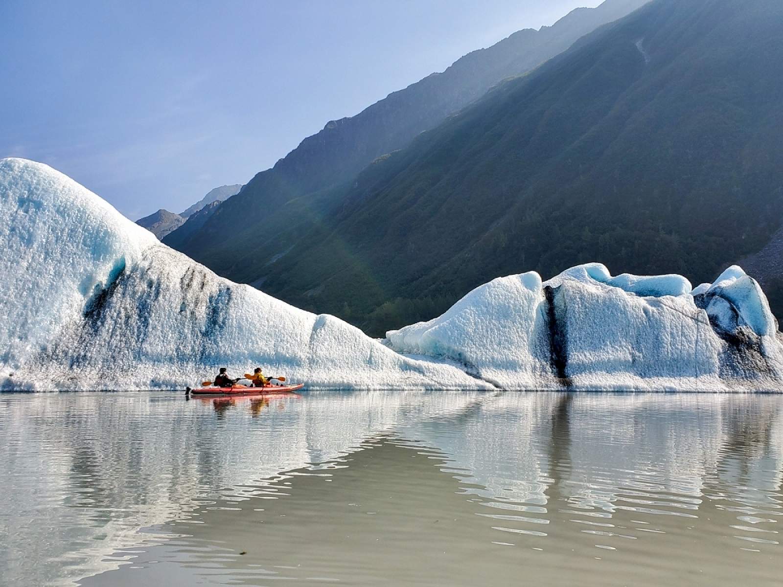
Anadyr Adventures watches the glacier closely and runs trips on Valdez Glacier Lake daily, from roughly June through September. You’ll paddle around the icebergs that have calved from the glacier.
The glacier actually used to be visible from the lakeshore—before the ice receded enough to move it out of view. In fact, the ice on this glacier has been more or less retreating for the last 10,000 years. At that time, this part of the Chugach was buried under more than 2,000 feet of ice. What’s there now is certainly notable, but try seeing the Valdez Glacier from the perspective of how small it has become. Look for features on the mountains that may indicate past ice levels, like horizontal “ledges” and U-shaped—rather than V-shaped—valleys.
More recently, the glacier has changed drastically. It’s going through a dramatic shedding cycle and has pulled away from the mountains on both sides. Without that support, icebergs the size of a city block have broken off. As a result, it’s not recommended to get within 100 meters of the glacier anymore. But if you go out in a kayak with a company like Anadyr Adventures, you’ll be able to see it safely. And even from a little distance, the glacier is a spectacular sight.
Another thing to be aware of: The melting produces two dramatic jökulhlaups, or glacial outburst floods, each summer, usually at the end of June/early July and mid-August. They cause high, rushing waters that have carried icebergs ¼-mile up the lakeshore! Of course, these events are closely monitored by the U.S. Geological Survey: If one is about to happen, the city will make an announcement urging visitors and paddlers to take extreme caution.
How to Visit
Drive & View from Shore
The most popular way to experience the glacier lake is to make the 15-minute drive from Valdez and marvel at the bergs floating in the water. At the end of the road, there’s a new park with a fire ring and a sitting area along the shore. It’s a great spot for photos.
Kayak
Anadyr Adventures watches the glacier closely and runs trips on Valdez Glacier Lake daily, from roughly June through September. You’ll paddle around the icebergs that have calved from the glacier. This unforgettable outing is one of their most popular.
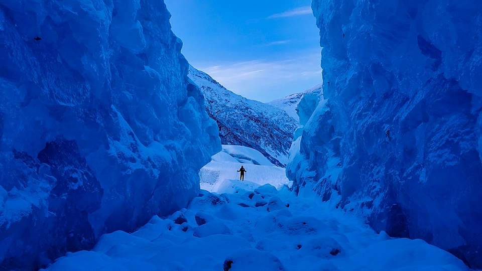
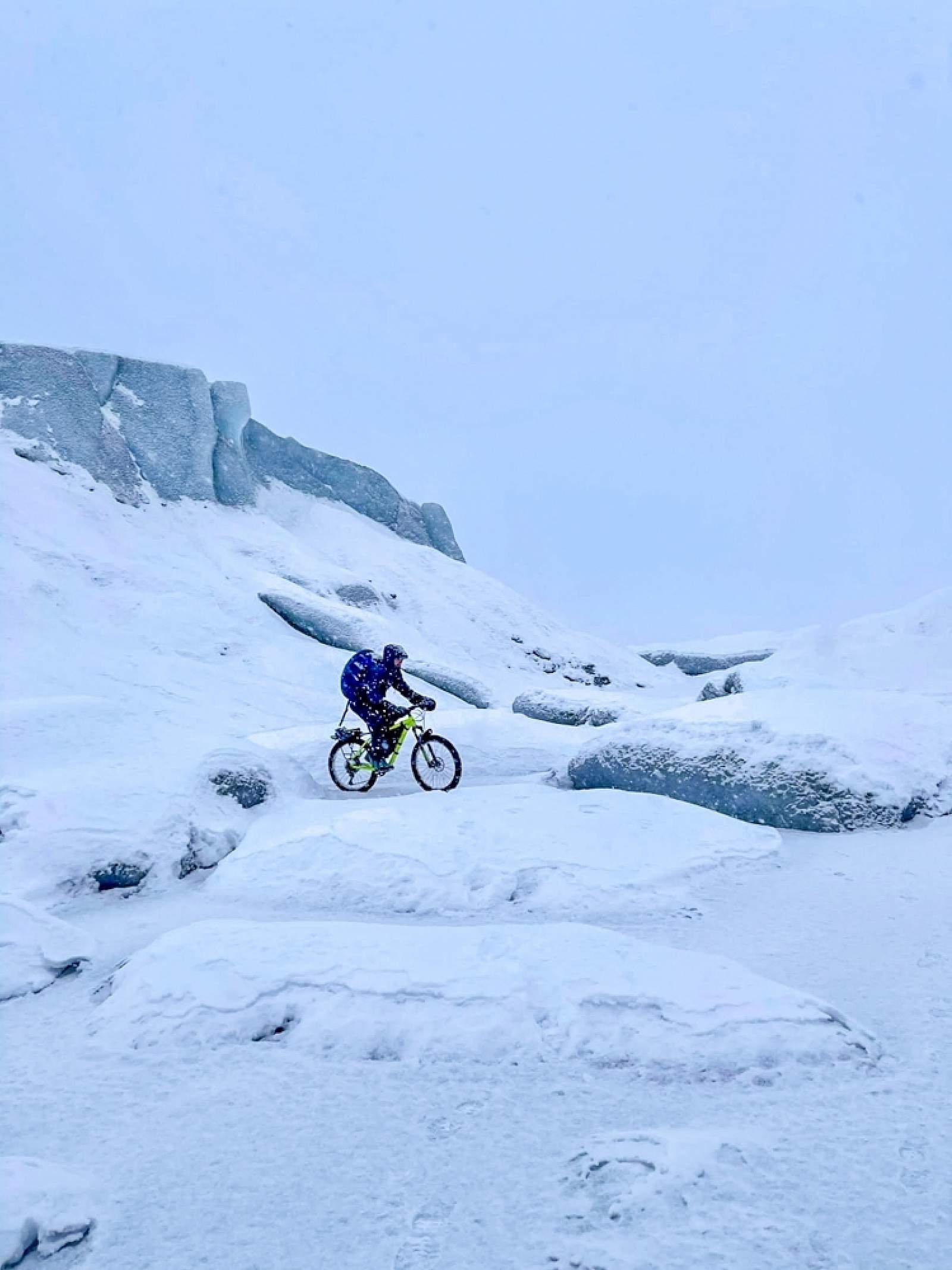
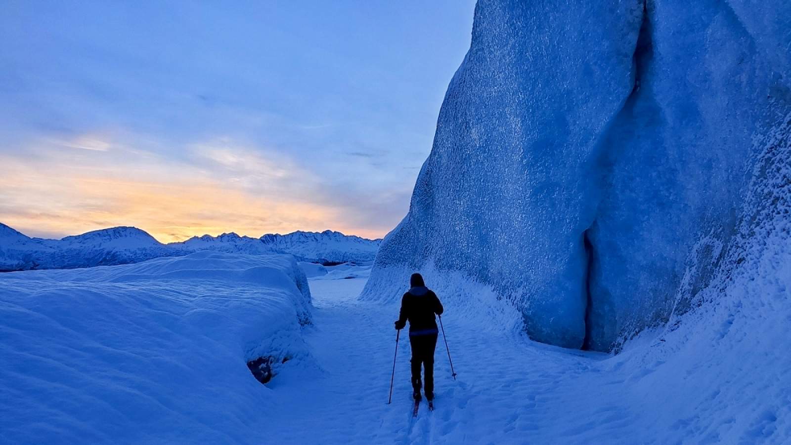
In winter, ski, snowshoe or fat bike around icebergs frozen in place.
The lake is open to unguided visitors, but you should use extreme caution. If you’re unfamiliar with the area, give Anadyr a call; they’re happy to talk to you about the local conditions. Stay away from the glacier face, and be mindful of the jökulhlaups. Anadyr Adventures worked closely with the city of Valdez to produce a series of YouTube videos on how to explore this beautiful area safely. You can view parts one, two, and three.
Winter
Winter is an extremely popular time to explore. In November (if the lake has frozen solid) and before there’s a lot of snow, it’s a popular spot to ice skate. You’ll always remember the experience of winding your way around icebergs frozen in place. And once the snow falls, this is a popular destination for nordic skiiers and snowshoers…a real winter wonderland!
Getting There

Coordinates
Latitude: 61.150277Longitude: -146.174126
Turn off the Richardson Highway and onto the Valdez Airport Road, where you’ll follow it all the way to the end to the open sandpits bordering the lake. About ¾ miles before the lake the road turns to gravel.
Photos