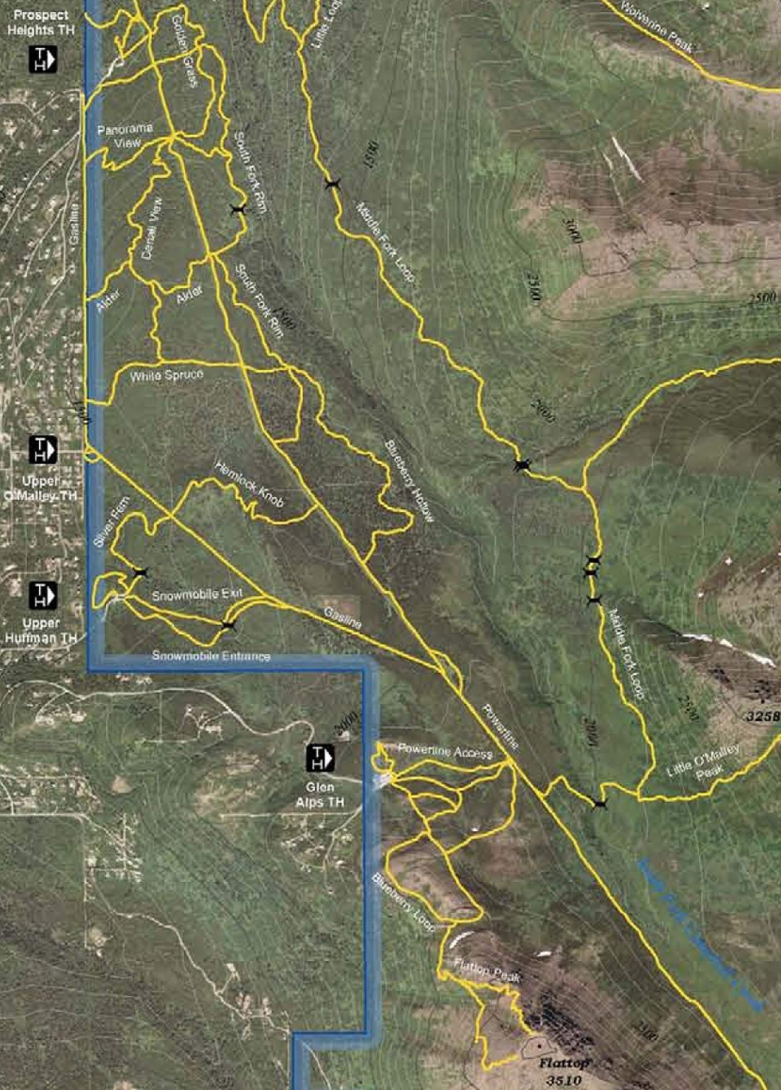
At first glance the Powerline Trail doesn't appear to be much more than a long dirt road connecting to Indian Valley. The first 6.0 miles of this trail are uniquely different from the last 5.0 miles in regard to terrain, vegetation, and even wildlife. Steep mountain walls, mountain peaks, beautiful valleys and streams, mature Sitka spruce forest, and areas rich in wildlife provide plenty of enjoyment along the way. The trail is generally wide and uphill until it reaches the pass and then becomes very steep as it heads down to Indian. This year-round multi-use trail provides access to other trails in the Hillside Trail System.
Sheep Viewing
Dall sheep can sometimes be seen grazing on the slopes above the Middle and South Forks of Campbell Creek on the Anchorage Hillside in Chugach State Park. These animals will often appear as white specks in distant alpine meadows. From the Glen Alps trailhead, walk a half-mile to Powerline Pass Trail and use binoculars to scan grassy fingers below ridges across the valley, especially during spring and summer mornings.