Tongass Nat’l Forest Parks & Trails
Show Map
Parks & Trails
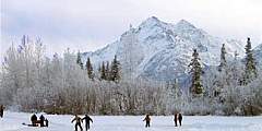
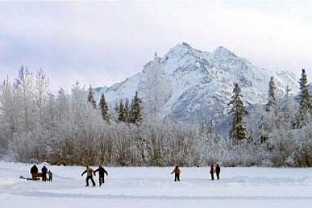
This is a wheelchair-accessible trail that follows the Mendenhall River greenbelt area, starting at Brotherhood Bridge off Glacier Hwy. The name is Tlingit for “going back clearwater trail.” Expect a lot of traffic. The trail is 2‑miles long, paved, and provides one of the great views of Mendenhall Glacier, beginning at the Brotherhood Bridge trailhead. In mid-summer, over a flat field of iris and fireweed, the Mendenhall rises between… ...more
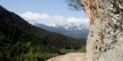
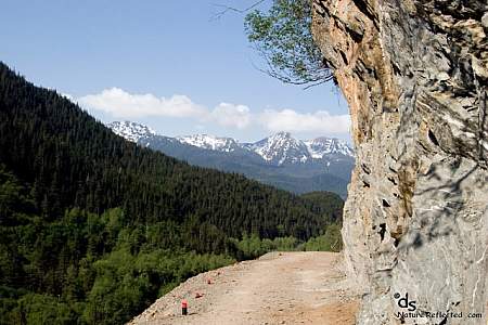
The path to the Perseverance trailhead, Basin Road, showcases a dramatic change from urban to wilderness, leading from downtown Juneau to a spectacular canyon. At the end of it is where Perseverance Trail begins, and this former rail line (named for the mine it once serviced) quickly climbs up above the Gold Creek valley. There’s plenty to see along the way, including old mine shafts that blow cool winds, and a stretch of trail where the ...more
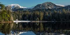
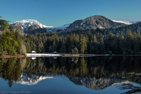
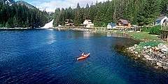
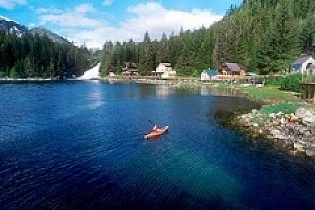
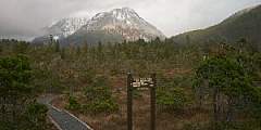
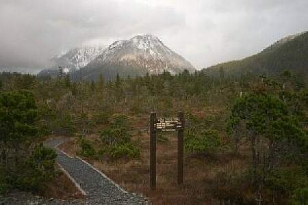
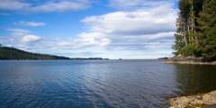
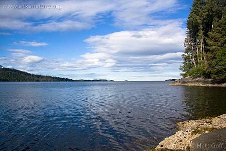
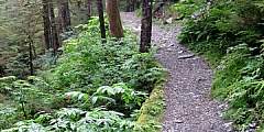
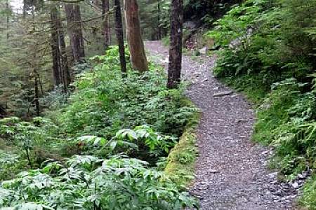
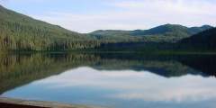
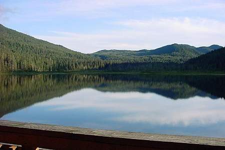
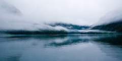
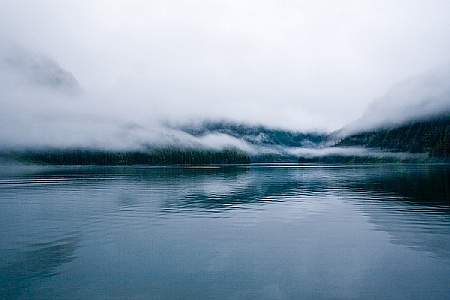
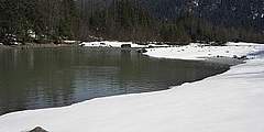
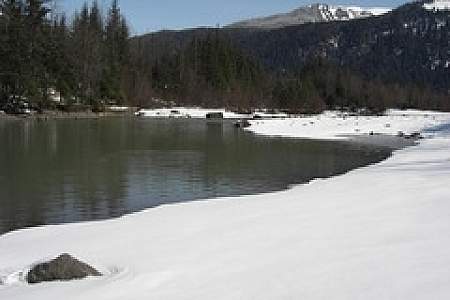
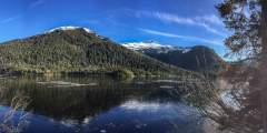
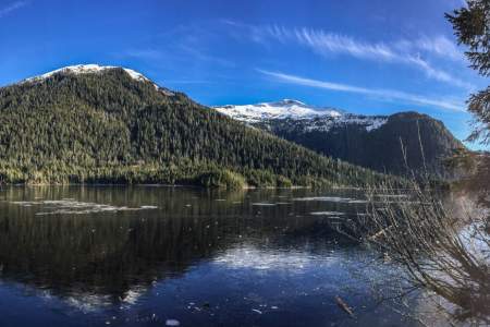
The mostly-flat Ward Lake trail follows the circumference of the lake’s shore in a swath of gravel that is wide enough for two people to walk abreast. Ward Lake is tucked into the edge of the Tongass National Forest boundary. Its proximity to town makes the recreation area popular with the locals.
Located in Mendenhall Wetlands State Game Refuge, this trail is wheelchair-accessible and close to the airport. It has many opportunities for waterfowl and bird watching. It is excellently maintained. This makes the trail a very easy hike. Many times you will see strollers, runners and bikers on this trail because it is paved.
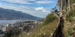
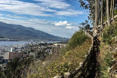
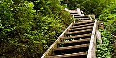
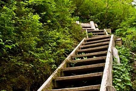
Running just above and parallel to Ketchikan’s Third Avenue Bypass, Rainbird Trail is perfect if you only have a couple hours but still want to experience a small piece of Southeast Alaska’s rainforest. The trailhead is only 20 minutes from downtown (a short drive relative to most other trails), and the trail’s southern end — just beyond the top of the metal stairs — offers great views of downtown Ketchikan, the Tongass Narrows, and the neighboring ...more
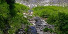
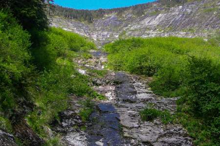
This is a popular weekend hike if you want to spend two-to-four hours in the Tongass National Forest and is only about 15 – 20 minutes north of town. Though you gain elevation on the hike up to the lake, it is not unforgivingly steep. Perseverance Lake is one of Ketchikan’s picturesque mountain-lake scenes.
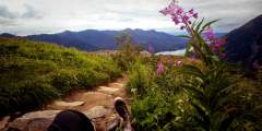
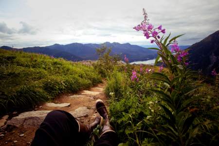
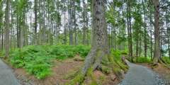
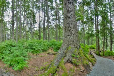
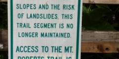
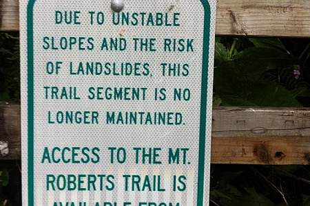
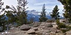
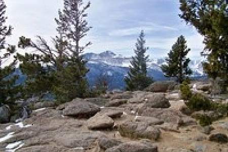
Once you reach the Mountain House at the 1,800-foot level of Mount Roberts, step onto trails that begin in a sub-alpine ecosystem and climb another 300 feet into the true alpine. With sixty stair steps, a length of one-half mile and an elevation gain of just 150ft, the main trail will take you to open vistas, mountain valleys, snow gullies, rocky ridges and stunning views of mountains in Glacier Bay, British Columbia, the Southeast Alaskan… ...more
Deer Mountain is Ketchikan’s iconic backdrop. The path briefly threads between residential lots, then turns to a rocky trail that quickly ascends. On the way up there are multiple scenic overlooks.
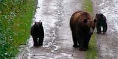
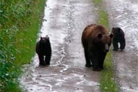
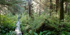
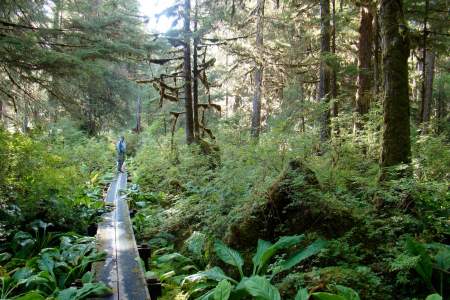
Close to town on moderate terrain, this trail is a popular destination for locals and travelers and is used for everything from family walks to trail runs. The trail follows the turquoise blue Indian River up through the valley to a waterfall. This riverside terrain makes it a good place to look for birds and other wildlife like deer. In late summer, the river fills with salmon (though fishing is prohibited). The bears have their own trail on ...more
With a 1,620 ft. vertical drop, 640 acres, and impressive backcountry access, Eaglecrest combines big mountain terrain with a local feel in Alaska’s capital city. It’s one of the few community-owned ski areas in the US, offering affordable prices, fewer crowds, and breathtaking ocean views. You can’t drive to Juneau— you have to fly, or ferry, which means shorter lift lines and untracked powder. Whether you are a beginner looking to play in the ...more

The one-mile gravel trail to Coast Guard Beach winds through Ketchikan Gateway Borough land and then crosses into Alaska Mental Health Trust Land. Mostly the trail descends to the beach; however, a few hills do rise along the way. This beach is a good place for walking, sunbathing, beachcombing, photography, writing, reading, meditation, tai-chi, just sitting, marine-life viewing, and dog swimming.
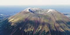
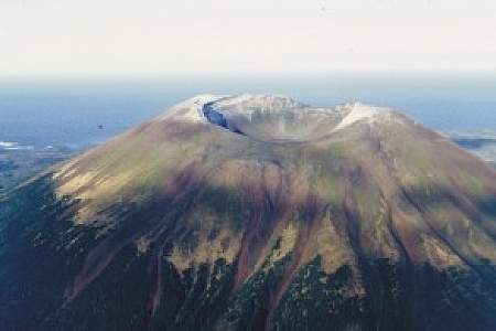
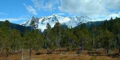
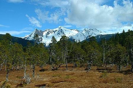
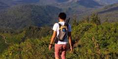
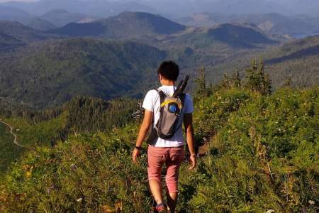
This is a beautiful hike in June and July, when the alpine wildflowers are at their peak. But it’s a beautiful hike anytime, because the views from up top — facing Mount Edgecumbe and overlooking Sitka Sound — are awesome. There are two ways up this mountain: a big climb or a big drive.
Sitka was Alaska’s first official Bike-Friendly Community, and it shows. Bike lanes and racks abound. Besides 14 miles of paved roads, there are many mountain biking trails, and even a new, single-track route of the intimate experience of riding through old-growth forest.
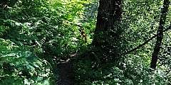
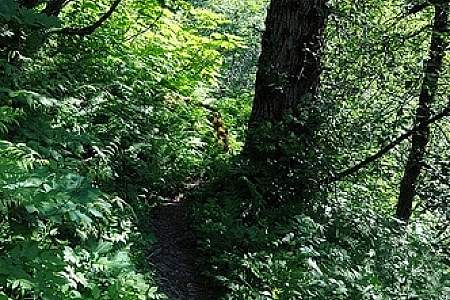
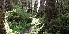
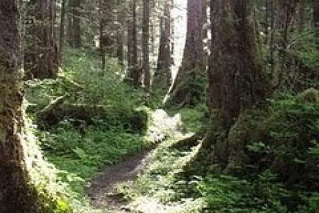
Connell Lake is a good choice if you want a trail that is less popular but just as close to town as the Perseverance trail. The rocky, dirt path gently climbs through the rainforest canopy and hugs the shoreline of the lake. On the other side is a nice flat area that the creek bows around, creating a small peninsula. A fire-pit indicates that this is a preferred spot to spend some time or camp.
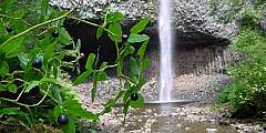
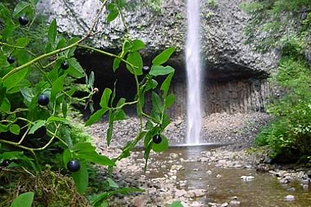
On one of the run-off creeks from Achilles Mountain or Twin Peaks Mountain above pours a 100-foot or more waterfall right beside Tongass Highway towards the end of the road
If you are looking for a shortish “in-town” trail, this trail begins at the back of a neighborhood and walks up a service road to a dam that overlooks a mountain-lake scene.
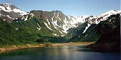
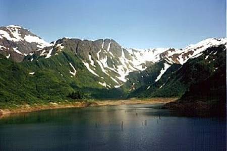
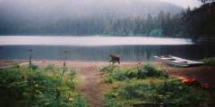
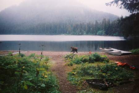
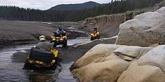
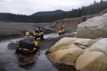
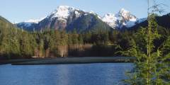
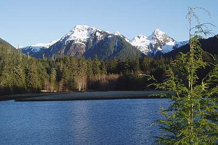
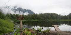
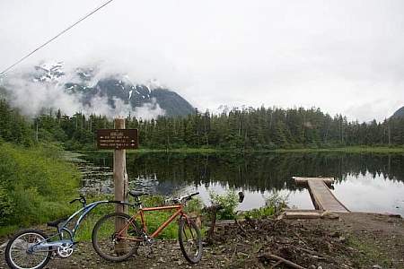
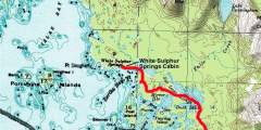
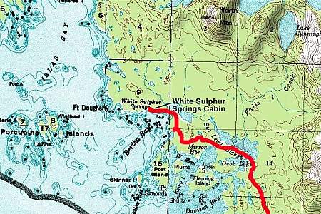
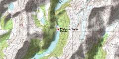
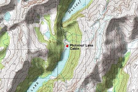
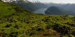
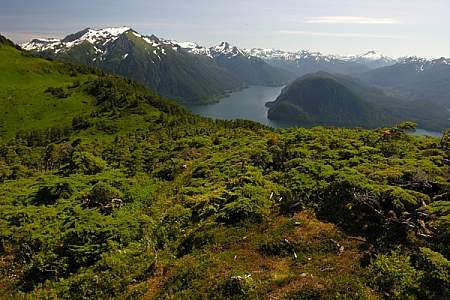
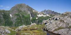
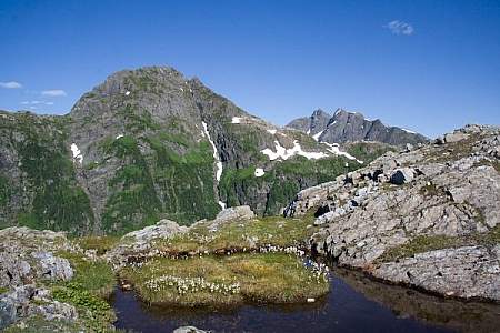
If you want to get away and don’t have a boat or a plane, this is as far away north one can easily get from Ketchikan. The trail ends at the headwaters of Lunch Creek — the shores of Lake Emery Tobin, which is surrounded by a rim of steep mountainsides often capped with snow ridges and peaks.
The drive out to the Dude Mountain trailhead is one of the most scenic drives that Ketchikan has to offer. The trail begins winding through lush rainforest. The last part is steep and can be muddy in wet weather or covered in snow in spring and fall.
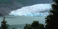
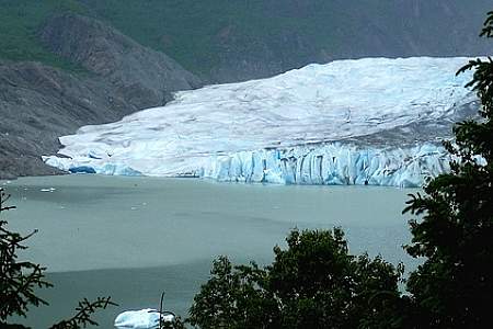
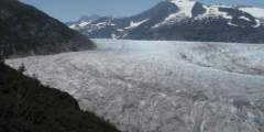
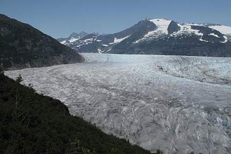
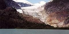
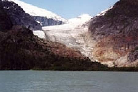
The lake and glacier are the premier destination for the thousands of cruise-ship tourists who visit Juneau, but they don’t venture much beyond the visitor center and the short trails just outside it, leaving the mountains above the center very quiet in comparison.
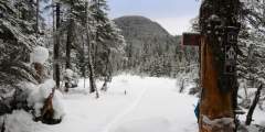
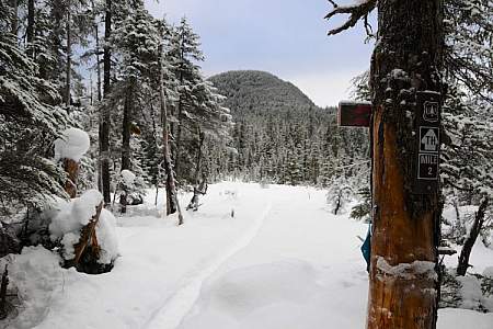
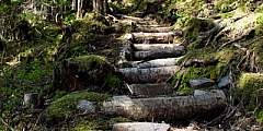
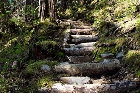
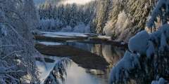
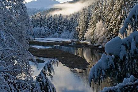
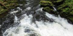
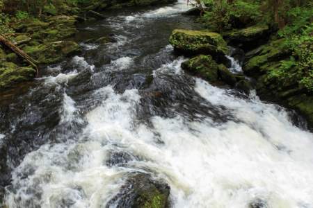
Located in the Tongass National Forest, Ward Creek is wide enough to drive a truck down, though no vehicles are permitted, and is popular with the locals for walking dogs. Across the road from the Ward Lake Recreation Area parking lot, trailhead 1 takes you north and follows Ward Creek, which flows out of Connell Lake, by the Last Chance campground, and through Ward Lake to eventually meet the ocean in Ward Cove.