Prince William Sound Area Hiking Trails
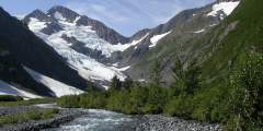
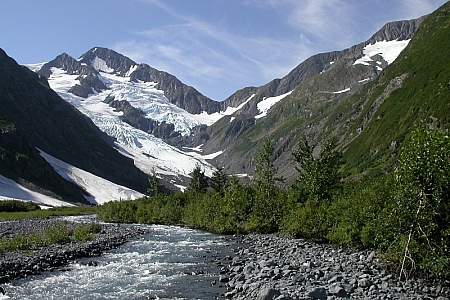
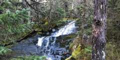
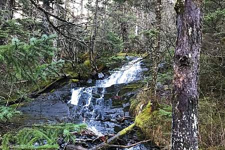
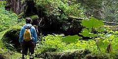
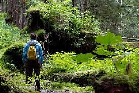
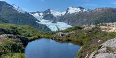
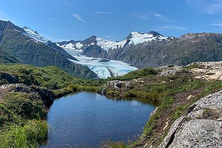
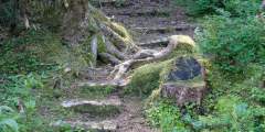
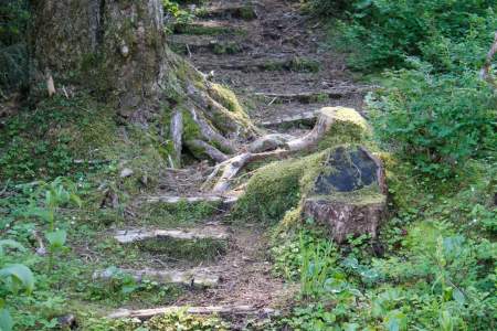
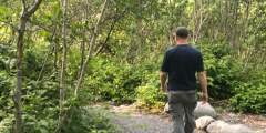
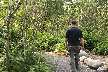
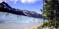
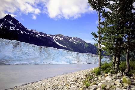
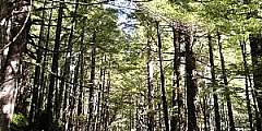
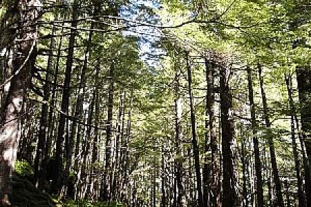
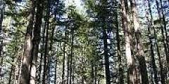
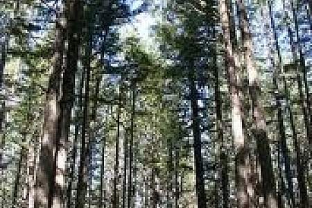
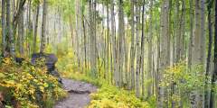
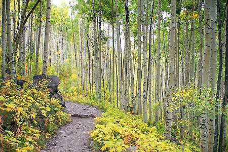
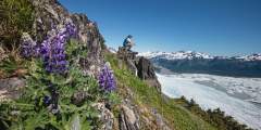
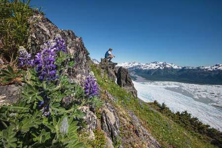
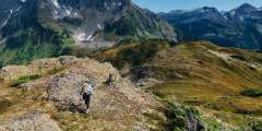
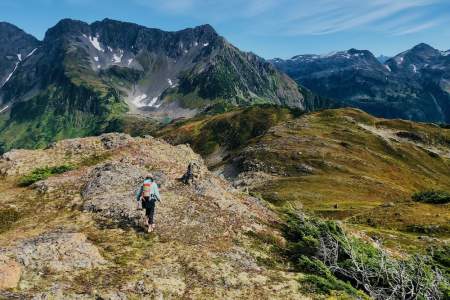
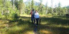
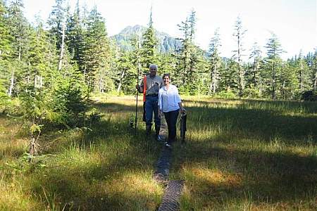
For a relatively compact area, the Prince William Sound region boasts an incredible variety of trails, most of which are exceptionally maintained by either the local parks and recreation departments or the U.S. Forest Service. And because of the area’s significant rainfall, the trails snake through mosses, lichens, and massive amounts of green lushness, making it feel like walking through a fairy tale. Several trails offer spectacular glacier views.
Be aware that snow in the higher elevations doesn’t fully melt until early to mid-June. For any hikes above treeline, shoot for late June/early July to avoid hiking through slush.
In Cordova, you’ll find most of the trails in the Chugach National Forest. There are roughly 40 miles of maintained, road-accessible trails (and well over 100 miles of trail in total) that take you to mountain tops, through muskeg meadows, and to glacier lakes. Popular trails include the Crater Lake Trail, Sheridan Glacier Trail, Pipeline Lakes and Mckinley Trail Loop, and the Heney Ridge Trail (which has some amazing views).
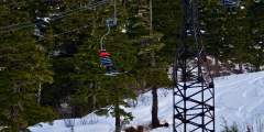
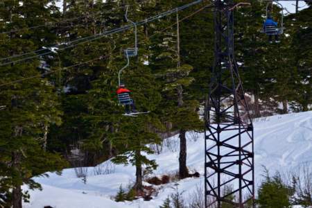
Whittier offers a great mix of well-established and new trails, thanks to the active local parks and recreation department. Arguably, the most popular option is Portage Pass—a short, 4-mile round-trip trek which leads to a vista of Portage Glacier and then on to the shorefront of Portage Glacier Lake.
Valdez has several great trails right near town, as well as just beyond town along the Richardson Highway in Keystone Canyon. They’re maintained by the local parks department and the volunteer Valdez Adventure Alliance. For an easy walk with great views near town, head to Dock Point. You’ll get views of the Duck Flats in one direction; the other serves up shimmering waters and snow-capped peaks. In the canyon, check out Goat Trail, where you’ll be treated to views of Bridal Veil Falls.
Show Map
Parks & Trails
6.2 round-trip easy hike through the Chugach National Forest to a glacial lake. Popular in winter for fat biking and ice skating. In summer, hiking and paddleboarding.
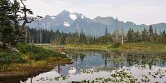
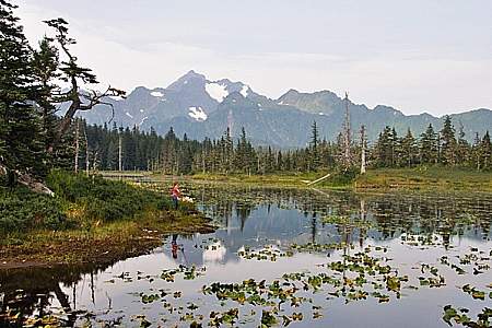
This short day hike — with an easily accessible trailhead a few hundred meters from the Begich Boggs Visitor Center — offers you big views of the Byron Glacier.
This 1.5‑mile hike is an easy stroll down to the lake that offers a great payoff in the form of a gorgeous glacier. If you’re here in winter and the conditions are right, it’s a great spot for wilderness ice skating, fat biking, or cross-country skiing!
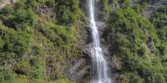
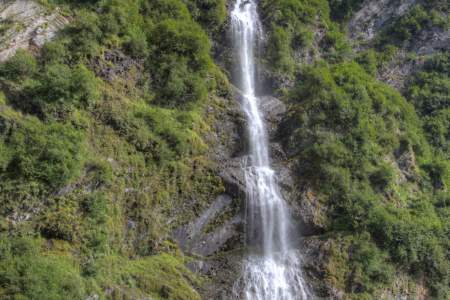
Bridal Veil Falls and the Valdez Goat Trail: This two-mile-long hike is a restored section of the Trans-Alaska Military Pack-train Trail that was the first glacier-free route from Valdez to the interior of Alaska. There’s a fantastic overlook about a mile down the trail.
This is a 6.6‑mile round-trip trail with very little elevation gain, making it a great option for the whole family. Along the way, you’ll glimpse amazing views of Prince William Sound. It takes about 90 minutes to hike halfway, out to the cove. And it’s worth the trip: Here you’ll find a lagoon fed by the tide and full of huge starfish.
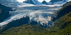
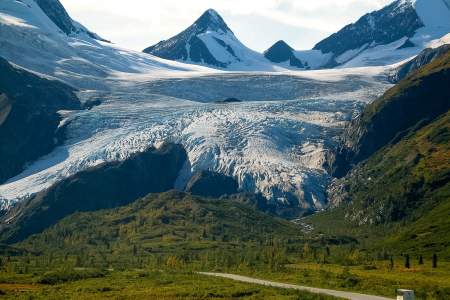
One of the most visited natural attractions along the Richardson Highway, this four-mile-long glacier descends almost to pavement and is easy to approach on foot. The state recreation site features parking, pit toilets, and a covered pavilion with a model of the glacier and interpretive signs, all close to small lake.
This 4.1‑mile trail starts through forest and muskeg meadows. You’ll cross a beautiful bridge over a creek that in mid-July and August is full of spawning chum salmon Then once you’re at the top take in views of Cordova, Nelson Bay, and Prince William Sound.
This 2‑mile-long, family-friendly trail, which begins 90 minutes south of Anchorage at the far end of the Whittier Tunnel, remains the only easy way to see Portage Glacier on foot. And it’s has a spectacular conclusion: After cresting Portage Pass, the trail drops through glacial scrub before popping out on the wide gravel shores of Portage Lake, directly across from the snout of gorgeous Portage Glacier.

This is a very steep, 6.4‑mile round-trip trail that’s mostly unmarked and requires experience with scrambling and climbing over rocks. Your reward for the effort, though, is some very dramatic views of Shotgun Cove and the glaciers in Blackstone Bay.
This leisurely, 0.75-mile trail begins just south of Whittier, a little seaside town located some 2 hours south of Anchorage. The trail doesn’t climb much, but it will take you high enough to get an unobstructed view of numerous waterfalls, including the long-dropping waters of Horsetail Falls as it sheets over the sheer rock face of Blackstone Ridge.
Whittier’s newest trail is a gem — a gentle, ¾‑mile stroll that follows Whittier Creek from the railroad crossing up to the waterfall. Locals love it: It’s right in the middle of town, but the lush greenery makes you feel like you’re far from civilization.
This trail has impressive views of the Chugach Mountains. Short spur trails offer access to five small lakes that are excellent for cutthroat fishing.
There is a good guide for this trail available at the Begich, Boggs Visitor Center at Portage Glacier. Numbered trail posts correspond to things in the guide. This is a great place to view spawning salmon in the fall. It is a well-maintained path with a thirty-foot bridge. This hike is wheelchair accessible and there are lots of berries and various wildlife species.
This is an easy .8‑mile boardwalk trail with lots of stairs. The boardwalk leads to overlook of the Copper River Delta with many signs. Be sure to bring your camera, this is a great place to see moose and bear.
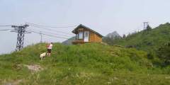
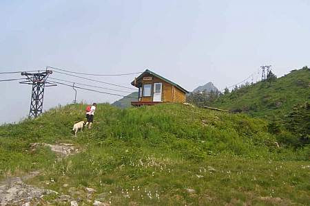
Discover year-round recreation above Cordova on this gorgeous mountain. In winter, you can lose yourself among the puffy snowdrifts and powder-covered trees as you schuss down the slopes. And in the summer, you’ll find berry picking, hiking, and festivals.
About four miles in, there is a fish hatchery on this trail. The trail was created to provide a close look at the hatchery’s dam, lake, and aqueducts. It also offers a good view of the Port of Valdez. It can be a step hike at times.
The first mile and a half of this trail leads up over rocky slopes that offer a great view of Eyak Lake and the Orca Inlet. At this point the trail splits in two and the hiker has a choice of going around the south end of Mt. Eyak or climbing straight up to the top.
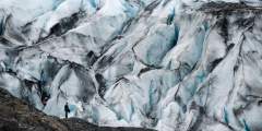
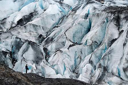
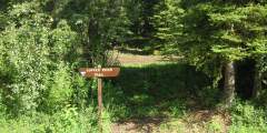
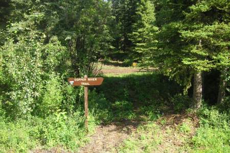
This very active glacier forms a wall along the fabled Copper River near a historic railroad route that once serviced the world’s largest copper mine. NOTE: A bridge at Mile 36 of the Copper River Highway is currently (2020) impassable, with repairs not expected for several years. Child’s Glacier is not currently accessible by road. Contact Cordova Ranger District for current venders providing transportation options to the far side. ...more
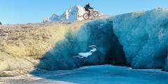
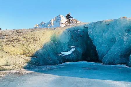
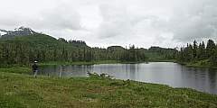
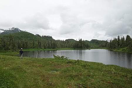
Paddle around a quiet lagoon with the impressive Shoup Glacier at one end and icebergs that have calved from the glacier, marvel at the lively black-legged Kittiwake Rookery, and take in the feeling of being somewhere remote — even if you’re only 5 miles from town.
This trail follows Power Creek then leads it’s hikers up multiple switchbacks. Midway, the Cordova Electric Hydropower Dam Can be seen from the trail. The last half passes by many beaver ponds and hanging glaciers.
This ski trail weaves through muskeg and forest and gradually gains elevation until it ends. The trail leads to a high muskeg that overlooks the Copper River Delta, Heney Range and the Gulf of Alaska. This trail is very wet during all seasons excluding winter and is not a hiking trail.
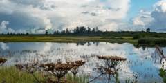
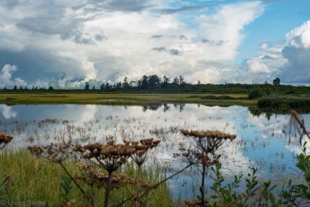
Located at Mile 17 of the Copper River Highway. An accessible boardwalk leads visitors to stunning views of both the expansive wetlands of the Copper River Delta and the surrounding mountains. A wide variety of wetland animals including trumpeter swans, moose, brown bear, and shorebirds can be seen in the area, especially during the spring and fall. The first half of this trail is paved with geoblock, so that it does not have a negative… ...more
An easy trail, about 0.6 miles long, that will take about 1 hour to hike and leads you to excellent views of Child’s Glacier. Important note: While the Forest Service still maintains it, you can’t get here by car, as the Copper River highway is washed out at Mile 36. You can only access the trail by hiring a boat or a plane from town.
This trail crosses Indian Creek several times on its gradual climb through the old growth forest. Brush and Alder give way to a panoramic a‑line near Indian Creek Pass. Parts of the trail can be difficult to follow, especially when traveling through the grass of the sub-alpine. This is part of the “Arctic to Indian” winter ski traverse.
This is a steep climb that ends where Crater Lake sits. The first half climbs over rocky sections with numerous switchbacks, with muddy areas and wood bridges. The second half continues to climb, but at a much nicer grade. At mile 1.2 there is an intertie to Ski Hill trail and at the lake there is the option to hike the Alice Smith Intertie. The entire loop from Crater Lake to Power Creek Trailhead is 12 miles. Along this trail there is good… ...more
This is a lightly sloping trail that parallels the Scott Valley and passes the shores of large and small lakes. The trail passes through an area that was previously logged. It is not a well-maintained trail.
The hike begins through the forest before it begins to climb. There are rock cairns to help guide you along the way. From the top, you’ll have impressive views of the Sheridan and Sherman glaciers.
This ridge route has amazing views of Prince William Sound, Eyak Lake, and the Copper River Delta. About halfway down the trail, there is small shelter available for day use or overnight camping. It is available on a first-come first-serve basis.
There are only a few places where you can spend time along the Lowe River without the sound of cars and motor homes — this unmarked turnoff is one of them. From here you can explore a little bit upstream and find a nice place to relax next to the river. And the only people you may see are local rafters, as this is used as a pickup spot after floating through Keystone Canyon.Just one warning: don’t fall into the water! Alaskan water temperatures… ...more
This is an easy 2.4‑mile hike with excellent fishing for sockeye, Dolly Varden and cutthroat. You’ll find access to McKinley Trail and McKinley Lake public use cabins. It is a well-maintained trail that has several bridges for easy stream crossings and interpretive signs to explain the trail’s history.
The 3.3‑mile long trail is mostly boardwalk over muskeg. This is an excellent spot to bird-watch, look for waterfowl feeding on Eyak Lake. Trumpeter swans frequent this lake. Most fly south for the winter however, up to 100 swans will winter here in this ice-free lake.