Kenai Peninsula Parks & Trails
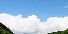
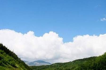
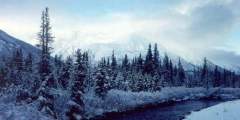
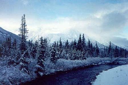
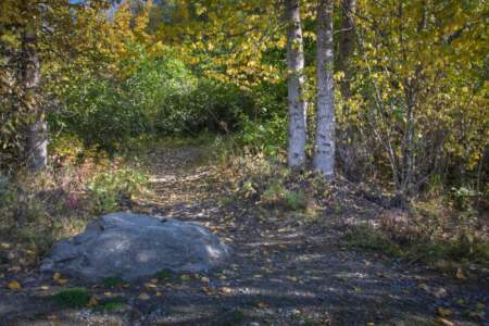
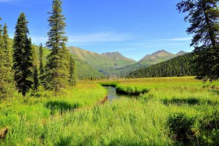
The Johnson Pass, Resurrection Pass, and Russian Lakes-to-Resurrection River trails of the Kenai Peninsula make up Alaska's most developed trail system. Turn of-the-century prospectors blazed these trails and carried millions of dollars of gold over them. The well-worn footpaths climb through forested valleys to open meadows shimmering with wildflowers and gem-colored lakes. Bridges make it one of Alaska's few regions where you can keep your socks dry.
Show Map
Parks & Trails
One of the top trails on the Homer side of Kachemak Bay, Diamond Creek is a 2‑mile trail that takes you through forest, alders, and tall grass meadows before descending to the beach, where you’ll find small Alaskan sealife.
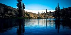
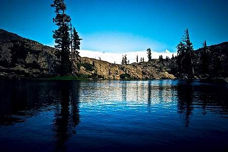
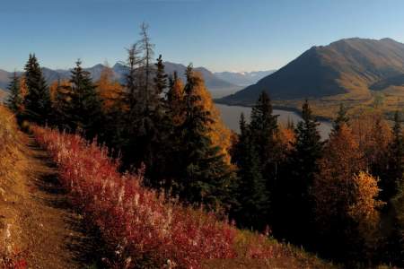
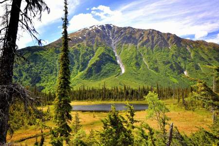
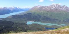
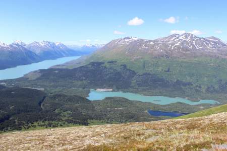
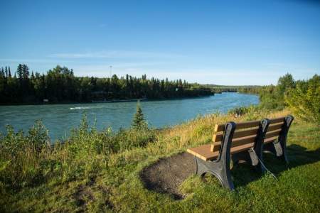
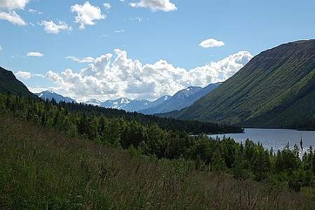
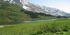
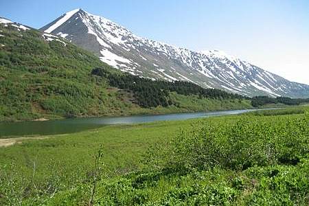
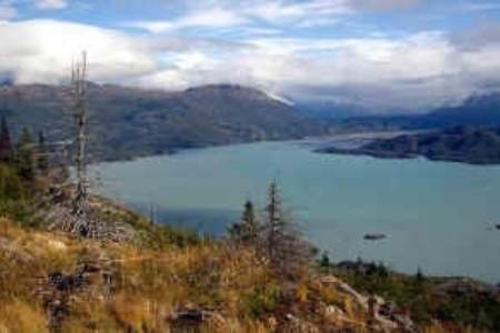
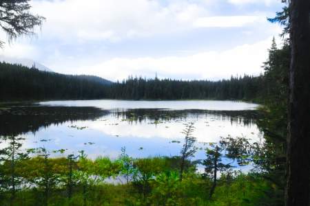
Beginning 103 miles south of Anchorage on the Seward Highway, the 3.5‑mile-long Ptarmigan Lake Trail makes for a fine family outing. The lake itself is a long and narrow body of water squeezed between ridges and mountains that tower as high as 6,000 feet. It even offers a small beach upon which to relax and enjoy the view while cooling your feet.

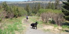
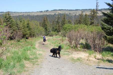
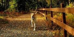
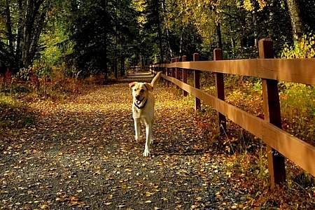
This wide, multi-use trail is popular with locals and a fun hike for everyone. The ADA-compliant trail winds through boreal forest, and it’s the only headquarters trail open to dogs and bicycles. You can even get your pup certified as a B.A.R.K. Ranger, meant to strengthen the relationship with your dog on federal public lands.
This trail, hands down, is one of the most popular hikes in the Kachemak Bay State Park. It is one of the easiest hikes in the park as the trail is well maintained, and you can’t beat the view of the glacier at the lake. For the first 1.5 miles, the trail meanders through mixed cottonwood and Sitka spruce. These cottonwoods are some of the largest in the park so take time to appreciate their enormous size. After 1.5 miles, the trail proceeds ...more
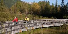
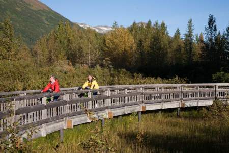
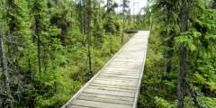
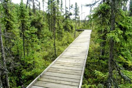
Two sets of stairs to river and 625 feet of elevated boardwalk.
This is one of Homer’s top hikes. It starts on top of Baycrest Hill, crosses Diamond Ridge Road, then follows Crossman Ridge to the Bridge Creek Reservoir. Throughout, it rolls through forests, meadows and over streams. The area is excellent for birding and catching a glimpse at the occasional moose.
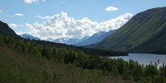
This trail is a good day hike for the whole family. It alternates between open meadows and forests and offers the option of tent camping or staying in Crescent Lake Cabin. There are options for longer hikes and there is a lot of wildlife to be seen such as moose, goats and bears.
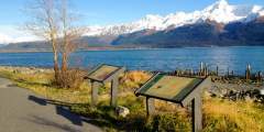
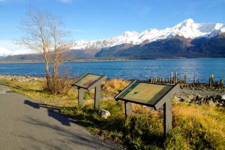
This is a day use site that offers 13 picnic sites with tables, a fish viewing platform, water, toilets, an information board, and fire grates.
Probably the second most traveled trail in the park, this trail offers a great day hike for those spending time in the lagoon. You can start hiking the trail from the ranger station or the trailhead in Halibut Cove Lagoon. The trail traverses up numerous switchbacks to a place called First Lake. On a hot summer day, a soak in this lake can’t be beat.
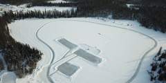
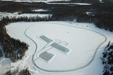
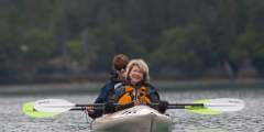
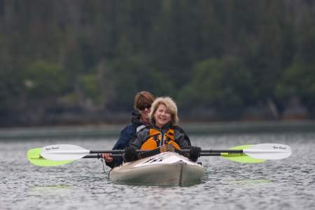
During the summer months it’s a great spot for canoeing, kayaking, paddle boarding, even paddleboard yoga. The colder months are just as lively as the warmer ones. There’s a skating loop on the lake’s perimeter, as well as several skating areas on the lake. The City offers free public skates Saturday afternoons, ice conditions dependent, December through February.
The wildflowers are abundant and verdant undergrowth can be check high sometimes. Most of the trail lies below treeline, so there are established camp clearings along the way that are nestled into the trees. One of the best campsites is 10 miles in from the northern trailhead, set among trees on a spruce-covered knoll looking over the trail and Bench Lake.
This 0.4‑mile-long trail, which begins within earshot of downtown Homer, plays host to a variety of birds and plants. Wheelchairs may have some trouble in the first few feet of soft gravel, but once they reach the plastic boardwalk they should find the going much easier — and maybe worth the trouble it took to drive 4 hours from Anchorage.
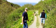
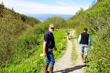
More a gated road than a trail, this hike largely remains a local secret among the residents of Cooper Landing, the fishing mecca located some 105 miles south of Anchorage on Sterling Highway. Many in this town consider it their personal getaway, which makes it quite a popular secret. A foreman for Chugach Electric (the company that manages the dam on Cooper Lake) said he often experienced congestion while driving to the dam, due to the heavy ...more
The popular, paved Unity Trail begins in Soldotna and winds its way around 9 miles to Kenai. It’s popular with locals and travelers alike for all kinds of activities: walking, biking, jogging, birding, rollerblading, and more.
Well-maintained and suitable for summer hiking and biking, the 10-mile Devil’s Pass Trail features a steep route up a spectacular V‑shaped valley that intersects with the Resurrection Pass Trail and a rental cabin in the alpine realm. The country is rugged, with great access to cross-country tundra exploration and berry picking.

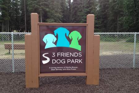
This park is a can’t miss for dog owners and dog lovers! It’s one of the busiest parks in town, with people and their dogs there practically 24⁄7. If you’re traveling with your dog, it’s a great place to give Fido some exercise. You’ll also have an opportunity to meet the locals, learn what it’s like to live in Soldotna, and get the inside scoop on the best things to see and do from people who live here.
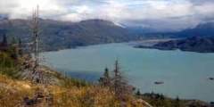
If you have the ability to transport bicycles, this trail makes for a great afternoon trip. The dirt path winds through the Portage Valley, passing glacial lakes and ending at Portage Lake (this part of the trip is 5 miles each way). Make sure to bring your camera: you’ll see hanging glaciers and, very likely, some wildlife.
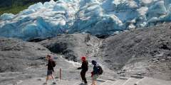
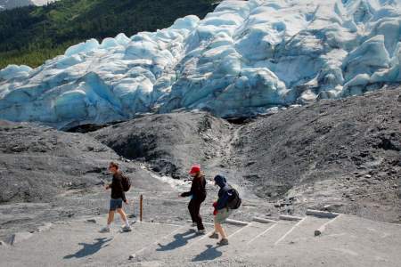
You can hike right up to Seward’s Exit Glacier and feel the dense blue ice while listening to it crackle. Walk the lower trail to get a good photo in front of the glacier face. Or, choose the more challenging 7‑mile round-trip Harding Icefield Trail. There is a short ranger-led walk daily at 11am and 3pm, from Memorial Day through Labor Day.
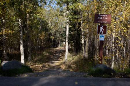
This 2.2‑mile loop trail is an off-shoot of the Keen-Eye Trail that departs from the Kenai National Wildlife Refuge Visitor Center. It is less crowded than the Keen-Eye Trail (which was built to accommodate large groups), and while it’s not a difficult hike, it features some light hills and varied terrain.
This 10-mile circuit of different loop trails is well-maintained and makes for fun hiking and skiing. Look for access from the parking lot at the Kenai National Wildlife Refuge Visitor Center, where there are bathrooms and outdoor port-a-potties. If you come here to ski, warm up inside the center, next to the soapstone masonry heater.
Many people know of the grueling Mount Marathon racecourse in Seward, some 130 miles south of Anchorage. However, most people don’t know that there’s also a hiking path to the top at Race Point — and it’s far less demanding. This 2.25-mile route, which entails hiking three different trails, takes you up the mountain and lets you to explore a glacial valley along the way.
This family-friendly, 2.5‑mile trail climbs 3,600 feet to a summit halfway between the sea and the heavens
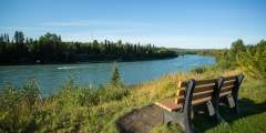
The Centennial Campground Loop Trail is a great place for a walk right in town at any time of year. It’s well-trafficked, well-marked, wide, and easy for most people to use. The trail is busiest in summer — especially the part near the campground where anglers access the Kenai River — and a little quieter during the other seasons.
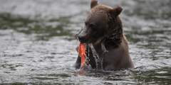
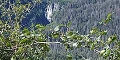
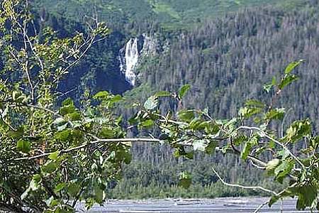
This wildlife sweet spot is worth a visit. The Russian Lakes Trail begins off the access road to the Russian River Campground in Cooper Landing, at milepost 52 of the Sterling Highway. Get off-the-beaten path, hike two miles to the falls and enjoy the immediate reward of spectacular salmon viewing.
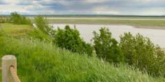
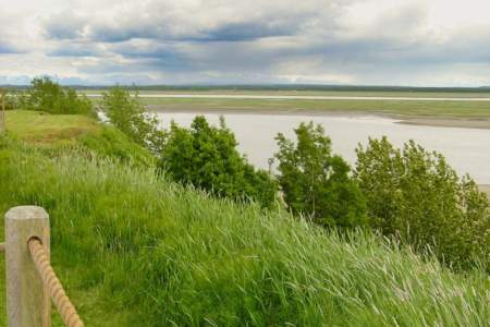
From the base of the Homer Spit, take this 4‑mile paved trail to the Nick Dudiak Fishing Lagoon. The trail is in excellent condition and is flat as a pancake for most of its length. The first mile of trail is along a broad estuary that is great for birding. Once you pass the one-mile mark you’ll be riding past fishing boats that are out of the water being worked on as well as a few shops.
This 38 mile long USFS trail starts in Hope and climbs Resurrection Pass (elev. 2,600) towards the south before descending to the opposite trailhead near Cooper Landing. There are 8 public use cabins along the trail, making this an advanced but comfortable day cabin-to-cabin hike. There are also 19 campsites available for tent camping.
This 38 mile long USFS trail climbs Resurrection Pass (elev. 2,600) and descends to the north to another trailheadtrailhead near Hope on Turnagain Arm. There are 8 public use cabins along the trail, making this an advanced but comfortable day cabin-to-cabin hike. There are also 19 campsites available along the trail.
The 23-mile Johnson Pass Trail offers hikers, backpackers and bikers a well-marked route through a lush pass in the Kenai Mountains — featuring gradual climbs, two lakes with fish, spectacular peaks and some way cool gorges.
This trail is also called the Primrose trail at the north end. It begins in a beautiful rainforest and eventually takes you up to a multiple of beautiful lakes in high meadows. Anglers can fish for rainbow trout in the lake.
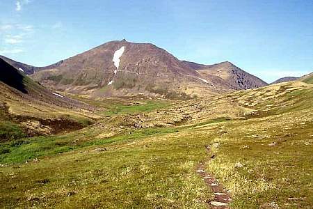
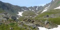
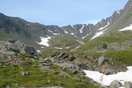
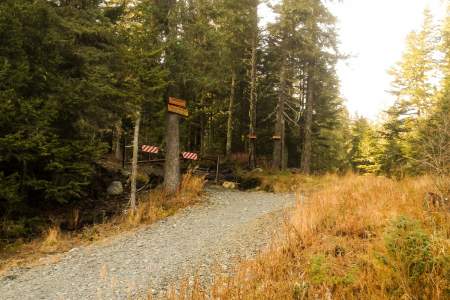
This meandering, single-track path leads to some of the Kenai Mountain’s most remote and fragile high country. On a route once trekked by gold rush prospectors, this trail ascends from spruce forest through the jungled zone of alders into a realm of sweeping tundra, with incredible views and productive berry picking. Plus, the top of the nine-mile journey ends in Resurrection Pass, about midway through the 39-mile Resurrection Pass Trail.
If you have some outdoor experience and an adventurous spirit, consider this 11-mile traverse up the Colorado Creek valley and down the Summit Creek. Beginning 2 hours south of Anchorage, this traverse doesn’t involve any rock scrambling, river crossings, or arduous bushwhacking. But if you feel comfortable hiking in wide and trackless country, you may reap the reward of having an entire valley to yourself.
In summer, the trails are open to all kinds of foot-powered recreation — walking, running, hiking, biking, photoshoots, wildlife watching and berry-picking. There’s even an 18-hole disc golf course. K‑9 feet are welcome, too. In winter, locals hit the trails for cross-country skiing and fat-tire biking. There are more than 25 kilometers of groomed ski trails, perfect for classic and skate cross-country skiing.
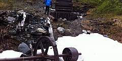
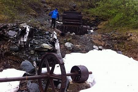
No other mining trail on the Kenai Peninsula climbs as high or takes in more extensive views as the 6‑mile-long Crown Mine Trail. Beginning some 2 hours south of Anchorage on the appropriately named Mine Road just south of Trail Lake, this trail climbs to 3,900 feet above sea level to a unique spot — a glacial cirque littered with mining paraphernalia.
This beautiful park set along the turquoise Kenai River hosts community events, has a boardwalk, access to the river, playground and more. There’s an ice loop for skating (free ice skates are available during winter festivals) and animal cutouts with white twinkle lights on them.
Your best bet for this trail is to go out on one low tide, spend the night — in either a forest service cabin or campsite — and then return the following day or several days later on another low tide. Great forest-to-beach hiking trail.
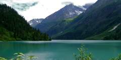
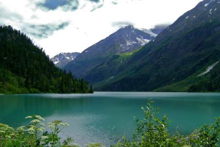
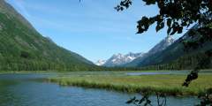
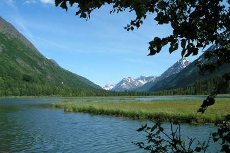
Popular with hikers and backpackers, this easy-to-follow trail connects the state’s most intense sockeye salmon sports fishery with stunning mountain backcountry. It offers many of the Kenai Peninsula’s highlights in one trip. The 21-mile route accesses Russian River Falls, Lower and Upper Russian Lakes, Cooper Lake, 3 federally managed recreational cabins, and numerous campsites
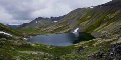
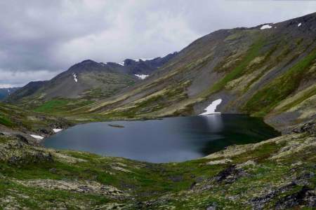
This easy trail winds along the banks of three lakes. There is a camping area on the side of the trail. The trail climbs a saddle and drops down into the valley. It can be dangerous to cross the rivers, as they are glacier-fed and you cannot see the bottom. The rivers are lower during the beginning of the year, but they are also colder.
Known to locals as the Divide Ski Area, this trail was built by dedicated community volunteers from the Seward Nordic Ski Club.
Difficulty: Moderate Distance: 5 – 50 miles Elevation Gain: Less than 500ft Type: Out-and-Back Features: Kid Friendly
If you’re a bird watcher, you’ll love this half-mile trail of Aspen and Spruce forest.
The Raven’s Way Loop is accessed from the Sterling Highway. You will see the Trailhead and large parking lot. The trail meanders through open spruce and muskeg terrain and there it is a great chance to see lots of eagles and ravens.
The trail is half a mile long and takes you through a mature birch forest that is carpeted with devil’s club and watermelon berry plants. It’s an easy walking, ideal for small children, and ends at a small camping area on a slight bluff that overlooks Bishop’s Beach and Bishop Creek.
The trail follows the south end of Cooper Lake and ends at Upper Russian Lakes Cabin, 13 miles from the winter trailhead. There is little elevation gain or loss on this forested trail.
Seward Waterfront Park extends from the small boat harbor to the SeaLife Center and contains paid tent and RV camping, playgrounds, a skate park, picnicing areas, beach access, and a trail lined with historical landmarks.
Features: Skiing
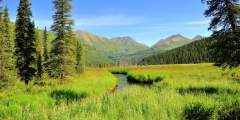
Palmer Creek and the road that follows it were named after George Palmer, who in 1894 first discovered gold on its banks. The creek was the site of early placer mining and later lode mining. Evidence of the historic Lucky Strike and Hirshey mines, as well as the Swetmann camp, can be found along trails that lead to Palmer Lakes. Several hiking trails are accessible from the Palmer Creek Road.
If you want a taste of dim spruce forest along a wild river bottom, try the first few miles of this mostly level route into the Resurrection River Valley. From the trailhead Mile 7 of Exit Glacier Road, the trail runs 4.5 miles to Martin Creek and is suitable for mountain biking or skiing after snowfall. It features two primitive campsites and occasional access or views of to the river.
Although this can be a busy spot, it is a lot less congested than the Homer Spit. Things to do here include: taking small day hikes, paddling in the lagoon, camping, staying at one of the three nearby public use cabins, and the most popular, fishing for Kings during the month of June.
The Keen-Eye Nature Trail is .75 miles long through a wooded area with a side trail leading down to Headquarters Lake. The Centennial Trail provide an additional 1.9 mile loop through a wooded area with further opportunity to view wildlife in the area.
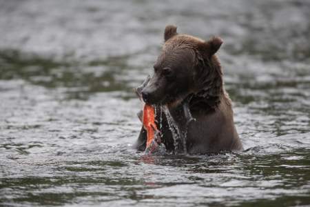
Stop off here during the summer for an eagle’s eye view of an annual Alaskan fishing frenzy. We really love our salmon, and it shows! Or, just count the bald eagles circling high overhead.
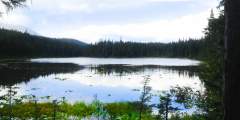
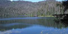
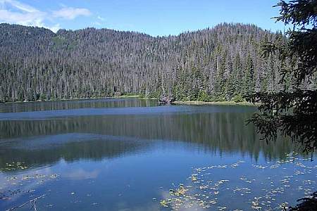
These popular trails lead to two beautiful, pristine lakes. Even better, they’re both easy hikes, which makes them perfect for people of all ages. Bring a fishing pole and angle for stocked trout in Meridian Lake or grayling in Grayling Lake.