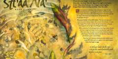
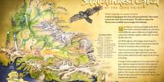
Guide to the Copper River Watershed
To enter Copper River Country means entering the heart of the renowned Copper River watershed, one of the world’s few remaining salmon strongholds and home to our largest national park, Wrangell-St. Elias National Park & Preserve. From the Richardson Highway, the Tok Cut-off, or the Edgerton Highway, you can see the mighty glacial river churning its way south as it carves a canyon through the Chugach Mountains before draining into the Gulf of Alaska. The expansive Copper River basin lies a few hours north of Anchorage, or you can enter by coming south on the Richardson Highway from Fairbanks or the Tok Cut-off from the Al-Can Highway.
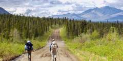
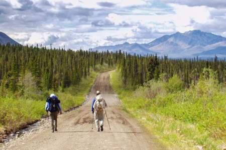
Spend three to seven days exploring the rivers, trails, museums, state campgrounds, mud volcanoes, and the historic mining town of Kennicott as you travel by story through this expansive river system. Eight signs will guide you through the Copper River watershed landscape. See if you can visit all eight signs on your tour through this upper watershed basin formed by the ancient, glacial Lake Atna!
Creating Your Itinerary
Spend three to seven days exploring the rivers, trails, museums, state campgrounds, mud volcanoes, and the historic mining town of Kennicott as you travel by story through this sprawling river system. Eight signs will guide you through the Copper River watershed landscape. See if you can visit all eight signs on your tour through this upper watershed basin formed by the ancient, glacial Lake Atna!
Glenn Highway, Anchorage to Glennallen
2 days: Hiking, rafting, flightseeing
Allow 3.5 hours to reach Glennallen from Anchorage. From Glennallen, you can explore the Copper River basin by white water rafting, scenic drives to view the Wrangell Mountains, and flight seeing for a spectacular view of the Wrangell Mountains and their glaciers.
Show Map
Guide Points
Tok Cut-Off

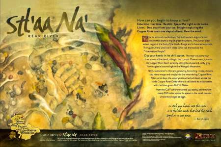
For thousands of years, under a winter moon, the Ahtna, Copper River’s first people, have begun their story telling season. Trained storytellers share the Sacred Stories, their Stories of Creation. Younger generations listen. Embedded in memory, traditions are restitched and sacred covenants made clear. Teaching stories follow throughout the year, passed on by respected elders: aunts, uncles, and grandparents. These ways of living in the land ...more
Drive down the 42-mile Nabesna Road for tremendous views to rival any road system in Alaska. The Wrangell, Mentasta and Nutzotin Mountains create a majestic panorama, characterized by some of the highest mountains in North America. Nabesna Road is one of two that allows access to Alaska’s largest national park, the Wrangell-St Elias National Park and Preserve. Services are limited and road conditions vary with the seasons, but there are plenty of ...more
Campground with 35 sites, picnic table, shelter, toilets, and 2.5 mile hiking trail overlooking the Tok River Valley.
Glenn Highway
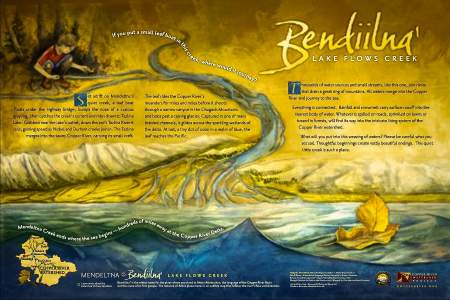
Stop here for a bathroom break and stretch your legs by the creek. Little creeks drain into bigger creeks and create bigger rivers. Learn how the waters in this small creek make their way to the Gulf of Alaska.
Campground with 80 RV sites, 20 Tent Sites. Access to Tolsona Mud Volcanoes Trail.
This is a privately maintained trail. It is located 14 miles west of Glennallen at the Tolsona Wilderness Campground, at mile 173 on the Glenn Highway. Hikers who are not registered campers are asked to pay a fee of $5 per vehicle.
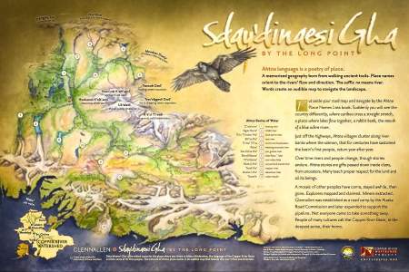
The town of Glenallen is named after two early explorers. Henry Allen was a lieutenant who travelled through this area in 1885 on his way to the Yukon River, and Capt. Edwin Glenn was part of the U.S. Government survey crew for the Richardson Highway that came through in 1898 – 99. Glennallen is also a part of the Copper River Watershed. Find the interpretive sign at the visitor’s center and orient yourself in the watershed with a map of Ahtna ...more
This is a privately maintained trail, located at Mile 187 on the Glenn Highway. In Glennallen, turn north on Co-op Drive, trailhead and parking area are marked with a sign that says “Aspen Interpretive Trail.” Trail is rated “easy,” allow about 1 hour for 1 mile round-trip. The beginning of this trail has been re-routed. At the trailhead, look for signs to the right, indicating the new route. The trail passes through three distinct ecosystems ...more
Richardson Highway
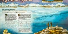
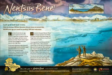
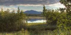
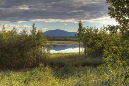
Traveling the Richardson Highway south of Glennallen, you will pass Willow Lake with spectacular views of the lake and the Wrangell Mountain volcanoes in the distance. Read about how ancient Lake Atna once filled the area you’re driving through and shaped the Copper River valley.
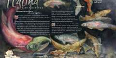
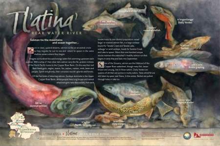
Historic Copper Center is one of the oldest non-native communities in Alaska’s Interior. Founded as a government agricultural experimental station, it later served as a transportation center for gold rush prospectors. Also find the interpretive sign where you’ll learn about the local fish species that make their home in different habitat niches of Copper River watershed creeks and rivers.
Housed in rustic log cabins, the museum offers the visitor a unique look at the varied past of the Copper River Valley area. Exhibits include early mining of gold and copper, and Russian artifacts.
Edgerton Highway & McCarthy Road
Kenny Lake (pop.500) Kenny lake was established in 1910 as an Alaska Road Commission Roadhouse for the Valdez-Fairbanks-Chitina Military Road. Today it is a small farming community where residents lead a self-sufficient lifestyle harvesting fish, game, berries and organic produce.
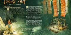
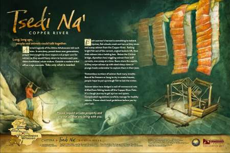
You’re now looking at the Chitina River just before it merges with the Copper River and disappears out of view. The braided Chitina below actually carries more water than the Copper River, despite losing the name battle. (It’s actually more of a name tie, though, as Chitina is the native word for copper.) Heavy rains, floods, and outbursts from glacially-dammed lakes can fill the riverbed, in comparison to the channels you’re likely seeing… ...more