Southeast & Eastern Alaska Float Trips
Its Boundaries
This is that region east of a line from Icy Bay to Mount St Elias. It includes the area around Yakutat, the Lost Coast, Glacier Bay, Lynn Canal and the islands to the south of Juneau, including the Taku and Stikine watersheds.
What It’s Like
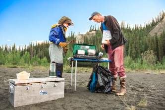
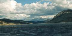
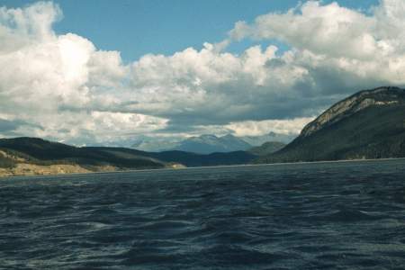
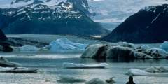
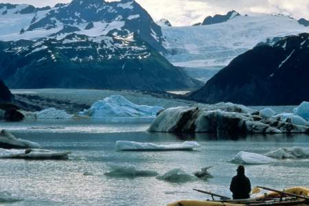
These are typically remote rivers, running along the edge of huge icefields and through huge spruce forests. One exception: The Mendenhall, which offers a fun day trip close to the state capital, Juneau. Indeed, there are countless miles of paddling that you can do in a sea kayak in this region, with Glacier Bay National Park as a major destination; the waters around Sitka are a favorite as well.
Some other highlights:
- The Tatshenshini and Alsek rivers offer some of the greatest wilderness trips in the world
- The Taku River flows out of a lovely aspen parklands in dry interior Canada
- The Stikine River empties straight into the salt waters near Wrangell
Show Map
Float Trips
Southeast Alaska Float Trips

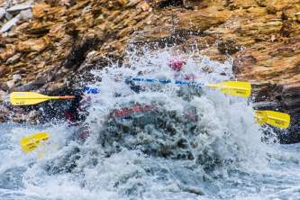
Overview The Tana River is a short, challenging Class IV+ stretch of river that leads to the Chitina River. It flows out of the Chugach Mountains directly towards the Wrangell Mountains and has a reputation that deserves skill and experience paddling along fast, cold glacier water. It starts as a medium size river flowing out of the Tana Glacier that is an ice tributary of the giant Bagley Ice Field. The Tana River alone is only 36 miles… ...more
Overview The Nizina River flows out of the Nizina Glacier and into the heart of the Wrangell Mountains from a point not far from the divide with the St Elias Mountains to the east. This area is a part of the largest protected parklands in the world and from near its source, it offers a 45-mile or 90-mile trip with moderate Class III difficulties. It is a tributary of the Chitina River that flows into the even larger Copper River. The… ...more
Overview The Nabesna River is a glacially fed Class I and II river that flows north out of the heart of the Wrangell-St Elias Mountains and cuts through a shallow canyon between the Mentasta Mountains and the Nutzotin Mountains of south central Alaska. It joins the Chisana River and, together, they form the mighty Tanana River, which flows through interior Alaska to its confluence with the Yukon. The river has 80 miles to float through, in an… ...more
The Copper River and its many tributaries drain one of the greatest regions of mountain, ice, snow and forest in North America. It is a giant river in its lower reaches, often flowing at rates over 200,000 cubic feet per second, while its headwater tributaries flow down steep, rocky gorges and through wide, braided glacial valleys. It is in a region that encompasses subarctic to temperate zones within a latitude range of 60 to 62 degrees. It… ...more
The Chitina River flows down a huge valley that traces a path separating the Wrangell Mountains and the St Elias Mountains of Alaska’s southeastern mountain region. This river trip can be done in 4 to 8 days depending on where you start your trip. This valley sits astride a giant fault line that runs through a region that has formed as colliding tectonic plates have pushed up some of the highest mountains in North America with Mt Logan… ...more
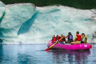
The Alsek is one of the great rivers of the world. It has been a waterway for hundreds of thousands of years and its mouth has the fifth largest discharge of water on the west coast of North and South America. It flows down through the heart of Kluane Provincial Park in Canada and runs through the largest protected parklands/biological preserves in the world. It crosses 4 major tectonic fault lines. It is part of a UNESCO World Heritage Site… ...more
Expert Advice