Why Take This Hike
Reaching either of the two summits of Syncline Mountain along Belanger Pass Trail—the only trail leading to these summits—will seem more a hike than an actual climb. Of these two summits, most people will probably choose to make the shorter 4-mile climb to the first 5,362-foot summit of Syncline Mountain. But if you have the energy, you should consider hiking the additional 4 miles it takes to cross the plateau-like summit ridge to the higher 5,471-foot summit. Along the way you will hike beneath a whole lot of sky and look out on a whole lot of country
The Details
To get to the beginning of Belanger Pass Trail should not present any difficulties—other than driving some 125 miles northeast of Anchorage. This will take some time—perhaps as much time as will take you to reach the first of the two summits of Syncline Mountain. From Anchorage just follow Glenn Highway through Palmer and up the broad Matanuska River valley—a drive you should find far from a boring drive as you wind upward beneath 6,000-plus-foot peaks to the high tablelands at the river’s headwaters in Tahneta Pass. There, 3 miles past Tahneta Lake turn left onto Martin Road on the left (north) side of the highway. Then follow Martin Road under 2 miles more to where it swings left and dead-ends at the beginning of the trail.
Like the country around it, the mining road that makes up Belanger Pass Trail seems to roll gradually upward instead of actually climbing. For 3 miles it slowly trends upward to the crest of Belanger Pass.
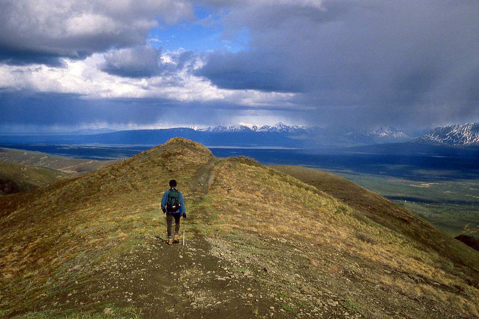
There, where you turn off onto a narrow ATV trail on the left, do you really feel like you’ve begun to climb. But this does not last long. After climbing less than 400 feet the trail levels off dramatically as it sets off across the broad summit ridge of Syncline Mountain. Some 1.5 miles later the trail reaches the roomy lower summit of Syncline Mountain (5,382 feet).
Reaching the second, and slightly higher summit (5,471 feet), requires another 4 miles of hiking. But these 4 miles of hiking only requires another 800 feet of elevation gain, most of which occurs in the trough you cross halfway across the summit ridge.
Though you must hike twice the miles as the hike to the first summit, the extra time and effort you spend in reaching the higher summit makes for a memorable excursion. As you make your way across the mile-wide and largely flat ridge you’ll feel like as if you had started across an immense plateau with clouds rubbing against its edges and the blue sky hanging just a few feet overhead.
(For more, see Walk-About Guide to Alaska, Volume Four by Shawn R. Lyons)