This is a popular weekend hike if you want to spend two-to-four hours in the Tongass National Forest and is only about 15-20 minutes north of town. Though you gain elevation on the hike up to the lake, it is not unforgivingly steep. Perseverance Lake is one of Ketchikan’s picturesque mountain-lake scenes.
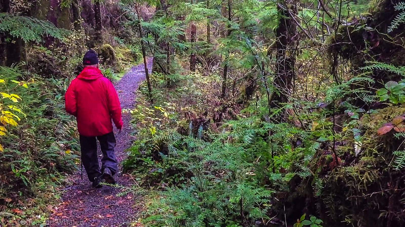
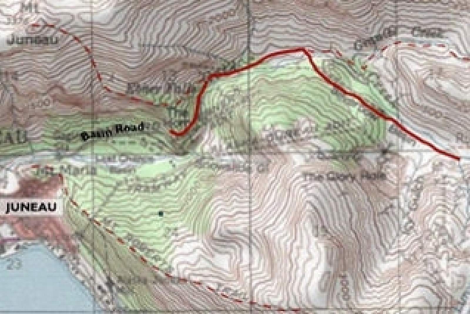
The Perseverance Trail leads up and away from Ward Lake and starts on the south side of Ward Creek, heading toward Connell Lake. The gravel path slowly and steadily climbs through the dense rain forest and crosses over a few bridge-spanned creeks. Eventually, you walk through a couple small muskeg flats and then the trail cuts into the hillside above a small creek valley below. The trail swings left to climb up to skirt the edge of a pond, then swings right to walk through the edge of another small muskeg field. Soon the trail steepens through the forest again, then switchbacks left as you climb out of the valley into a less dense forest. Switchback to the right, you climb into a brief muskeg opening and swing left back into the trees. Switchback right again and you are on the final stretch to the lake. Here you are above another valley on the left where a creek drains out of Perseverance Lake and into a waterfall that tumbles down to flow into Connell Lake, which you can sometimes glimpse through the trees. Walking on, you will hear the waterfall get closer and see it through the trees off to the left. Soon the trail will turn to boardwalk in a small muskeg field and just a little further, you will reach a fork in the trail.
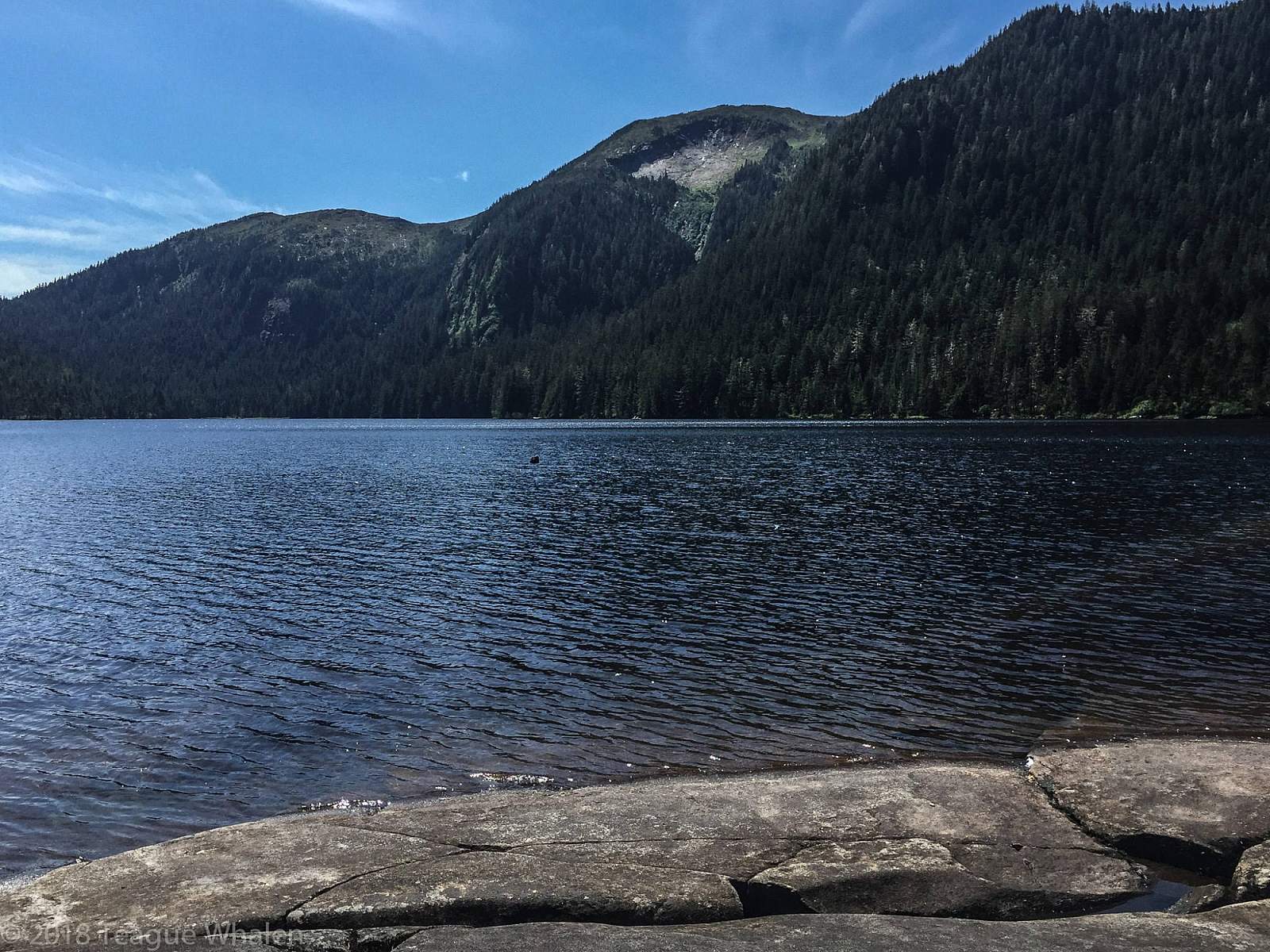
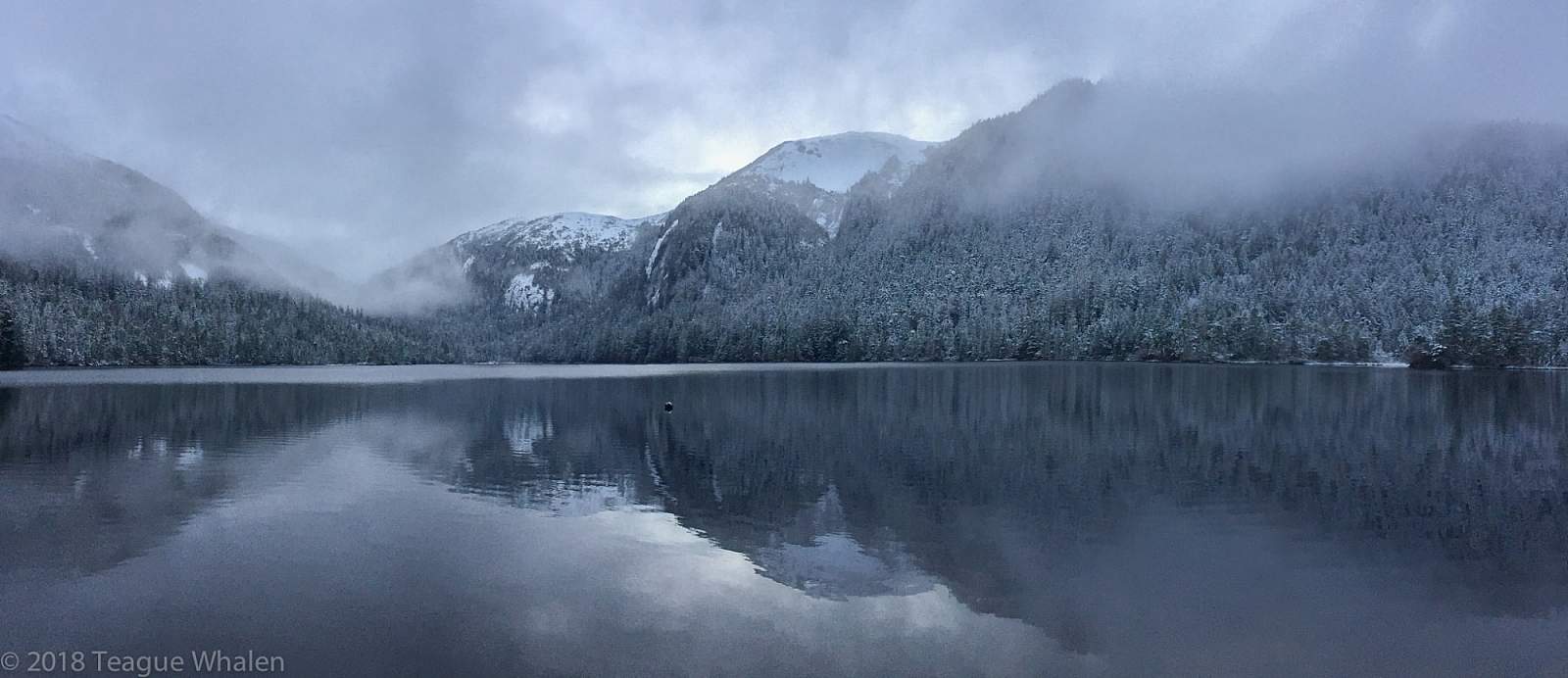
Straight ahead the trail crosses a bridge over the headwaters of the creek and continues on for about a quarter mile along the creek to terminate at a tent platform on the north end of Perseverance Lake. Here you can see a clear view of Juno and Minerva Mountains on the other side of the lake and Diane Mountain to your left. Many large trunks of driftwood cedars and spruce are gathered here like a tangled raft of haphazard docks. Back at the fork, if you take the trail to the right, this is the beginning of the Minerva Mountain Trail, which steps up Ward and Juno Mountain and down into Minerva Mountain to descend to the Carlanna Lake Trail. About a half mile up this trail is another lakeside tent platform, which can be accessed by what looks like a deer trail through the vegetation. This platform is perched many feet above the water and provides an intimate view of Diane Mountain. The best mornings are when the lake is still and mirrors the mountains and a lone loon greets you with its echoing call.