Why Take This Hike
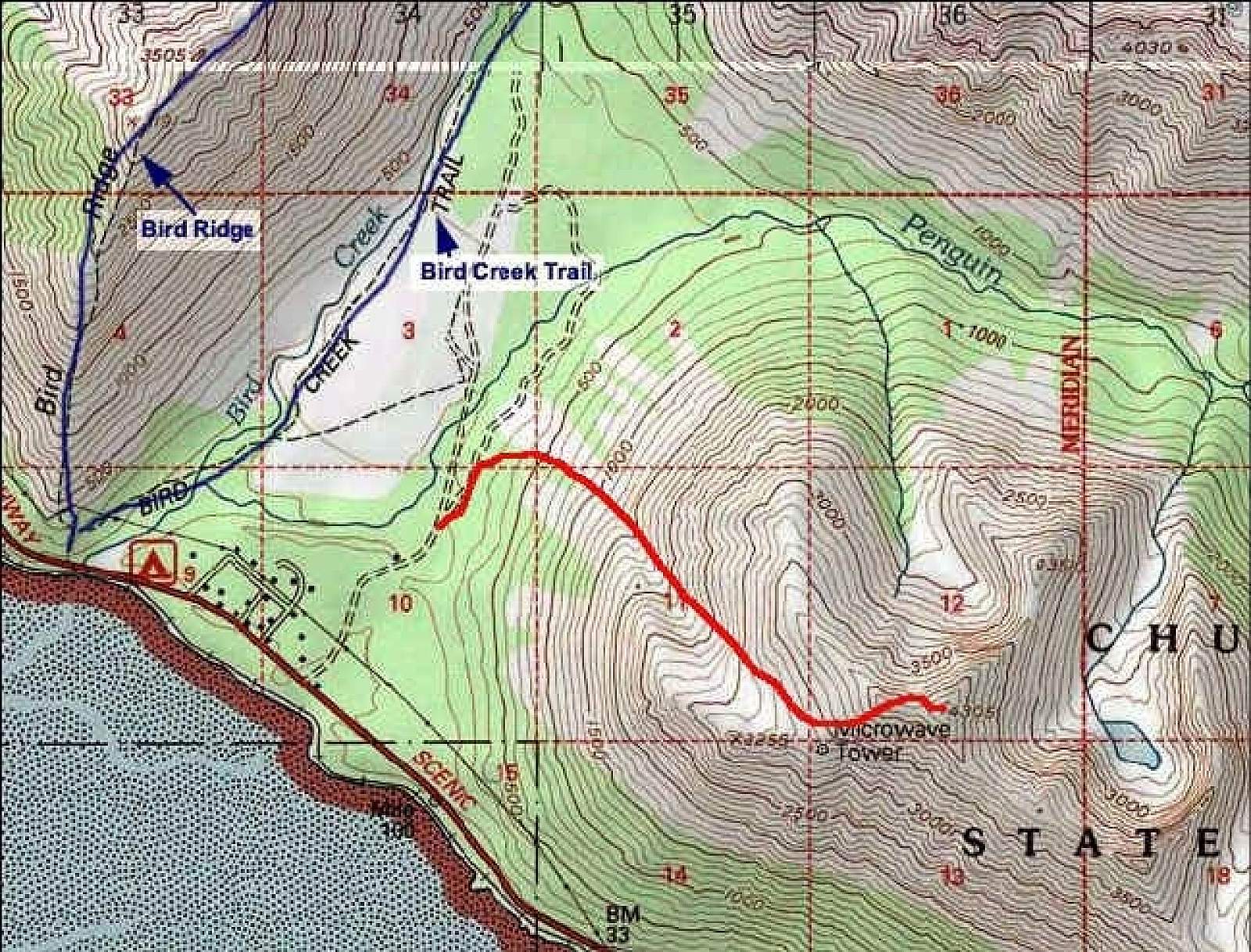
This trail, which begins 27 miles south of Anchorage, served as a racecourse before the nearby (and more accessible) Bird Ridge Trail stole its glory. But the fact that it was worthy of hosting a race makes it very worthy of a workout. You have to run 0.5 miles up Bird Creek Trail before even starting up the 3-mile, 4,200-foot Penguin Peak, but think of it as a warm up.
The Details
You’ll find the trailhead for Bird Creek Trail at the uppermost end of Konikson Road, off the Seward Highway near Bird Creek. From the parking area, the trail passes around a fire gate before continuing up a wide dirt road that’s often dotted with puddles. But don’t let this easy first section fool you. In about 0.5 miles you’ll reach the beginning of the much narrower and steeper Penguin Peak Trail on the right.
Now the climbing begins. Initially following a wide ATV trail, the trail quickly dwindles to a footpath as it climbs up the central trough of an intimidatingly large avalanche chute. This chute should serve as a warning to check the ridge above before continuing very far up the trail.
Here’s why. In winter, the prevailing winds form large cornices across the entire length of the ridgeline. As wind and snow continue to build these cornices, they eventually lose the ability to support their own weight. Finally falling off the ridge, they drop in one great mass, pushing the slope of snow below them downward in a great whooshing rush that often sweeps all the way down to the bottom of the trail. Then, if snow continues to fall, the wind begins forming another cornice. Some of these cornices can cling to the ridge well into June before giving way. So just because you find the bottom slope clear of snow, beware of what may fall from above.
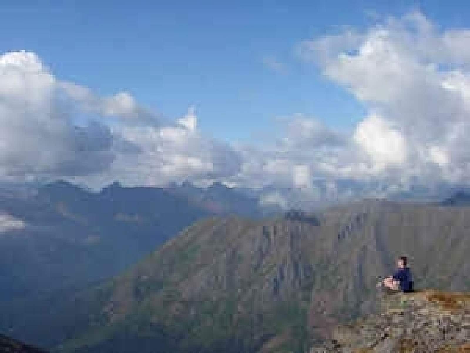
In just under 1 mile, you pop above tree line at the bottom end of a broad, steep basin. Climb up the basin, and then the steeper face of the rim, and you’ll top out on the mountain’s narrow west ridge. Suddenly your view will expand to include much of Turnagain Arm, spread out some 4,000 feet below.
Now turn and follow the trail up the ridge’s crest; you’ll soon reach a relay tower. Stay on the occasionally rocky crest of the ridge for 0.5 more miles to reach the trail’s end on the summit of Penguin Peak (4,305 feet). Just don’t run recklessly over the summit in your excitement; you may end up plunging down the near-sheer north face into Penguin Creek Valley on the opposite side.
As you relax, take a moment to thumb your nose at Bird Ridge, the next ridge to the west. You’ve not only climbed almost 900 feet higher, but you also now stand on a real summit—not just a bump on a ridge.
(For more, see Walk-About Guide to Alaska, Volume One by Shawn R. Lyons)