The Gulkana River is an approximately 80-mile long river that can be done in 5 to 7 average length days. It is a National Wild and Scenic River and one of Alaska's most popular whitewater river trips. It is an excellent fishing river trip, as well, with a large King Salmon run and lots of smaller sport fish to try for. The first three miles are, generally, Class II with 4 mph current and some Class III. The next 13 to 15 miles to canyon rapids are Class I with an easy slow moving river current. The canyon rapids are very fast (5 mph), and are a boulder filled, Class IV stretch of water, about 1/2 mile long. The eight miles following the canyon are fairly rocky, Class II waters. The remaining length is Class I and rocky all the last 35 miles, except for a fifty yard-long set of Class II rapids some miles upstream of the bridge. It is a pleasant river for the experienced canoeists and for rafting by those with some experience. The canyon should be portaged by non-expert paddlers. The trip begins on Paxson Lake and requires a 7-mile paddle to the lake's outlet.
Put In
The common put in is at the camping wayside at Paxson Lake alongside the Richardson Highway at the Paxson Lake Campground at mile 175. From this point you have a 7-mile paddle to the end of the lake to its outlet where after 3 miles you join the Middle Fork.
An alternate, and much more difficult, option involves starting on the Tangle Lakes along the Denali Highway, and paddling south, portaging from one lake to another to a point where the Middle Fork begins.
Take Out
Take out is at Sourdough Campground at Mile 127 of the Richardson Highway.
The Trip
Paxson Lake to Canyon Rapids: 20 miles
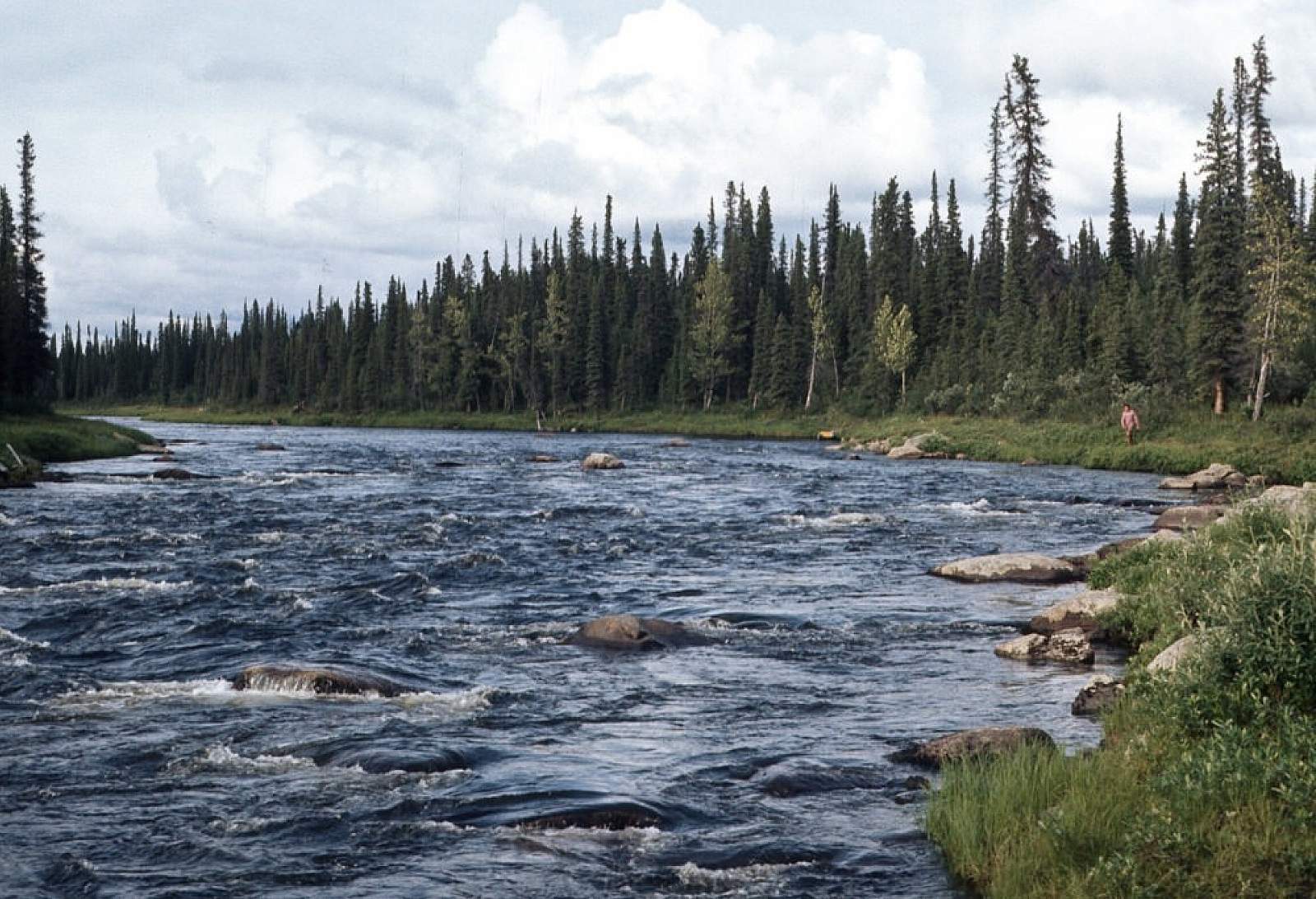
This is the access to the Middle Fork of the Gulkana River and is the common route taken by most boaters. From the put in at the Paxson Lake Campground it is nearly a 7-mile paddle across the placid lake. Once at the lake outlet you have 3 miles of Class II riffles till you reach the Middle Fork that begins a 15-mile section of Class I and II river. Through here the river is deep and quiet as it winds it's way along. There are plenty of good fishing holes to stop for.
Canyon Rapids to Sourdough Campground: 26 miles
At mile 18 a canyon begins and signs mark a way on the river’s left shore to portage the 1/4 mile around the Canyon Rapids. Experienced paddlers, after having had a thorough scout, may choose to run the rapids and if you are in a canoe it will be a wild ride. Have everything tied in and waterproofed for the 1/2 mile of whitewater. Just after the portage, a trail leads a mile to Canyon Lake and is a nice walk. Below this area the river has 8 miles of rocky, Class II rapids, with the need to maneuver around rocks and logs. The last 18 miles into Sourdough is another easy Class I section. The Sourdough Campground is on the left about a mile below where the Alaskan Pipeline crosses the river. An alternate take out would be to float an additional 13 miles to the Poplar Grove Campground.
Sourdough Campground to Mile 127 of the Richardson Highway: 35 miles
From the Sourdough Campground it is 13 miles of easy water to the Poplar Grove campground and a few miles below this is a Class II to III rapid. After that, the biggest danger is meeting speeding jet boats that come upriver to fish the waters of this stretch of river, especially on weekends.
Other Advice
- If you plan to do the Middle Fork from the Tangle Lakes region, be prepared for strenuous portaging as you hump your gear from one lake to another.
- There is heavy bear traffic along the river when the salmon are running. Be prepared to store food properly and keep a clean camp.
- The portage around Canyon Rapids is only a quarter of a mile and is along a well used trail. Scout the rapid well if you choose to run the rapid and be "rigged to flip".
USGS Maps
Gulkana River A-5, B-3, B-4, C-4, C-5, C-6, D-4, D-5, D-6
Distance
80 miles
Days
5-7
Difficulty
Moderate
Class
I, II, III, IV
Craft
Canoe
Kayak
Raft
Cost
$