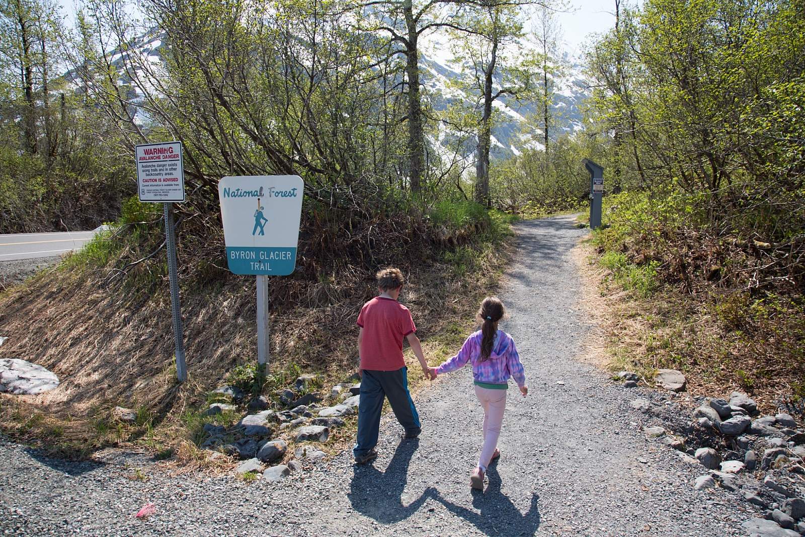
Byron Glacier & Byron Glacier Trail
Distance
1 miles
Elevation Gain
100 ft.
Difficulty
Easy
This short day hike—with an easily accessible trailhead a few hundred meters from the Begich Boggs Visitor Center—offers you big views of the Byron Glacier. The glacier itself lies just beyond the end of a flat, well-maintained trail up a narrow, glacier-scoured valley south of the Portage Lake.
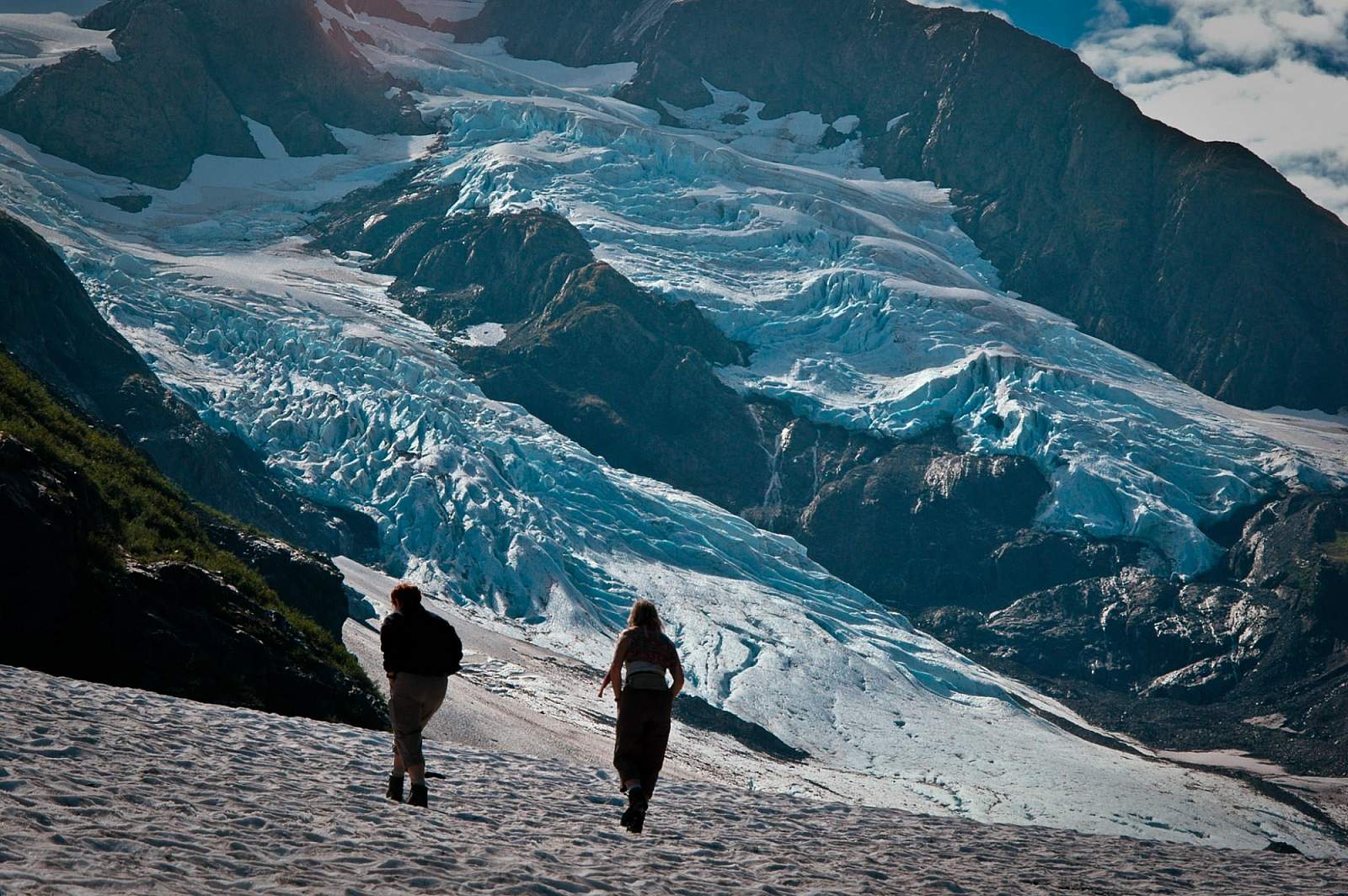
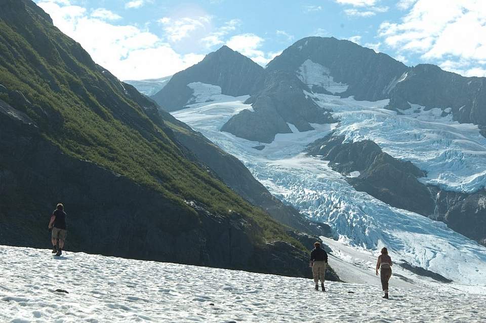
Byron Glacier descends from the same ice field that feeds both Portage Glacier on the lake and Blackstone Glacier in Prince William Sound. The trail is a real-time demonstration of how an ecosystem rebounds from the ice age, with large trees and forest giving way to alder thickets, which in turn morph into lichen-dotted rock only recently exposed by retreating ice. The upper valley is rugged and raw—with silt-blackened debris covering ice—offering an austere feel for authentic glacial terrain, as though you were on an adventure deep in Alaska’s coastal backcountry.
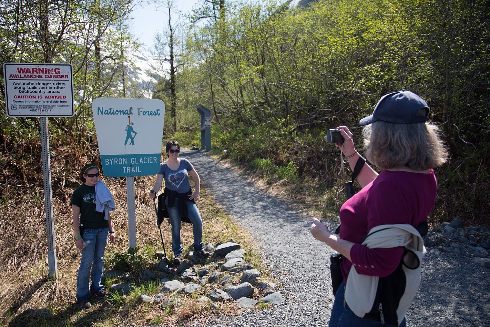
The Trail
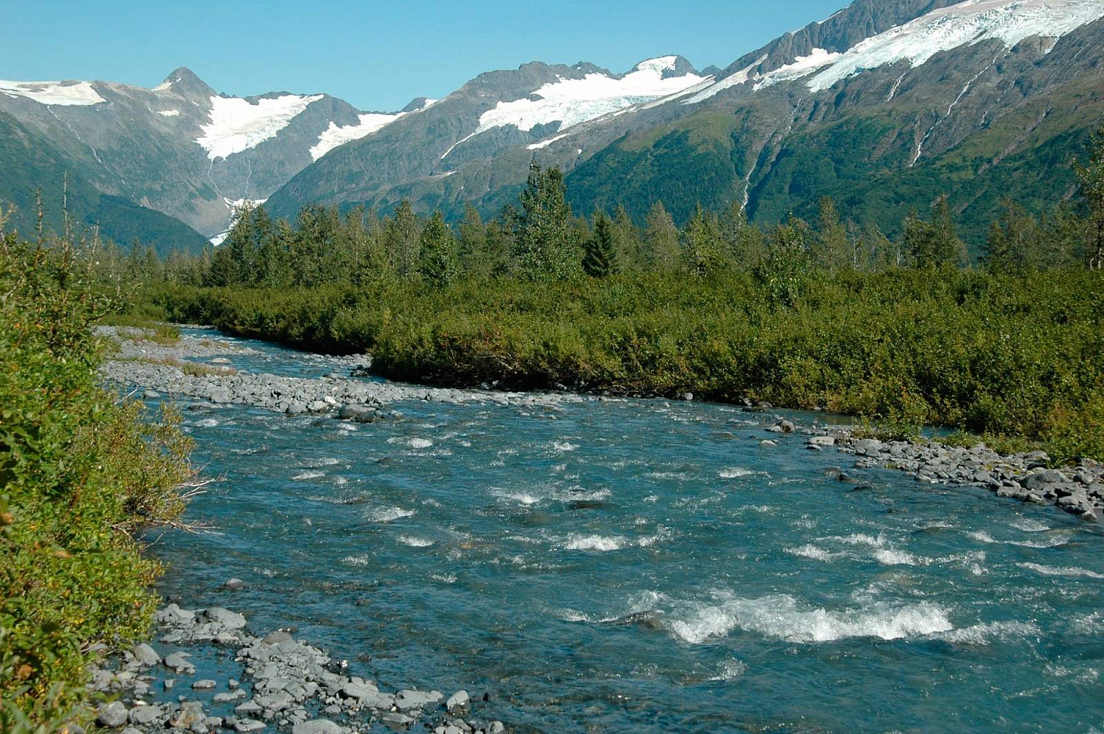
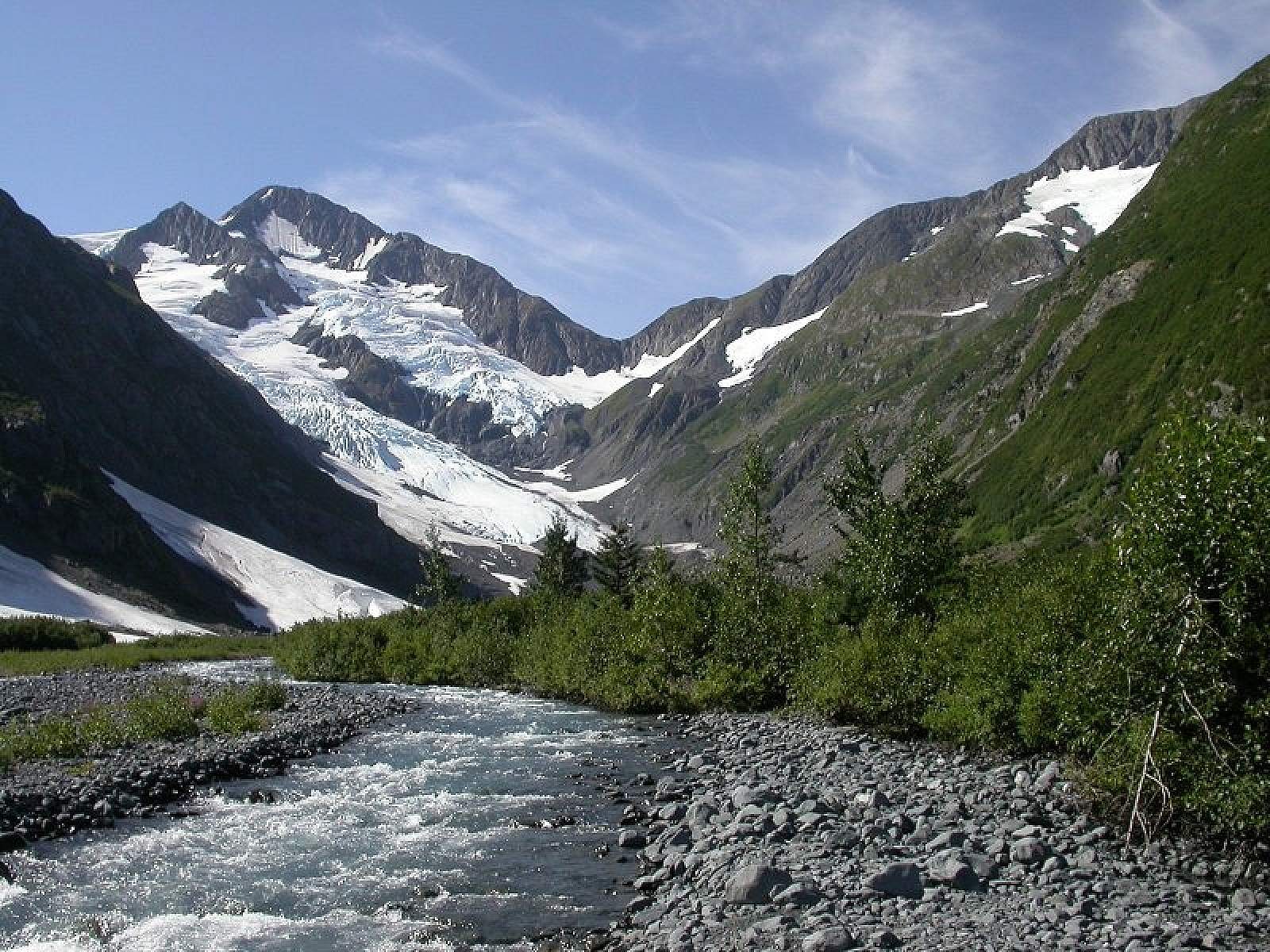
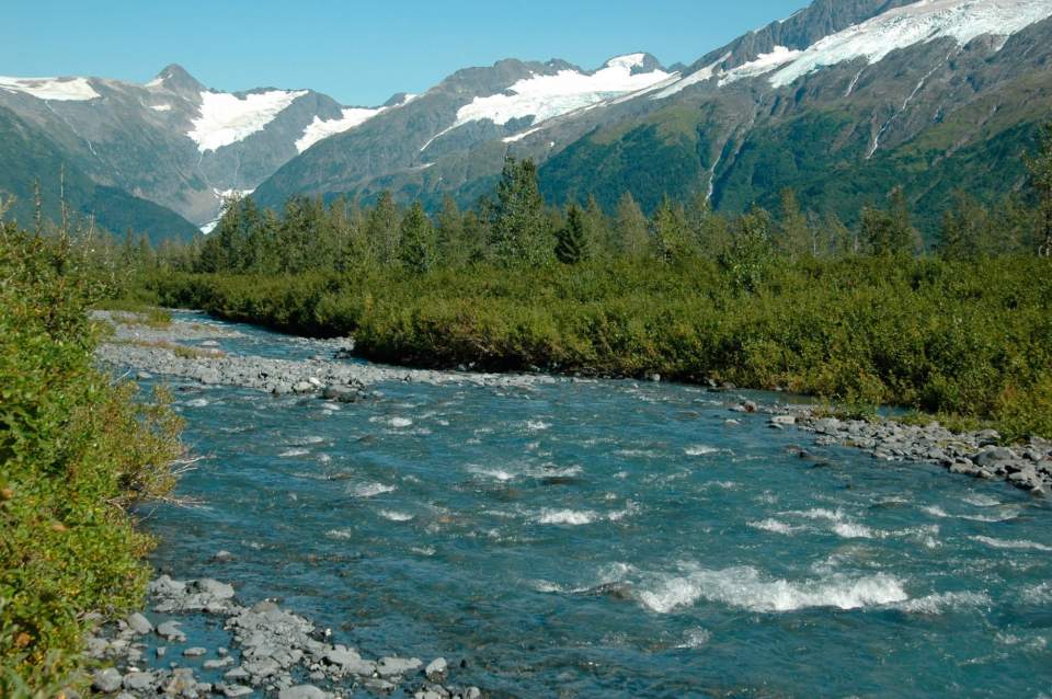
The trail starts at a well-marked pullout, about half a mile from the end of the road. When the trees were shorter, you could see the glacier well from the road, but now you have to hike a ways before the ice face comes into view. Follow the winding, mostly flat trail through a rocky, verdant alluvial plain that is now interspersed with tall alders and a smattering of cottonwood and aspen trees. Much of the trail is close to Byron Creek, where kids can play among the smooth stones, but keep an eye because the water is cold and sometimes rapid. As you approach the glacier, the forest thins out to display views of the rugged cliffs and glacier and—if you turn around—Portage Lake and Valley. It’s fun to have an impromptu snowball fight in snowfields left over from winter avalanches, or take one of the multiple side trails that will lead you to the edge of the valley where bouldering opportunities abound.
Two colossal ice cones created by snow avalanches hug the eastern walls of the valley, sometimes showing off dramatic ice caves formed by meltwater streams. Depending upon how much it avalanched during the previous winter, the closest cone might also straddle the creek, which then carves out its own, new cavern. (Do not attempt to enter these ice caves—hunks can fall without warning!) A remnant of Byron lies buried beneath a large rock glacier of boulders and silt, rising above the creek and blocking a view of the upper valley. Byron’s exposed terminus is a quarter mile further up.
Ice Worms
If you want to experience ice worms, return to the valley at solar dusk, which can be as late 9 pm to 11 pm in near the solstice in June. The worms will surface once all sign of the sun is gone, and light grows dim. The black, tiny, thread-like ice worms can be found on the lower slopes of exposed ice, concentrated on the glacier’s algae-strewn “dirty” surface. Byron may be the easiest spot in the world to view ice worms in the wild.
Proper Gear & Winter Visits
Be sure to bring rain gear: this valley is known to trap clouds that produce everything from slow drizzles to the less-frequent (but pelting) cloudbursts.
Forest service warns against winter travel due to steep walls of Byron Valley and high snowfall, which makes the area prone to avalanche risks.
Explore
Trail is rated as easy, and takes approximately 30-minutes one-way to hike to 1.4 mile trail (2.8 round-trip).
Getting There

Girdwood, AK 99587
Head south from Anchorage on the Seward Highway to the head of Turnagain Arm. Turn east on the Portage Glacier Road and drive about five miles to the shore of Portage Lake. Continue south on the road as it curves around the lake toward the mountains. The trailhead for the 1-mile Byron Glacier Trail is just over .6 miles ahead on the right.
Photos