Whittier Parks & Trails
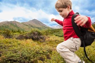
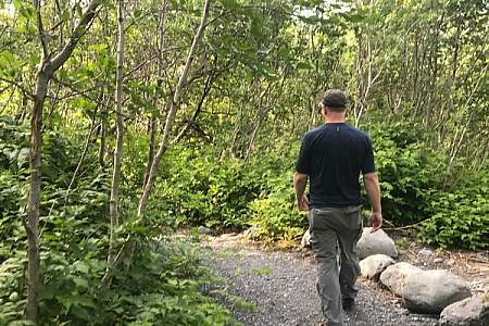
The hiking trails in Whittier offer a fun, scenic way to explore the lush environment in and around town. The trails are not only gorgeous, but also fairly new, thanks to a huge local government and volunteer effort to build them over the past five years. Today, they’ve become a point of pride for this community of just 200 people.
Exploring these trails takes you through super-lush greenery, thanks to their prime spot in North America’s northernmost temperate rainforest. You’ll hike past magical scenes of moss-covered rocks and lichens clinging to trees. And from many of the trails, you’ll also get unrivaled scenic views of massive glaciers, craggy mountains, cascading waterfalls, and overlooks of Prince William Sound.
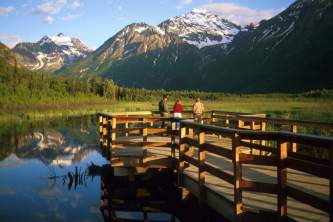
Which trails should you hike? If you only have a few minutes, stroll the short Whittier Creek Trail. But the most popular trail is Portage Pass, which offers up views of Passage Canal and Portage Glacier. Hike to the peak of the pass, or continue down the other side to the lakefront. And for a real challenge, tackle the Blackstone Bay Vista Trail. You’ll be scrambling over rocks and following rock cairns above treeline; the payoff for all that work is jaw-dropping views of the bay and glaciers.
Show Map
Parks & Trails

This is a very steep, 6.4‑mile round-trip trail that’s mostly unmarked and requires experience with scrambling and climbing over rocks. Your reward for the effort, though, is some very dramatic views of Shotgun Cove and the glaciers in Blackstone Bay.
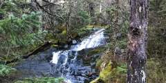
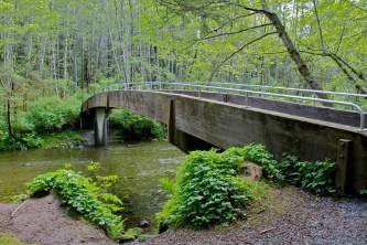
This leisurely, 0.75-mile trail begins just south of Whittier, a little seaside town located some 2 hours south of Anchorage. The trail doesn’t climb much, but it will take you high enough to get an unobstructed view of numerous waterfalls, including the long-dropping waters of Horsetail Falls as it sheets over the sheer rock face of Blackstone Ridge.

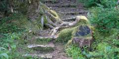
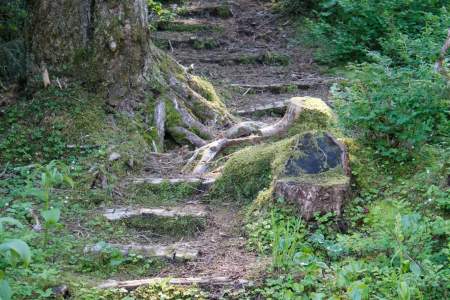
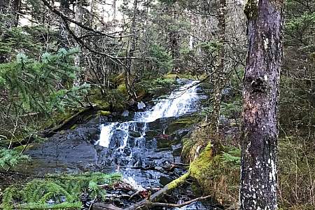
Whittier’s newest trail is a gem — a gentle, ¾‑mile stroll that follows Whittier Creek from the railroad crossing up to the waterfall. Locals love it: It’s right in the middle of town, but the lush greenery makes you feel like you’re far from civilization.
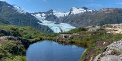
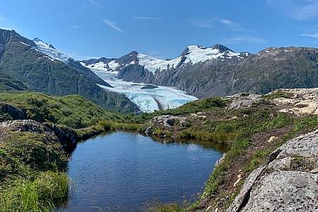
This 2‑mile-long, family-friendly trail, which begins 90 minutes south of Anchorage at the far end of the Whittier Tunnel, remains the only easy way to see Portage Glacier on foot. And it’s has a spectacular conclusion: After cresting Portage Pass, the trail drops through glacial scrub before popping out on the wide gravel shores of Portage Lake, directly across from the snout of gorgeous Portage Glacier.
This is a 6.6‑mile round-trip trail with very little elevation gain, making it a great option for the whole family. Along the way, you’ll glimpse amazing views of Prince William Sound. It takes about 90 minutes to hike halfway, out to the cove. And it’s worth the trip: Here you’ll find a lagoon fed by the tide and full of huge starfish.
Explore Further
Expert Advice