Printable Denali Park Map
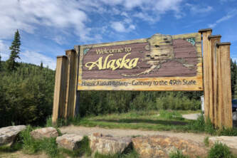
Print this guide to the Denali Park Road or take it with you on The Alaska App. Be aware that you'll only be able to drive a private vehicle on the first 15 miles of the road unless you luck out and get a special permit in the annual drawing.
0.0: Junction with Alaska Highway 3 (elev. 1585ft)
0.45: Riley Creek Mercantile & Campground Entrance
0.75: Wilderness Access Center Entrance
1.15: Railroad Tracks
1.25: Alaska Railroad Denali Depot
1.40: Traffic Circle
1.50: Denali Nat'l Park Visitors Center
3.10: Development Ends, Wilderness Begins
3.25: Rock Creek & C Camp
3.40: Original Park Headquarters (elev. 2080ft)
9.00: First Denali (Mt. McKinley) View
10.60: Both peaks of Denali are framed by Double Mountain and Sable Mountain.
12.75: Savage River Campground
14.75: Savage River Bridge (east end elev. 2590ft), River Loop Trail, Check Station & Pavement Break
16.00: Primrose Ridge rest area & Primrose Ridge Trail
19.70: Crest of Pass, large turnaround, last view of Denali
21.20: Hogan Creek (culvert)
22.65: Sanctuary Campground entrance
22.75: Sanctuary River
23.70: Spindly Spruce on Permafrost
24.10: Crest of Pass (elev. 2640ft)
29.10: Teklanika Campground entrance
30.20: Teklanika River Viewpoint & Trail
31.25: Teklanika Bridge (east end, elev. 2655ft)
34.05: Igloo Ranger Station, Campground, & Bridge (elev. 2940ft). Hear about campgrounds in the area & wildlife viewing .
37.50: Tattler Creek & Sable Mountain Trail
38.35: Sable Pass Wildlife Closure Sign
39.05: Sable Pass (elev. 3900ft)
42.65: End of Wildlife Closure
42.95: East Fork Cabin
43.35: East Fork Bridge (elev. 3055ft)
45.85: Polychrome Pass (elev. 3695ft)
46.40: Marmot Rock
51.65: Porcupine Forest
53.10: Toklat River (elev. 3035ft) & East Branch Trail
53.50: Toklat Road Camp Junction
58.25: Highway Pass, highest point on road (elev. 3980ft)
61.95 - Stony Hill Overlook (elev. 3890ft). Hear about the view.
64.45: Thorofare Pass (elev. 3950ft)
65.90: Eielson Visitor Center (elev. 3733ft)
68.00: Grassy Pass
74.65: Moose Creek Pit
84.40: Wonder Lake Campground Junction
84.50: Wonder Lake
84.60: Dalle-Molleville
85.30: Reflection Pond
86.50: Wonder Lake Ranger Station
87.15: Wonder Lake North End (culvert)
87.75: Wilderness Boundary Sign
89.00: Moose Creek Bridge
89.10: Camp Denali Road
89.10: North Face Lodge
90.80: Kantishna Roadhouse
90.90: Eureka Creek ford
91.55: Skyline Drive
92.10: Friday Creek
92.15: Kantishna Ghost Town & Quigley Cabin
92.20: Kantishna Airstrip
92.45: End of Road
Comments
Explore Further